Download
1 / 72
750 likes | 957 Views
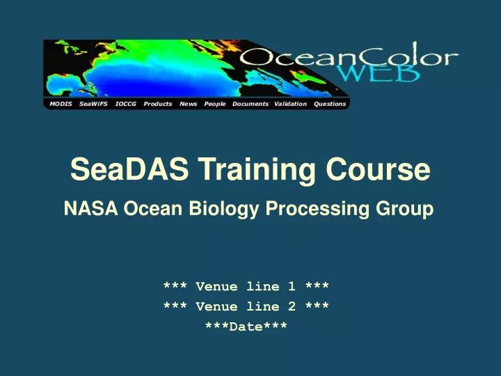
SeaDAS Training Course. NASA Ocean Biology Processing Group. *** Venue line 1 *** *** Venue line 2 *** ***Date***. What is SeaDAS?.

E N D
SeaDAS Training Course NASA Ocean Biology Processing Group *** Venue line 1 *** *** Venue line 2 *** ***Date***
What is SeaDAS? -The SeaWiFS Data Analysis System (SeaDAS) is a comprehensive image analysis package for the processing, display, analysis, and quality control of ocean color data.-SeaDAS is intended for use with all of the OBPG supported sensors: MODIS/Aqua, MODIS/Terra, SeaWiFS, OCTS, CZCS.-SeaDAS can also be very useful as a general scientific imagery/data analysis package.
SeaDAS Functionalities Processing-All sensors L0 or L1A to SMI-subscening-browse productsData Visualization-image package (reads many formats)-geolocated display (coastline, gridlines, etc.)-various image/data functionsData Manipulation-projection-band operations-output data
UNIX -SeaDAS runs on “UNIX-like” systems (UNIX/linux/OS X)-This means it does NOT run on Windows.-Dedicated UNIX computer best, but there are options for Windows users. Mac OS X Microsoft Windows UNIX linux SGI IRIX Sun Solaris
What is UNIX? -UNIX is a fully featured modern Operating System-History (AT&T Bell Labs, Berkeley, UNIX, linux, OS X)-It is available in a variety of ‘flavors’-It is comprised of simple tools (commands) that perform a single function well-These tools can be used together to perform complex tasks-Powerful Command line-GUI
UNIX Basics UNIX Directory Structure:-At login, you are in your home directory.-This is your “current working directory”.-All files and directories below your home directory usually belong to you.-You change your working directory by changing to another directory with the “cd” command.
SeaDAS is made up of binaries and libraries, UNIX shell scripts, and IDL code. Binaries and Libraries-binaries are executable files created by compiling code-mainly used for data processing (e.g. msl12 = L1->L2 processing)-made from C and/or Fortran code-SeaDAS also includes HDF binaries and librariesUNIX Shell Scripts-Shell scripts are executable text files containing many commands-mainly used as “wrappers” for processing-there are also stand-alone utility scriptsIDL Code
IDL (Interactive Data Language) -IDL stands for the Interactive Data Language-Made by ITT Visual Information Solutions, ITT VIS (formerly RSI)-It is a scientific programming language (similar to Matlab)-It is also a “scientific environment”-SeaDAS GUI written in IDL-SeaDAS also uses IDL for data display and analysis functions-non-SeaDAS IDL functionalities are also available!Runtime SeaDAS - free, but no SeaDAS command line or proceduresPurchasing IDL - command line, procedures, full IDL environment
SeaDAS Directory Structure seadas/ - - - - - - - - - - - - SeaDAS root directory bin/ - - - - - - - - - - C and Fortran processing binaries config/ - - - - - - - - - SeaDAS config files (Imake and default files) data/ - - - - - - - - - - Data files used for processing and display common/benchmarks/ - Data files/scripts for running SeaDAS benchmarks common/luts/ - - - - Color LUTs directory (store custom LUTs here) common/metoz/ - - - MET/OZONE ancillary files storage directory common/oisst/ - - - OISST ancillary files storage directory modis/atteph/ - - - MODIS attitude and ephemeris storage directory demo/ - - - - - - - - - - Demo and test data files doc/ - - - - - - - - - - SeaDAS HTML documentation files etc/ - - - - - - - - - - Stand-alone data processing wrapper scripts examples/ - - - - - - - - Example batch scripts hdf/ - - - - - - - - - - HDF software (binaries and libraries) idl_lib/ - - - - - - - - Copy of all SeaDAS IDL routines idl_rt/ - - - - - - - - - Required directory for Runtime SeaDAS mode inc/ - - - - - - - - - - Include files for C and Fortran routines lib/ - - - - - - - - - - C and Fortran compiled libraries src/ - - - - - - - - - - Root directory of all SeaDAS source code c4idl/ - - - - - - - C routines used within IDL programs c_procs/ - - - - - - Main data processing C routines idl_procs/ - - - - - IDL routines idl_utils/ - - - - - IDL utility routines lib/ - - - - - - - - C and Fortran routines for SeaDAS libraries utils/ - - - - - - - Utility programs used by wrapper scripts util/ - - - - - - - - - - SeaDAS general utilities directory var/ - - - - - - - - - - Miscellaneous ancillary navigation files
SeaDAS Requirements Operating Systems:-linux (Red Hat, Fedora, CentOS, etc.)-Mac OS X 10.3, 10.4 (PPC or Intel)-Sun Solaris 2.7, 2.8-SGI IRIX 6.5-Vmware on Windows / Knoppix Live CDRAM: 128MB minimum, 1GB+ bestDisplay: 1024x768 minimum, millions of colorsDisk space: 1.5GB for SeaDAS install plus space for dataOptional: full IDL licenseOptional: gcc and fortran compilers
SeaDAS Modes There are 3 ways to use SeaDAS:1. Graphical User Interface (GUI)2. Command Line: -IDL command line -UNIX command line3. Automated: -IDL command (batch) files -IDL procedures -UNIX shell scripts
Exercise Understanding the SeaDAS Environment On the server:-Change directory into your home (~/) directory: cd-List the contents of your home (~/) directory: ls -lChange directory into your home (~/) directory: cd $SEADAS-List the contents of the SeaDAS directory: ls -l-List the contents of the SeaDAS bin directory: ls bin -List the contents of the SeaDAS etc directory: ls etc-List your shell environment variables: env-change directory into your data directory: cd data-List the contents of your data directory: ls -l data
Exercise Displaying data with SeaDAS -On the server:cd ~/data/processseadasDisplay the SeaWiFS Level 1 subscene S2004111164518.L1A_MLAC.x.hdf: -Click Display -Select the S2004111164518.L1A_MLAC.x.hdf file and click Ok -Select the 555nm product and click Load -In the Band List Selection window click Display -Resize display window by dragging the lower right corner -Using the Functions menu: *overlay a Coastline and latitude/longitude Grid *turn on the Color Bar *turn on the Cursor Position window *Select Color LUT->Load LUT and select different color LUTs
Review of OBPG Satellite Data
Data Processing using the SeaDAS GUI
Operational MODIS Ocean Band Suite VIS/NIR Ocean Color Thermal SST
Level 0 raw digital counts native binary format Level 1A raw digital counts HDF formatted Data Levels & Flow • ATT & EPH • spacecraft attitude • spacecraft position • GEO • geolocation • radiant path geometry • Level 1B • calibrated reflectances • converted telemetry • Ancillary data • wind speed • surface pressure • total ozone • Reynolds SST • Level 2 • geolocated geophysical products for each pixel
Level 0 raw digital counts native binary format Level 1A raw digital counts HDF formatted Data Levels & Flow • ATT & EPH • spacecraft attitude • spacecraft position • GEO • geolocation • radiant path geometry • Level 1A Subset • reduced to standard ocean bands only • Level 1B • calibrated reflectances • converted telemetry • Ancillary data • wind speed • surface pressure • total ozone • Reynolds SST • Level 2 • geolocated geophysical products for each pixel
L1A Subscene 1. Display A2005205180000.L1A (choose EV_3959_22)2. Functions -> Cursor Position 3. Process -> MODIS -> modis_subscene4. Enter SW-Corner: 40, -75 / NE-Corner: 43, -65
MSL12Multi-Sensor Level-1 to Level-2 • Common software for Level-2 processing of MODIS, SeaWiFS and other sensors in a consistent manner. • Supports a multitude of product algorithms and processing methodologies. • standard and non-standard, validated and experimental • run-time selection of output product suite • For MODIS, replaced: • PGE09, PGE10 • products MOD18 - MOD28
L1B to L2 (msl12)
Level 2 Processing Flags -As data is processed by msl12 from Level 1 to Level 2, checks are made for different defined conditions.-When certain tests and conditions are met for a given pixel, a flag is set for that pixel for that condition.-A total of 31 flags can be set for each pixel.-These msl12 Level 2 processing flags are stored in the Level 2 data file as the "l2_flags" product.-The storage method sets bits to 0 or 1 in 32-bit integers that correspond to each pixel.
Level 2 Processing Flags (flags in red are masked during Level 3 processing)
Level-2 Flags and Masking RGB Image Chlorophyll Sediments Glint Cloud
Add masking for high glint Add masking for straylight Level-2 Flags and Masking RGB Image nLw (443) Sediments Glint Cloud
Processing Masks -For Level 1 to Level 2 processing (msl12), masked pixels are not processed and are typically set to zero so as to eliminate them from future analysis.-For products where zero could be a valid data value, a number outside the possible data range is substituted.-For SeaWiFS and MODIS, msl12 currently has 8 predefined L1A processing masks (each comprised of only one flag) that can be turned on (1) or off (0) by the user. These 8 masks and their default settings are:maskland=1maskcloud=1maskhilt=1maskbath=0maskglint=0masksatzen=0masksunzen=0maskstlight=0
SST Quality Tests SST Quality Levels
Importing and Exporting Data using SeaDAS SeaDAS can export data files as HDF, SeaDAS Mapped, flat binary, ascii text, png, and postscript
SeaDAS can read / display / analyse: -All OBPG HDF Data files (MODIS, SeaWiFS, OCTS, CZCS) -Some non-OBPG legacy Ocean HDF formats -General HDF (any 2D SDS in an HDF file) -Navigated HDF (a 2D SDS plus a “lat” SDS and “lon” SDS) -“SeaDAS Mapped” HDF files -AVHRR V5 w/ standard NASA or NOAA SDS attribute names -AVHRR V4 SST/JPL PO.DAAC HDF Pathfinder Best SST -AVHRR V4 SST/JPL PO.DAAC HDF MCSST -Binary flat files -PNG files -True Color files -Multi-column ascii text files
Definitions Projection - any process which transforms a spatially organized data set from one coordinate system to another. For MODIS Ocean data products this will refer to two-dimensional data sets. Mapping - a process of transforming a data set from an arbitrary spatial organization to a uniform (rectangular, row-by-column) organization, by processes of projection and resampling. Binning - a process of projecting and aggregating data from an arbitrary spatial and temporal organization, to a uniform spatial scale over a defined time range. Ideally the binning process will preserve both the central tendency (e.g., average) and the variation in the data points that contribute to a bin.
Ocean Product Projections Equal-area: sinusoidal, with equally space rows and number of bins per row proportional to sine of latitude; resolutions of 4.6 and 9.2 km Equal-angle: rectangular (Platte Carre) with rows and columns equally spaced in latitude and longitude; resolutions of 24 and 12 points per degree. Ocean equal-area and equal-angle projections are equivalent at the equator.
Level-3 Binned vs Mapped • bin files • multiple products • stored as float • sampling statistics included • map files • single product • stored as scaled integer bin file grid map file grid
MODIS “Bowtie” Effect Increasing Pixel Size