Download
1 / 12
120 likes | 299 Views
Using geospatial analysis techniques to investigate the spatial properties of tropical cyclone rain fields. Corene J. Matyas Department of Geography, University of Florida. Use of GIS for Spatial Analysis. Raster and polygon-based data formats

E N D
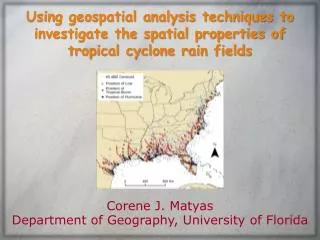
Using geospatial analysis techniques to investigate the spatial properties of tropical cyclone rain fields Corene J. Matyas Department of Geography, University of Florida
Use of GIS for Spatial Analysis • Raster and polygon-based data formats • Calculate spatial attributes: position, compactness, orientation, elongation, fragmentation, etc. • Ability to scale and rotate polygons Matyas, C.J. 2010. Associations between the size of hurricane rain fields at landfall and their surrounding environments. Meteorology and Atmospheric Physics, 106:3-4, 135-148. Matyas, C.J. 2009. A spatial analysis of radar reflectivity regions within Hurricane Charley (2004). Journal of Applied Meteorology and Climatology, 48:1, 130-142. Matyas, C.J. 2008. Shape measures of rain shields as indicators of changing environmental conditions in a landfalling tropical storm. Meteorological Applications, 15:2, 259-271. Matyas, C.J. 2007. Quantifying the shapes of U.S. landfalling tropical cyclone rain shields. The Professional Geographer, 59:2, 158-172.
Research Questions For the 24-hour period following landfall examining separately TCs that do and do not become extratropical within 3 days of landfall • How large are the rain fields and how do their sizes change after landfall? • How much of the rain field is comprised of lighter and heavier rainfall regions? • What characteristics exhibit statistically significant relationships to rain field composition and the growth/ loss of areal coverage?
Techniques • GIS analysis of Level III WSR-88D reflectivity data • Lighter rainfall regions: 20-35 dBZ • Heavier rainfall regions: 40+ dBZ • Temporal period: 24 hours after U.S. landfall • Identify location and size of heavy rainfall regions every 3 hours • Determine total area covered by rain field and calculate the percentage occupied by heavy rainfall every 6 hours
Radar Analysis in GIS Hurricane Bret (1999) Polygons analyzed t0-t24
Positions of 40 dBZ Regions Relative to Storm Motion Vertical Wind Shear
Statistical Testing Nonparametric tests required • Mann-Whitney U: significant difference between two groups (ET vs. non ET) • Spearman’s Rank Correlation Coefficients: variables exhibiting similar rank patterns
Mann-Whitney U Test Results ET No ET Significant at α = 0.000 20-35 dBZ areas (km2) Mean rank = 121.8 Mean rank = 79.7 Mean rank = 105.7 Mean rank = 87.6 40+ dBZ areas (km2) Significant at α = 0.000 40 30 20 10 0 Mean rank = 85.8 Mean rank = 97.3 % area 40+ dBZ No difference
Spearman’s Rank Correlation Coefficients Significant at α = 0.01 Significant at α = 0.05 20-35 dBZ area 40+ dBZ area % of area 40+ dBZ
Future Research • Calculate attributes of shape and orientation for convective regions • Quantify the characteristics of stratiform precipitation that encompasses these convective regions • Consider angle TC crosses coastline, interaction with topography, diurnal cycles, etc.
Thank You Matyas, C.J. 2010. A geospatial analysis of convective rainfall regions within tropical cyclones after landfall. International Journal of Applied Geospatial Research, 1:2 (April-June), 69-89. Matyas, C.J. 2010. Analyzing areas of heavy and light rainfall within landfalling tropical cyclones. (In preparation)