Download
1 / 16
160 likes | 382 Views
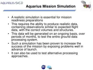
Aquarius Mission Simulation. A realistic simulation is essential for mission readiness preparations This requires the ability to produce realistic data, containing observations similar to expected flight data, with the correct volumes and structures.

E N D
Aquarius Mission Simulation • A realistic simulation is essential for mission readiness preparations • This requires the ability to produce realistic data, containing observations similar to expected flight data, with the correct volumes and structures. • This data will be generated on an ongoing basis, over periods of months, to test the entire ground data processing system. • Such a simulation has been proven to increase the success of the mission by exposing problems well in advance of launch. • It can also be used to test alternative processing approaches.
SeaWiFS Heritage • The SeaWiFS Project developed a realistic data simulation based on CZCS data and the sensor operations scenario. • The simulation was configured to run daily, starting from a simulated orbit and sensor command schedule, through end-to-end processing of the data with the production system. • This mission simulation was run continuously for 18 months prior to the SeaWiFS launch, uncovering many bugs and allowing major refinements in the processing system. • As a result, SeaWiFS was able to produce scientifically credible data products from the very first sensor observations on September 4, 1997.
Mission Simulation Requirements • A useful mission simulation requires: • Simulating sensor output starting from realistic geophysical values with sufficient fidelity to exercise “all” logical paths in the data processing algorithms • Simulating sensor downlink data in the correct format and the expected data rates and volumes • Simulating realistic data collection scenarios • Use of operational data processing software and formats • Use of actual ancillary data sets wherever possible • Ability to generate one day of data per day.
Mission Simulation Requirements (cont.) • It does not necessarily require: • Simulating every aspect of the data path (e.g., surface-to-instrument, sensor operation) with maximum possible fidelity • Simulating 100% of the sensor output (e.g., housekeeping telemetry not required by science algorithms) or dynamics • Ability to incorporate anomalous behavior
Aquarius Mission Simulation Flow Salinity Map Simulated Orbit Input File Intermediate Data Persistent Data Output File
Aquarius Mission Simulation Flow Salinity Map Simulated Orbit Data Collection Scheduler Downlink Schedule Input File Intermediate Data Persistent Data Output File
Aquarius Mission Simulation Flow Ancillary Data Sensor Measurements Salinity Map Radiative Transfer Model Sensor Geometry & Timing Surface Measurements Simulated Orbit Data Collection Scheduler Downlink Schedule Input File Intermediate Data Persistent Data Output File
Aquarius Mission Simulation Flow Ancillary Data Sensor Measurements Sensor Telemetry Salinity Map Radiative Transfer Model Sensor Output DN Sensor Geometry & Timing Instrument Model Surface Measurements Simulated Orbit Data Collection Scheduler Downlink Schedule Input File Intermediate Data Persistent Data Output File
Aquarius Mission Simulation Flow Ancillary Data Sensor Measurements Sensor Telemetry Salinity Map Radiative Transfer Model Sensor Output DN Sensor Geometry & Timing Instrument Model Surface Measurements Simulated Orbit ICDS Simulator Science Blocks Data Collection Scheduler Downlink Schedule Sensor Memory Simulator Sensor Memory Input File Intermediate Data Persistent Data Output File
Aquarius Mission Simulation Flow Ancillary Data Sensor Measurements Sensor Telemetry Salinity Map Radiative Transfer Model Sensor Output DN Sensor Geometry & Timing Instrument Model Surface Measurements Simulated Orbit ICDS Simulator Science Blocks Data Collection Scheduler Downlink Schedule Sensor Memory Simulator Sensor Memory Spacecraft Telemetry Simulator Spacecraft Telemetry Input File Intermediate Data Ephemeris File Persistent Data Output File
Aquarius Mission Simulation Flow Ancillary Data Sensor Measurements Sensor Telemetry Salinity Map Radiative Transfer Model Sensor Output DN Sensor Geometry & Timing Instrument Model Surface Measurements Simulated Orbit ICDS Simulator Science Blocks Data Collection Scheduler Downlink Schedule Sensor Memory Simulator Sensor Memory Spacecraft Telemetry Simulator Spacecraft Downlink Simulator Spacecraft Telemetry Input File Intermediate Data Downlink Files Ephemeris File Persistent Data Output File
Aquarius Mission Simulation Scenario • Simulated orbit (e.g., from TLEs) is used with the station coordinates to generate a daily data downlink schedule. • Simulated orbit is used with the sensor geometry and timing and the global salinity map to generate surface observations and viewing geometry. • Surface observations are combined with geometry, radiative transfer model and ancillary data to generate sensor observations. • “Simplified” instrument model (with required engineering telemetry) is used to produce sensor output values (DN).
Aquarius Mission Simulation Scenario (cont). • Sensor values and telemetry are formatted into science blocks. • Science blocks are accumulated in “onboard memory” according to data collection/memory management scenario. • Critical spacecraft telemetry (navigation) is formatted into spacecraft telemetry blocks at the specified sampling rate. • Aquarius memory and spacecraft telemetry are “downlinked” at specified times according to downlink strategy (i.e., multiple Aquarius transmissions) and staged at CONAE.
Aquarius Mission Simulation Scenario (cont). • Aquarius file is preprocessed at CONAE using ADPS-provided system. • Aquarius and spacecraft files are acquired by ADPS. • ADPS processes Aquarius and spacecraft data to levels 1A, 1B , 2 and 3 in mission product formats using operational data system, product generation software and ancillary data. • ADPS generates matchups and provides to AVDS. • Aquarius GS and Science team compare mission products with original source files. • Repeat daily until launch!
Implementation Stages • Initial simulation efforts would involve single orbits, downlinks and days to verify formats, interfaces and software. • Spacecraft telemetry would use interim formats or best available information until SAC-D formats are finalized. • CONAE interactions would be exercised after internal ADPS verification. • Objective is to have full-up mission simulation running daily no later than L – 1 year. • The simulation fidelity can always be improved once the basic mechanics are functioning.
Possible Improvements • Simulated cold-sky maneuver. • Multiple downlink stations • Incorporate instrument characterization test results • Incorporate various noise and error models • ?