Download
1 / 29
290 likes | 324 Views
Learn about GPS receivers, NMEA messages, and APRS (Automatic Position Reporting System) for vehicle tracking. Explore commercial AVL uses and APRS equipment like TNC and digipeaters. Find out about APRS server and worldwide tracking.

E N D
Vehicle Location / APRS • What is AVL / APRS? • Automatic Vehicle Location • Automatic Position Reporting System • Commercial AVL – CES • APRS – Amateur Radio
Vehicle Location / APRS • Vehicles Equipped with GPS Receiver • Mobile Sends GPS Location Data over RF Path • Fixed End Receives Location Data and Displays on Computer
How does GPS work? http://www.colorado.edu/geography/gcraft/notes/gps/gps_f.html http://electronics.howstuffworks.com/gps.htm
GPS Receivers • Handheld • Garmin • Magellan • Dedicated • Oncore • Receiver / Antenna Combos • Tripmate (Delorme) • Pharos • Tripnav
GPS Receiver Output • Typical output is NMEA Standard (National Marine Electronics Association) • Various NMEA Messages containing: • Location • Speed • Altitude • Direction of Travel • Time • Validity of fix • DOP (accuracy of fix) • # Satellites tracked • Which Satellites are Being Tracked
RMC Message • RMC - Recommended minimum specific GPS/Transit data • RMC,225446,A,4916.45,N,12311.12,W,000.5,054.7,191194,020.3,E*68 • 225446 Time of fix 22:54:46 UTC • A Navigation receiver warning A = OK, V = warning • 4916.45,N Latitude 49 deg. 16.45 min North • 12311.12,W Longitude 123 deg. 11.12 min West • 000.5 Speed over ground, Knots • 054.7 Course Made Good, True • 191194 Date of fix 19 November 1994 • 020.3,E Magnetic variation 20.3 deg East • *68 mandatory checksum
Commercial AVL Uses • Police • Taxis / Limos • Ready-mix Trucks • Delivery Trucks • Construction Equipment • Ambulances
APRS – Basic TNC
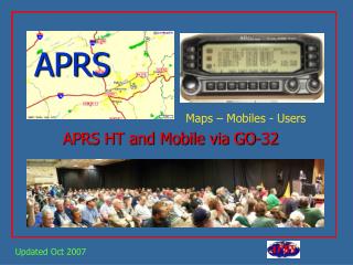
APRS Mobile Equipment • GPS Receiver • Anything that outputs NMEA data • APRS Capable TNC • KPC3, KPC3+ • Tiny Tracker • Mobile Radio • Any VHF Mobile
APRS Base Equipment • Any TNC • Mobile Radio • Any VHF Mobile • Mapping Software • APRS + SA • WinAPRS • UIVIEW • DOS APRS
APRS Digipeaters Digipeater – Store & Forward Data Repeater RELAY – Typical home station. Lower ant height – smaller coverage area. Most home stations are set up as RELAY station. WIDE – Wide area coverage. Typically 100’ or higher tower Most WIDEs are set up as WIDE and RELAY. GATE – Digipeats from one band to another. Typically VHF to HF IGATE – Gateway from VHF to the internet.
APRS Digipeat Paths Typical mobile path : RELAY,WIDE,WIDE Do NOT use RELAY,RELAY! Typical Packet: K9SA-9>GPSMV V RELAY,WIDE,WIDE:$GPRMC, . . . . Typical fixed path: WIDE,WIDE Do NOT use RELAY,WIDE, WIDE (unless you are out of range of any WIDES) WideN-N 1st hop WIDE3-3 2nd hop WIDE3-2 3rd hop WIDE3-1 etc. Typical Packet: K9SA-9>GPSMV V WIDE3-3:$GPRMC, . . . .
Wide Area APRS (Worldwide) • Mobiles digipeat from VHF to IGATE • IGATE passes location data to internet APRS server • Server stores locations of ALL received APRS packets • Anyone worldwide can access this information • In some cases IGATES can digipeat from server to VHF
Worldwide APRS • All APRS Programs can download from server to the • computer for display on a map. • Findu http://map.findu.com/k9mot • javAPRS http://www.aprs.net
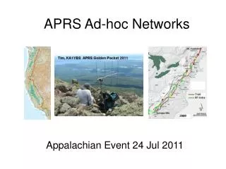
APRS Uses • Public Service / Parades • Special Events • Balloon / Rocket Launches • Bike Rides • Round the World Flights • Shuttle / Satellite Tracking • Weather Tracking • Wife / Kid Tracker