Download
1 / 26
260 likes | 407 Views
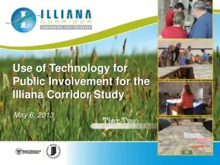
Use of Technology for Public Involvement for the Illiana Corridor Study. May 6, 2013. Presentation Agenda. Project Overview Technology Uses Question and Answers. Bi-State Partnership. Indiana & Illinois Governors signed MOA in June 2010

E N D
Use of Technology for Public Involvement for the Illiana Corridor Study May 6, 2013
Presentation Agenda • Project Overview • Technology Uses • Question and Answers
Bi-State Partnership • Indiana & Illinois Governors signed MOA in June 2010 • Both states passed P3 legislation for Illiana in 2010 • Joint INDOT & IDOT Illiana Corridor Study initiated in April 2011
Tiered Environmental Process COMPLETION WINTER 2013/EARLY SPRING 2014
Study Area • 950 square miles – about the size of Rhode Island • Parts of Will and Kankakee (IL) and Lake (IN) counties
Why does this Region need a new facility? VITAL NATIONAL LINK KEY INTERMODAL LOGISTICS AREA
Why Does this Region Need a New East-West Facility? • Lack of continuous & multi-lane east-west roads • Population & employment growth by 2040 • Vehicle trips will increase by 126% by 2040 resulting in increased congestion • I-80 congested & assumed at full build out • National truck freight increasing • 47,000 daily intermodal truck trips by 2040 • Truck trips will increase by 193% by 2040
Tier One Corridor Alternatives Alternatives Workshop Ideas Initial Alternatives Tier One DEIS Alternatives
Single Document (Combined Final EIS/ROD): B3 and No-Action • Less environmental impacts • Higher travel performance • Greater stakeholder support • Lower construction costs Alternatives Carried Forward to Tier Two B3 and No-Action
Benefits: Regional & Local • 9,000 construction jobs • 30,000long term jobs • $1.4 billionshort-term economic output • $4 billionlong-term economic output JOBS/ECONOMIC GROWTH
Tier One FEIS/ROD • Tier One “Single Document” Final EIS/ROD approved January 17, 2013 • First “single document” in country approved under new MAP-21 streamlining provisions
Technology Applications • Convey Impacts of multiple alternatives • Fly through videos of impacts • Show the stakeholders meaningful data that relates to their individual properties • Interactive Mapping • Capture public Input for long term use • Comprehensive comment data Management
Representative Alternatives • Eight Limited Access Alternatives • Two Arterial Alternatives (widening existing roads)
Sample Impact Summary Video • Demo Video
Relate to the Stakeholder Impacts • A 950 square mile study area presents challenges with displaying level of detail • ArcGIS online mapping used to allow the team to zoom in on the stakeholder area of interest while using larger maps for project wide issues
Tier One Public Involvement Project Website 9CPG/TTF Meetings 3Rounds of Public Meetings FormalPublic Hearings 130+ Stakeholder Meetings 5 Newsletters/Fact Sheets
Video Stations Google Earth fly-through demonstrations used at the public meetings
Tier Two Public Involvement • 45 one-on-one stakeholdermeetings • Five landowner meetingsin February with 850 attendees • Two Corridor Planning Group meetings • Land Use Task Force Meetings on April 10 & 30 • Tier Two Public Meetings on April 16 & 18 with 700 attendees
From Maps to the Digital Tablet • The 47-mile corridor required a 41’ long exhibit to show meaningful level of detail • Study team members answer land owner questions while referencing maps on IPads • Multiple stations are setup at every meeting to accommodate the large groups
Hand Held Devices & Tablets • The corridor can be displayed on mobile devices that run the ESRI app • Allows users to quickly locate areas of interest and with GPS enabled devices, locate themselves relative to the corridor
Public GIS Mapping • Stakeholders can view an online version of the corridor map • Search for addresses • Print scaled images • Web site www.illianacorridor.org
Stakeholder Database • Each affected property owner has a unique entry by parcel • All interaction is tracked including comment history and property details
Information Logged for Future Use • Records of Conversation • Property details • Photographs • Responses to comments