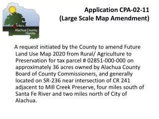
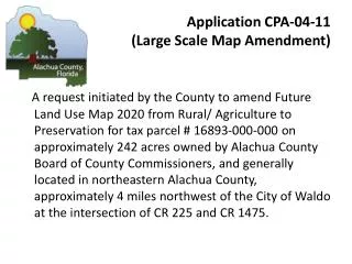
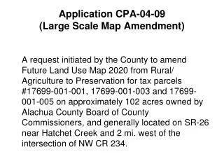
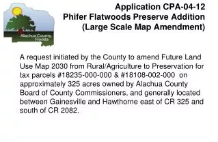
Download
1 / 11
110 likes | 224 Views
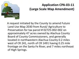
Application CPA-06-09 seeks to amend the Future Land Use Map for approximately 5,633 acres owned by the Board of County Commissioners. The proposed change is from Rural/Agriculture to Preservation, focusing on land located about 2 miles east of SW Williston Road and south of Wacahoota Road. This application includes various views showcasing access points and existing land uses. Staff recommends transmitting the amendment to the State Land Planning Agency for further review based on the analysis provided.

E N D
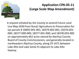
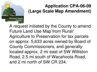
Application CPA-06-09 (Large Scale Map Amendment) A request initiated by the County toamend Future Land Use Map from Rural/ Agriculture to Preservation for tax parcels on approx. 5,633 acres owned by Board of County Commissioners, and generally located approx. 2 mi east of SW Williston Road, 2.5 mi south of Wacahoota Road, and 2 mi north of SW CR 234.
Locator CPA 06-09 Barr Hammock
Aerial CPA 06-09 Barr Hammock
Application CPA-06-09 (Large Scale Map Amendment) View of access along Wachahoota Rd. View looking west along Wachahoota Road
Application CPA-06-09 (Large Scale Map Amendment) View of access along Wachahoota Road View of project access looking south on the left and residential access along the north rim of the project area.
Application CPA-06-09 (Large Scale Map Amendment) View from project access looking east to I-75 View of access to the project area from Barr Hammock
Future Land Use CPA 06-09 Barr Hammock
Existing Land Use CPA 06-09 Barr Hammock
Zoning Districts CPA 06-09 Barr Hammock
Proposed Future Land Use CPA -06-09 Barr Hammock
Application CPA-06-09 (Large Scale Map Amendment) STAFF RECOMMENDATION: Transmit CPA-06-09, Future Land Use Map 2020 amendment, as shown in the staff report, to the State Land Planning Agency for review with the appropriate data and analysis.