Download
1 / 16
160 likes | 232 Views
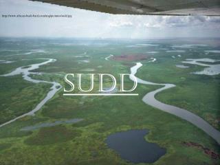
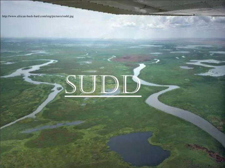
http://www.african-bush-bard.com/img/pictures/sudd.jpg. SUDD. Sudd is located at the southern Sudan. http://en.wikipedia.org/wiki/Sudd.

E N D
Sudd is located at the southern Sudan http://en.wikipedia.org/wiki/Sudd
Sudd stretches from Mongalla at the south to near Sobat confluence with white Nile just upstream of Malakal as well as westwards along the Bahr El Ghazal . Covers 500 km south-north & 200 km west-east Patrick Denny 1984
General information about Sudd Topographically Sudd area was divided to three categories 1- High land (Free flooded) 2-The intermediate land (seasonally flooded) 3- Permanent swamp (Always under water) Surface area ~ 30 000 to 40 000 km2 . It extends to 130 000 km2 during the wet season Sudd area generally flat composed of clayish soils Rain falls from April to Nov. and peak of the rainfall in August and the dry period extends from Nov. to March - Varying from 900 mm/yr (south) & 800 mm/yr (north) Average Temp. Dry season 30 -33o C Rainy season 26 -28o C M. A. H. Shamseddin et al , 2006
Sudd is one of the largest wetland on the Nile river and considered the largest in Africa. Sudd is an Arabic word mean Barrier Also Sudd is the largest freshwater wetland in the Nile basin The Sudd swamp is considered as a potential water resource of Sudan and Egypt (6 milliard cubic meters of water will be saved for Sudan from the swampy area. Several studies have been done to estimate the evaporation from Sudd swamp by results from those studies were a inconsistent due to 1- The inacceibility of the area 2- The vast areas of swamp 3- complexity of the dynamic behavior of the swamp during the year (permanents and seasonal flooded areas 4- Civil war
Mohamed 2005and Sutcliffe et al,1999 divided the area into three distinctive basins 1- Bahr El –Jebel 2- Bahr El – Ghazal 3- The Sobat basin Shamseddin et al, 2006 referred to the above three basin as wetland and swamp but Sudd donate to Bahr El Jebel swamp. J, V, SUTCLIFFE* & Y, P. PARKS, 1987
Bahr El Jebel river originates form Lake Victoria Uganda It is 68,800 square kilometers (26,560 mi²) in size Kenya Outflow of Lake Victoria causes Sudd extension particularly in rainy seasons Tanzania
Half of the White Nile river flow is lost I the Sudd area because of evaporation *Jonglei canal (360 km) is project was aimed to reduce water losses in Sudd area due to the evaporation. Project began in 1978 , but stopped or not completed due to civil war . *1984 - 2/3 (240 km)of Jonglei canal already accomplished and stopped due to civil war The expectation of producing is 4.8x 10⁹ m3/yr J, V, SUTCLIFFE* & Y, P. PARKS, 1987 *Due to the less channel capacities and high flows, the excess flow of Baher El Jebel river leave through small channels on both sides of the river and created the swamp. also during 1960th increase in Lake Victoria discharge led to 2.5 size increase of permanent swamp and seasonal floodplains
Sudd Humidity & temperature Y. A. Mohamed et al , 2005
More than 115 satellite images with SEBAL (Surface Energy Balance Algorithm for Land) used to obtain monthly evaporation map for years 1995,1999 and 2000. Y. A. Mohamed et al , 2005
The monthly measure of Mangalla inflow and outflow (1905 -1980) rainfall season and low evaporation the outflow of the swamp is constant (~ half of inflow) J, V, SUTCLIFFE* & Y, P. PARKS, 1987
References G. Petersen1, J. A. Abeya2, and N. Fohrer3 , Spatio-temporal water body and vegetation changes in the Nile swamps of southern Sudan, European Geosciences Union, 2007 Patrick Denny, Permanent swamp vegetation of the Upper Nile, Hydrobiologia, 1984 Y. A. Mohamed, H. H. G. Savenije, W. G. M. Bastiaanssen, and B. J. J. M. van den Hurk, New lessons on the Sudd hydrology learned from remote sensing and climate modeling, Hydrology and Earth System Sciences Discussions, 2005 M. A. H. Shamseddin, T. Hata, A. Tada, M. A. Bashir, and T. Tanakamaru, Estimation of flooded area in the Bahr El-Jebel basin using remote sensing techniques, Hydrology and Earth System Sciences Discussions, 2006 J, V, SUTCLIFFE* & Y, P. PARKS, Hydrofogical modelling of the Sudd and Jonglei Canal, Hydrological Sciences, 1987 http://en.wikipedia.org/wiki/Sudd