Download
1 / 26
260 likes | 444 Views
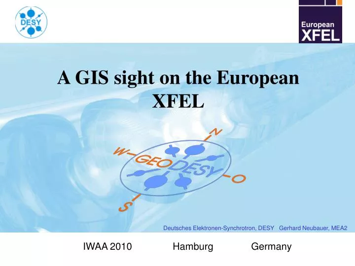
A GIS sight on the European XFEL. Deutsches Elektronen-Synchrotron, DESY Gerhard Neubauer, MEA2. IWAA 2010 Hamburg Germany. A GIS sight on the European XFEL. A bird’s eye view on the European XFEL :. Status of the Project. Schleswig-Holstein. Sights on XFEL.

E N D
A GIS sight on the European XFEL Deutsches Elektronen-Synchrotron, DESY Gerhard Neubauer, MEA2 IWAA 2010 Hamburg Germany
A GIS sight on the European XFEL A bird’s eye view on the European XFEL : Status of the Project Schleswig-Holstein Sights on XFEL State Border GIS for XFEL Hamburg Osdorfer Born Schenefeld Examples Photon Distribution Co-ordinate Systems Main Linac DESY Bahrenfeld Future Prospects Injector 500m 500m IWAA 2010, DESY A GIS sight on the European XFELGerhard Neubauer, MEA2 2
A GIS sight on the European XFEL Status of the Project : Status of the Project Sights on XFEL GIS for XFEL Examples Co-ordinate Systems • January 2009: Start of civil construction • October 2009: Foundation of the European XFEL GmbH • July 2010: Start of tunnel boring • August 2010: First tunnel completed Future Prospects IWAA 2010, DESY A GIS sight on the European XFELGerhard Neubauer, MEA2 3
A GIS sight on the European XFEL Sights on XFEL : Status of the Project Examples: Sights on XFEL GIS for XFEL Examples Co-ordinate Systems Organization CAD Future Prospects EDMS Room book (FMS) GIS IWAA 2010, DESY A GIS sight on the European XFELGerhard Neubauer, MEA2 4
A GIS sight on the European XFEL Schematic diagram of the XFEL : Status of the Project Contract sections of civil construction: Sights on XFEL GIS for XFEL Examples Co-ordinate Systems 2nd stage (later) Future Prospects Section 1 : XHEXP, XSDU1, XSDU2, XS4, XTD3-XTD10 (4,6m tunnel) Section 2 : XS1, XS2, XS3, XTL, XTD1, XTD2 (5.3m tunnel) Section 3 : XSIN, XTIN, XSE (cut and cover) IWAA 2010, DESY A GIS sight on the European XFELGerhard Neubauer, MEA2 5
A GIS sight on the European XFEL GIS for XFEL : Status of the Project • For geodetic purposes a geographic information system (GIS) is the appropriate tool. • Since 2004 a modern GIS based on a Oracle Database is available at DESY. The survey group is mainly responsible for the contents of the system while the group IPP (Information Management, Processes and Projects) is running the system technically. • The data can be accessed by the native system running on some PCs for data acquisition or for information only on a web browser. • The content is structured in modules which can be shown in any combination. Concerning XFEL there are • The basic map including terrain altitudes and supply circuits • Geodetic reference points • A overall plan like a city map • The XFEL planning data including foreseen machine components • Additional there are official topographic maps, cadastral maps and aerial images which after geocoding can be shown together with the GIS contents. Sights on XFEL GIS for XFEL Examples Co-ordinate Systems Future Prospects IWAA 2010, DESY A GIS sight on the European XFELGerhard Neubauer, MEA2 6
A GIS sight on the European XFEL Desktop Client : Status of the Project Sights on XFEL GIS for XFEL Examples Co-ordinate Systems Future Prospects IWAA 2010, DESY A GIS sight on the European XFELGerhard Neubauer, MEA2 7
A GIS sight on the European XFEL Web Client : Status of the Project Overall map with TK25 Sights on XFEL GIS for XFEL Examples Co-ordinate Systems Future Prospects IWAA 2010, DESY A GIS sight on the European XFELGerhard Neubauer, MEA2 8
A GIS sight on the European XFEL Web Client : Status of the Project Schenefeld site with aerial image Sights on XFEL GIS for XFEL Examples Co-ordinate Systems Future Prospects IWAA 2010, DESY A GIS sight on the European XFELGerhard Neubauer, MEA2 9
A GIS sight on the European XFEL Web Client : Status of the Project DESY site with cadastral map Sights on XFEL GIS for XFEL Feature list Technical data Examples Co-ordinate Systems Future Prospects IWAA 2010, DESY A GIS sight on the European XFELGerhard Neubauer, MEA2 10
A GIS sight on the European XFEL Setting out new land boundaries : Status of the Project (has to be done by the competent land registry office) Sights on XFEL GIS for XFEL Examples Co-ordinate Systems Future Prospects IWAA 2010, DESY A GIS sight on the European XFELGerhard Neubauer, MEA2 11
A GIS sight on the European XFEL Setting out new land boundaries : Status of the Project Sights on XFEL GIS for XFEL Examples Co-ordinate Systems Future Prospects Integration into DESY GIS New cadastral map IWAA 2010, DESY A GIS sight on the European XFELGerhard Neubauer, MEA2 12
A GIS sight on the European XFEL Zones of influence by tunnel boring: Status of the Project Sights on XFEL PR’s field of interest GIS for XFEL Estimated settlement crater Examples Hazards by tunnel boring – no wells allowed Co-ordinate Systems Radiation protection zone – land servitudes Future Prospects IWAA 2010, DESY A GIS sight on the European XFELGerhard Neubauer, MEA2 13
A GIS sight on the European XFEL Basic Reference System : Status of the Project Sights on XFEL GIS for XFEL Examples Co-ordinate Systems Future Prospects IWAA 2010, DESY A GIS sight on the European XFELGerhard Neubauer, MEA2 14
A GIS sight on the European XFEL Soil examination borings: Status of the Project Sights on XFEL GIS for XFEL Examples Co-ordinate Systems Future Prospects IWAA 2010, DESY A GIS sight on the European XFELGerhard Neubauer, MEA2 15
A GIS sight on the European XFEL Supply lines: Status of the Project Sights on XFEL GIS for XFEL Examples Co-ordinate Systems Future Prospects IWAA 2010, DESY A GIS sight on the European XFELGerhard Neubauer, MEA2 16
A GIS sight on the European XFEL Digital Terrain Model: Status of the Project Terrain at injector complex before Sights on XFEL GIS for XFEL and after excavation Examples Co-ordinate Systems Future Prospects IWAA 2010, DESY A GIS sight on the European XFELGerhard Neubauer, MEA2 17
A GIS sight on the European XFEL Digital Terrain Model: Status of the Project Sights on XFEL Longitudinal cut along the XFEL route GIS for XFEL Examples Co-ordinate Systems Future Prospects IWAA 2010, DESY A GIS sight on the European XFELGerhard Neubauer, MEA2 18
A GIS sight on the European XFEL Components : Status of the Project Sights on XFEL The visualization of the planned accelerator components can be generated from the lattice list: GIS for XFEL Examples Co-ordinate Systems Future Prospects IWAA 2010, DESY A GIS sight on the European XFELGerhard Neubauer, MEA2 19
A GIS sight on the European XFEL Components : Status of the Project Web Client: Only 2D Sights on XFEL GIS for XFEL Examples Co-ordinate Systems Desktop Client: 3D Future Prospects IWAA 2010, DESY A GIS sight on the European XFELGerhard Neubauer, MEA2 20
A GIS sight on the European XFEL XFEL Co-ordinate Systems : Status of the Project As it is the special thing about GIS to handle spatial data it is crucial to have all geometry data in one co-ordinate system. This has to be defined carefully. Sights on XFEL Global machine co-ordinate systems: GIS for XFEL Examples Co-ordinate Systems Future Prospects IWAA 2010, DESY A GIS sight on the European XFELGerhard Neubauer, MEA2 21
A GIS sight on the European XFEL Earth Systems : Status of the Project For setting out buildings and components with conventional survey instruments it is necessary to have co-ordinates in a system following the earth curvature. The earth model shall represent the real gravity field as good as possible to fulfill the tangent constraints. It was chosen a sphere with the mean radius of curvature following the XFEL route on the Bessel ellipsoid (6390km). The datum of this system shall be chosen so that distortions due to the projection on a plane are minimal (1000m from the beginning). This point becomes co-ordinates in the HERA earth system so that both systems are in principle the same. They differ in the boundary area by 0.1mm in height. At last the co-ordinates are charged with addition constants so that they are positive and differ substantially in size (5000/10000 for the datum point). To have a consistent system for all accelerators at DESY the HERA earth system was chosen as reference for the GIS. Sights on XFEL GIS for XFEL Examples Co-ordinate Systems Future Prospects IWAA 2010, DESY A GIS sight on the European XFELGerhard Neubauer, MEA2 22
A GIS sight on the European XFEL Earth Systems : Status of the Project Vertical cut Sights on XFEL GIS for XFEL H0 = 11.986 m R = 6390 km Examples Co-ordinate Systems Future Prospects IWAA 2010, DESY A GIS sight on the European XFELGerhard Neubauer, MEA2 23
A GIS sight on the European XFEL Earth Systems : Status of the Project Sights on XFEL Top view GIS for XFEL Examples Co-ordinate Systems Future Prospects IWAA 2010, DESY A GIS sight on the European XFELGerhard Neubauer, MEA2 24
A GIS sight on the European XFEL Local Systems : Status of the Project • Each building or tunnel and each virtual room has its own local co-ordinate system. • The origins and orientations of these systems are defined in a document called BO-list (from base orphan). • With the help of this list all 3D models can be put together as an assembly in one the global machine systems. Sights on XFEL GIS for XFEL Examples Co-ordinate Systems Future Prospects IWAA 2010, DESY A GIS sight on the European XFELGerhard Neubauer, MEA2 25
A GIS sight on the European XFEL Future Prospects : Status of the Project • Update the system to a more modern one including FDO technique, closer integration of native and web system and making it easy for the user to adapt the design of the maps. • Introduce special modules for water, waste water, district heating and electricity giving the responsibility for the technical data to the appropriate working group. Sights on XFEL GIS for XFEL Examples Conclusion : Co-ordinate Systems Our experience has taught that specially for large accelerator centers a GIS is not only a nice to have but a must. Future Prospects IWAA 2010, DESY A GIS sight on the European XFELGerhard Neubauer, MEA2 26