
HMT-HPC/ESRL Atmospheric River Retrospective Forecasting Experiment (ARRFEX)
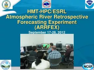
HMT-HPC/ESRL Atmospheric River Retrospective Forecasting Experiment (ARRFEX). September 17-28, 2012. Hydrometeorology Testbed (HMT).

HMT-HPC/ESRL Atmospheric River Retrospective Forecasting Experiment (ARRFEX)
E N D
Presentation Transcript
HMT-HPC/ESRLAtmospheric River Retrospective Forecasting Experiment(ARRFEX) September 17-28, 2012
Hydrometeorology Testbed (HMT) • HMT conducts research on precipitation and weather conditions that can lead to flooding, and fosters transition of scientific advances and new tools into forecasting operations • 5 major activity areas • QPE • QPF • Snow Information • HASP • DST • hmt.noaa.gov
QPF Activities in HMT-West Using HMT-Ensemble • Improve precipitation forecasts (intensity, duration, timing)associated with land falling tropical cyclones along U.S. west coast (Atmospheric Rivers) • Improve microphysical representation of orographic rainfall processes • Explore probabilistic forecast skill • Assess uncertainty of ensemble forecast in comparison to operational ensembles • Effort supported through California Department of Water Resources and USWRP Example Atmospheric River events
HMT-ENSEMBLE EXPERIMENT DESIGN 2009-2010, 2010-2011, 2011-2012 • Nested domain: • Outer/inner nest grid spacing 9 and 3 km, respectively. • 6-h cycles, 120hr forecasts foe the outer nest and 12hr forecasts for the inner nest • 9 members (listed in the following slide) • Mixed models, physics & perturbed boundary conditions from NCEP Global Ensemble
QPF Example of 24-h QPF 9-km resolution 9 members: ARW-TOM-GEP0 ARW-FER-GEP1 ARW-SCH-GEP2 ARW-TOM-GEP3 NMM-FER-GEP4 ARW-FER-GEP5 ARW-SCH-GEP6 ARW-TOM-GEP7 NMM-FER-GEP8 • WRF-ARW and WRF-NMM • WRF-ARW runs: Ferrier, Schultz, Thompson microphysics • WRF-NMM run: Ferrier microphysics
ARRFEX • Goal: bring researchers and operational forecasters together and evaluate impact of new “experimental” models and tools for forecasting AR events • Hosted by Hydrologic Prediction Center (HPC) • HPC forecasters • Environmental Modeling Center (EMC) • Eureka Weather Forecast Office (WFO) • Northwest River Forecast Center (NWRFC) • ESRL Physical Sciences Division (PSD) • University of Utah
Experiment Goals How can forecasters add value to extreme precipitation forecasts at mid-range (3 – 5 day) timeframes? Do probabilistic QPF (PQPF) products provide a viable alternative for increasing awareness of extreme precipitation events? Do the high-resolution, multiple-physics schemes of the HMT-ensemble benefit extreme precipitation forecasting? Do the experimental datasets (HMT-ensemble, multi-model ensemble, reforecasting data) improve extreme precipitation forecasts? What are the biases/strengths/weaknesses of current model guidance in terms of AR forecasting?
Experiment Activities Issue 24 h probability of exceedance forecasts for 3” of precipitation at 5 day (120 hour) and 3 day (72 hour) lead times 10% and 40 % Issue 72 h total QPF forecast for Days 1-3 4”, 8”, >12” Issue an AR-duration (start/stop) forecast for specific West Coast locations 6 hour windows Explore uses of known AR forcing mechanisms for use in precipitation forecasting Subjective model and forecast evaluation
Numerical Model Guidance 12Z 12Z 12Z 00Z 00Z 00Z 00Z 24 hr PQPF 24 hr PQPF 72 hr QPF
Subjective Verification Compare model QPF and user-generated forecasts to: Stage IV: 32 km or 4 km Atmospheric River Observatory Analyze model performance as a method to systematically assess strengths/weaknesses and biases regarding QPF forecasts Does model appear to be consistently better with precip location? Amount? Timing? Does the experimental guidance demonstrate more skill? Comparison to archived HPC QPF: Does the inclusion of the experimental guidance appear to lead to better forecasts? Evaluate new methods of AR forecasting Can model representations of known AR forcing mechanisms be used as indicators of heavy precipitation events? Can they be used to help identify location and/or timing? Do the experimental datasets provide valuable information to forecasters?
Day 5/3 24 hr probability > 3” Day 5 Day 3
Verification: Day 5 GEFS CMCE ECENS MMENS RFCST
Verification: Day 3 GEFS CMCE ECENS MMENS RFCST HMT
Probability Subjective Verification Day 5 • Rate your forecast (Good, Fair, Poor) • Explain • For each of the model probability forecasts, did the probability field capture ALL of the area observed to receive > 3"? • In your opinion, how did the experimental guidance perform compared to the ECENS? • Explain Day 3 • Rate your forecast (Good, Fair, Poor) • Explain • For each of the model probability forecasts, did the probability field capture ALL of the area observed to receive > 3"? • In your opinion, how did the experimental guidance perform compared to the ECENS? • Explain • In your opinion, which ensemble probability forecast provided the most useful guidance? Which provided the least? Why?
Probability Subjective Verification Reforecast deemed ‘most helpful’ in 6 cases (CMCE: 1, HMT: 2) Reforecast and HMT-ENS consistently better than ECENS (when applicable)
Verification: 72 h QPF Stage IV GEFS GFS CMCE ECENS ECMWF
Verification: 72 h QPF Stage IV NAM HMT
72 h QPF Subjective Verification • User forecasts were deemed and ‘improvement’ over the archived HPC forecast • in 7 out of 8 cases.
Experiment Summary • “Reforecast dataset is very useful.” • “The best guidance was the reforecast data…this is a big improvement over the raw member forecast…I hope this can be implemented operationally at HPC asap.” • “Reforecast seems like a very nice way to try and squeeze more utility out of climatological data…I see good performance in the precip patterns... but have no good feel for the magnitude.” • “…reforecast data seems to miss both the magnitude and distribution in general of the extreme nature of the QPF near the focus (AXIS) of the AR (showing a more dispersed solution)…” • “The HMT ensemble was about the best in accurately predicting the magnitude and placement of heavy precipitation. The only drawback of this product…is that its domain is too small.” • “…the HMT…was by far the most superior of the guidance we interrogated during this experiment with high-resolution data over the favored topography.” • “…HMT ensemble members clustered well, and the maxima were all false alarms.” • “In particular, the HMT and Reforecast information was very helpful and generally more accurate.”
Experiment Summary • Higher-resolution data is very beneficial, especially in West Coast/terrain driven events • Surprised by NAM/HMT performance • Reforecast (PQPF) and HMT-ensemble data largely considered the best guidance, GFS/GEFS/ECENS rated as the worst • HMT could be too wet (?) • Resolution of global ensembles a detriment • PQPF seems to be a worthwhile way to explore extreme QPF at mid-range lead times: • “The primary thing the PQPF offers is an enhancement in situation awareness showing the threat for possible heavy precipitation in the medium range time scales.” • “Currently, the viability seems limited, but I think the potential is huge and it's absolutely where we need be going with our precipitation forecasting” • Several participants noted that their time in the experiment was beneficial: interaction, discussion, training, additional insight, product development, etc….
Next Steps • Victor Stegemiller (NWRFC) office training session (October 2012) • Tom Wright (Medford WFO) forecaster training seminar (November 2012) • Western Region webinar (tentatively mid-November 2012) • AMS annual meeting oral presentation (January 2013) • ARRFEX summary report • Already had ARRFEX data and result requests (Tom, Victory, Jon, Environment Canada) Other
Additional Experimental Guidance Multi-Model Ensemble 90 members: 20 CMCE, 20 GEFS, 50 ECENS 70 km resolution Provides a more realistic “true” probability (Hamill, 2012) Standardized Anomalies Computed from a 1948-2011 climatology of NCAR/NCEP Reanalysis data Model output interpolated onto the 2.5 degree Reanalysis grid 15 day centered averages used to filter climate data and make anomalies (standard deviations)
Point Forecast Verification • When do you forecast the precipitation to start and stop at the given location? • When do you forecast the heaviest precipitation to start and stop at the given location? • What is the confidence level of this forecast? • When do the observations show that the precipitation (as well as the heaviest precipitation) started and stopped at the given location? • How well do the locations of the maxima of moisture flux correspond the locations of the 6-hour precipitation maxima? • How well do the locations of the maxima of the standardized anomalies of moisture flux correspond the locations of the 6-hour precipitation maxima? • Were there any large changes in the guidance compared to the initializations from 2 days earlier? (e.g. do the models show run-to-run consistency?)
Point Forecast Verification ECMWF ECMWF GFS GFS
Daily Schedule 8:00 am (Monday only) – Orientation 8:30-9:45 am – Create 24-h PQPFs (00Z to 00Z) for 5 day and 3 day lead times 10:00-11:00 am – Create Day 1-3 72-hour QPF Optional: 11:00am – HPC Map Discussion 11:30-12:30 pm – Lunch 12:30-1:30 pm – Verify 24-h PQPFs (00Z to 00Z) for 5 day and 3 day lead times 1:45-2:30 pm – Verify 72-hour QPF 2:45-4:15 pm – Make and verify precipitation duration at specific locations 4:15-4:30 pm – Group discussion and/or exit questions
72 h QPF Subjective Verification Forecast • Rate your forecast (Good, Fair, Poor) • Explain • Does the group's forecast appear to be an improvement of or a degradation of (e.g. quantitatively or spatially) of the archived HPC forecast? • Explain • Rate the QPF output of each model forecast (Good, Fair, Poor) HPC
Experiment Summary • In your opinion, did the experimental guidance provide benefit to the forecasting of heavy precipitation events at the mid-range (3 and 5 day) time frame? • What is your opinion of the higher resolution guidance (HMT-ensemble and NAM) in terms of forecasting precipitation in atmospheric river events? • Was there a model or guidance product that you felt performed the best during the experiment? Worst? • What is your opinion of the viability of PQPF in terms of forecasting heavy precipitation events at mid-range lead times? Do they provide any additional benefit compared to the traditional deterministic QPF products? • Do you feel using known AR characteristic parameters, such as precipitable water or moisture flux, provide benefit to forecasting precipitation timing, location and amount? • In your opinion, what is the most crucial issue with forecasting West Coast heavy precipitation events?
Next Steps • Analyze ARRFEX participant survey results (Lead: Tom Workoff) • Conduct objective and spatial verification of the ARRFEX data (Lead: Ellen Sukovich) • Probabilities (including reforecast HMT-Ensemble) • 24 h QPF (including reforecast mean and each HMT ensemble member) • 72 h QPF • Continue to investigate the reforecast dataset for AR events and precipitation (Lead: Ben Moore) • Differing timeframes for QPF (e.g. 72 h and 6 h) • Use other parameters as analogs • Investigate various model parameters and QPF duration, location, and intensity (Lead: Tom Workoff) • Study MJO and AR relationships (Lead: Tom Workoff & Mike Bodner) • CPC plots Cases from ARRFEX show a tendency to occur in MJO phases 5-6-7
GSS 1/15-2/15 (w/o hot start) Results – Hot Start Implications • During the 2011-2012 HMT winter exercise, ARW ensemble model members (red) were hot-started using LAPS during the period March 15-April 15, but were not hot-started before that. • The NNM members (blue) were not hot started during either period. • To assess the impact of this LAPS feature, we compare verification results during the later period with an earlier month with a similar rainfall regime. GSS 3/15-4/15 (with hot start)
Results - QPF Better Optimal No Skill 6 9 12 15 6 9 12 15 Lead Time (hr) Lead Time (hr) • 6hr Accum Precip > 1”- All scores are low – partially due to sample-size but SREF (32km) shows very little skill whereas HMT & AFWA (3 & 4km) ensembles can score as high at 0.6 • Prob (6hr Accum Precip) > 1”- All scores are low at 6hr lead time – There are differences in the median AFWA and SREF values at 12 hr leads that may be significant HMT/GSD (3km - 9 member) SREF (32km - 21 member) AFWA (4km - 10 member)