Download
1 / 25
250 likes | 375 Views
THE ISLAND CHALLENGE Rob Greenberg Chapel Hill High School. rgreenbergscience.wikispaces.com. rgreenberg@chccs.k12.nc.us. A multidisciplinary endeavor that provides opportunities for collaboration, critical and creative thinking and sharing Knowledge with the community. COACHING STUDENTS

E N D
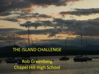
THE ISLAND CHALLENGE Rob GreenbergChapel Hill High School
rgreenbergscience.wikispaces.com rgreenberg@chccs.k12.nc.us
A multidisciplinary endeavor that provides opportunities for collaboration, critical and creative thinking and sharing Knowledge with the community
COACHING STUDENTS • cooperative team • engage in ongoing discussions • problem-solving • critical thinking • address important concepts and issues. • use imagination • develop an understanding of the concept of sustainability and its applications in many areas of life. • possible course of study in college
TIME COMMITMENT: requires some work during lunch, before school or after school - class time alone might not be enough to achieve excellence, which is your goal. Regular communication with group members is important
ENGAGED IN VARIOUS DISCIPLINES Land use and management Renewable energy Civil Engineering Architecture Landscape design Transportation Agriculture Cartography Conservation
LEED (Leadership in Environmental and Energy Design) decision-making based on real geologic, hydrologic, weather, climate and ocean data using human history to guide decisions (i.e. “Collapse” by Jared Diamond)
PROVIDED BY TEACHER: • entire project can be viewed from web site • bound hard copies of entire project including rubrics in classroom • links to useful web sites for each “category” • paper for large maps • scheduled guest presenters • organizational system for safe storage completed “benchmarks” • “limited” class set of drawing supplies
EACH GROUP PROVIDES ITS OWN: • drawing kit (markers, pens, colored pencils, erasers, templates, etc.) • tri-fold display board
PRESENT PROJECT TO COMMUNITY AT • EARTH DAY EVENT IN APRIL • engage the general public in a talk about your island using visuals: • tri-fold display board (with final copies of research posted) • small topographic map of natural island • large detailed map of your developed island • detailed map key • three-dimensional model that demonstrates “green design” • restaurant or diner menu featuring locally-grown foods
START-UP • Students will work in cooperative groups of three to four. • Each group will have one student who at the very least is a fair to good “artist.” • Each group chooses their top five choices from the list of world’s islands. Your group will be assigned one of your five choices * • * this is where I am at right now!!
NORTH ATLANTIC SOUTH ATLANTIC Azores Falkland IslandsCanary Islands AscensionCape Breton Islands St. HelenaFaeroe Islands Tristan de CuhnaMadeira Islands South Sandwich IslandsShetland Islands South GeorgiaChannel Islands (in English Channel) Svalbard
CARRIBBEAN SEAMEDITTERANEAN SEABahamas Balearic Islands (Mallorca)Cayman Islands Aegean Sea IslandsTrinidad Aeolian IslandsMartinique MaltaGuadeloupe PanteleriaGrenadaVirgin Islands SOUTH PACIFIC OCEANAntigua Easter Island (Isla de Pascua)St. Thomas Pitcairn IslandSt. Croix Galapagos Islands
INDIAN OCEANOCEANIAMaldives FijiSeychelles TahitiMauritius SamoaChristmas Island Cook IslandAndaman & Nicobar Islands Tonga IslandsChagos Archipelago TahitiTimor New CaledoniaComoros Soloman IslandsMollucas French Polynesia JavaSumatra
NORTH PACIFIC OCEAN Marshall IslandsPhillipinesJapan (smaller islands – not main island)MicronesiaNorthern Mariana IslandsQueen Charlotte IslandsAleutian IslandsIsla SocorroIsla Maria MadreMagdelenaClofasChannel Islands (off California coast)
SEEDS OF THE ISLAND CHALLENGE EVOLUTION OF AN IDEA
Sandbox Geoscience Paradise Project Barrier Island Project Island Project *2.0 Island Project *XP“Island Challenge” . The Roots of the Island Project
CONTENT TAUGHT IN PREPARATION Topography and topographic maps Landform features Plate tectonics Geology and geologic history Weather and climate Oceanography Hydrology Natural resources
TASA program on a set of Imac computers in our school has an excellent interactive program for topographic maps