Download
1 / 57
570 likes | 702 Views
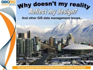
Why doesn't my reality. Reflect my design?. And other GIS data management issues…. The New Geospatial Enterprise: Integrating Government, Industry and Research. Purpose of the presentation. To describe GIS data management issues encountered at the CoV including:

E N D
Why doesn't my reality Reflect my design? And other GIS data management issues… The New Geospatial Enterprise: Integrating Government, Industry and Research
Purpose of the presentation • To describe GIS data management issues encountered at the CoV including: • Branch need vs. Corporate need • Data duplication • Design vs. As-built • To describe how the CoV is using a new technology to address some of our historical data discrepancies The New Geospatial Enterprise: Integrating Government, Industry and Research
The City of Vancouver • 8th largest city (578,000) and 3rd largest metropolitan area (2.1 million) in Canada • Considered to be one of the most livable City’s in the world (42nd most expensive) • Hosted the 2010 Winter Olympics • Home of the ‘almost’ Stanley Cup champion Vancouver Canucks
GIS at the City • We manage • Over 232 kms of Sewer pipes • Over 412 kms of Water lines • 4647 Parking meters • Over 100,000 property parcels • 50,000 + Street poles • VanMap and Open Data web sites winning numerous innovation awards and kudos like: ‘City of Vancouver Wins Top Innovator Award from BC Business for Open Data site’ So what issues could we possibly have!!??? The New Geospatial Enterprise: Integrating Government, Industry and Research
Imagine you are god… You design the most beautiful creature ever to be seen on earth…. The New Geospatial Enterprise: Integrating Government, Industry and Research
Then one day you are walking around down there… The New Geospatial Enterprise: Integrating Government, Industry and Research
And you run into your creation… Hi God! The New Geospatial Enterprise: Integrating Government, Industry and Research
Seems someone made some changes during construction and forgot to tell you… Welcome to the world of GIS data management! The New Geospatial Enterprise: Integrating Government, Industry and Research
Overview • Data has been compiled over many years using: • a variety of tools • a wide assortment of accompanying methodologies • Variation in acquisition and input create discrepancies in: • positional accuracy • completeness • currency The New Geospatial Enterprise: Integrating Government, Industry and Research
Culture • In 1997 the CoV: • de-centralized Mapping & CADD function • gave control of the GIS data entry staff to the individual branches • Rationale primarily administrative • Impact of decision not felt until many years later The New Geospatial Enterprise: Integrating Government, Industry and Research
Branch vs. Corporate need ‘the needs of the many don’t always outweigh the needs of the few’ • Data isn’t always ‘wrong’ • ‘Input based on the needs of the data owners at the time • creating node–arc–node connectivity was secondary to a good looking map The New Geospatial Enterprise: Integrating Government, Industry and Research
Requirement interpretation • An example is the sewer main below 15.5m 5.2m 5.7m The New Geospatial Enterprise: Integrating Government, Industry and Research
Data Duplication • Silos • Shared responsibilities The New Geospatial Enterprise: Integrating Government, Industry and Research
Data Duplication The New Geospatial Enterprise: Integrating Government, Industry and Research
As-builts • Business process issue • GIS data entered based on the designed version • Modified in the field • Changes not brought back into the office • Result = GIS does not reflect reality The New Geospatial Enterprise: Integrating Government, Industry and Research
Issues well-hidden • 1990’s data issues were annoyances only • Impact on the business was small • Data access limited • Silos restricted sharing The New Geospatial Enterprise: Integrating Government, Industry and Research
Web Mapping 1999-2001 • GIS web mapping technologies made access to the data much simpler • Users not really using the data beyond viewing and printing it out The New Geospatial Enterprise: Integrating Government, Industry and Research
Asset Management • Engineering implements asset management system in 2009 • Assets needed to be • tracked • valued • Depreciated (and appreciated ) • available to assign work orders and service requests to • Primary source was GIS data • Data migration raised questions • Analytics required ‘good’ data The New Geospatial Enterprise: Integrating Government, Industry and Research
Open Data • Decision by council to make all of our data available to the public • Exposed the data to further scrutiny and raised questions as to the overall value of the data released • Disclaimers • ‘as is, where is’ • ‘buyer beware’ The New Geospatial Enterprise: Integrating Government, Industry and Research
Shared Services • Shift in the City’s cultural paradigm • Reversal of the decentralization model of the mid to late 90’s • Brought the departmental GIS groups together with a new common mandate • Corporate onus shifted from application development to data management • GIS data entry staff remain decentralized The New Geospatial Enterprise: Integrating Government, Industry and Research
Asset Management group • Engineering department • Mandate includes: • metrics and tools to mine the asset data for the purposes of advanced asset analysis • Relationship established with the Corporate GIS group • intent of addressing data management issues The New Geospatial Enterprise: Integrating Government, Industry and Research
Mobile GIS data collection pilot • Pilot project • McElhanney acquired the Canadian rights to a mobile mapping technology called GeoAutomation • CoV saw a presentation at a GIS conference and could envision it as one solution to the issues described The New Geospatial Enterprise: Integrating Government, Industry and Research
Business value • Keys are: • Capability to use the imagery and tracking points captured to confirm and clean up our existing data • ability to capture data that we don’t currently have spatial records for • Above ground data issues only • Doesn’t address ‘sustainment’ process issues The New Geospatial Enterprise: Integrating Government, Industry and Research
Project scope • Entire length of Kingsway, Boundary Rd to Main St • City supplied much of the ground control • Contracted vendor was required to fill in stretches with appropriate photo control points as needed The New Geospatial Enterprise: Integrating Government, Industry and Research
GeoAutomationOverview Survey-Enabled Streetscape Imagery The New Geospatial Enterprise: Integrating Government, Industry and Research
So, what exactly, is survey-enabled imagery? Imagery that allows users to simply point and click on their office workstation screen to “survey” or map features. x, y and z values are directly input to your CAD or GIS. Each pixel has a potential x, y and z value. Direct input of points, line strings and polygons. Plug-ins for ArcGIS, MicroStation and AutoCAD. The New Geospatial Enterprise: Integrating Government, Industry and Research
Cameras and Collection • Cameras collect and compress 11 frames per second • Each camera has it’s own computer with a 1.5 TB or 2.0 TB storage capacity • Optimal collection speed is 35km (22 miles) per hour • 30 - 40 GB of image data per km The New Geospatial Enterprise: Integrating Government, Industry and Research
Image Overlap The New Geospatial Enterprise: Integrating Government, Industry and Research
Image Processing Processed Feature Point Cloud Processed Feature Points or ‘Tracks’ The New Geospatial Enterprise: Integrating Government, Industry and Research
Track Points • Track points are easy to find in urban digital imagery: • At intersections of linear features; • Along linear features; and • At locations of image contrast The New Geospatial Enterprise: Integrating Government, Industry and Research
Accuracy Expectations The New Geospatial Enterprise: Integrating Government, Industry and Research
Asset Inventory: The New Geospatial Enterprise: Integrating Government, Industry and Research
Auto Feature Recognition: 3D or 2D location Signs Manholes Valve Covers Hydrants Catch Basins The New Geospatial Enterprise: Integrating Government, Industry and Research
GIS Data Collection and Verification: The New Geospatial Enterprise: Integrating Government, Industry and Research
Engineering Survey and Design: • Most useful in road redesign projects: • Cross Section Surveys • Topographic Mapping • Volumes • Site Surveys • Other Applications: • Slope Analysis • Terrain Modeling • Pavement Distress Evaluation • Route Condition Inventory The New Geospatial Enterprise: Integrating Government, Industry and Research
Pavement / Road Condition Inventory: The New Geospatial Enterprise: Integrating Government, Industry and Research
Virtual As-Builts: Vectors overlain on imagery Camera view angle The New Geospatial Enterprise: Integrating Government, Industry and Research
3D Modeling: The New Geospatial Enterprise: Integrating Government, Industry and Research
Additional Applications: • Property Assessment • Forensics / Accident Investigation • Code Enforcement The New Geospatial Enterprise: Integrating Government, Industry and Research
Benefits: • 24/7 Virtual Visits. • Reduced Field Collection Time. • No GPS Problems. • No Weather Delays. • Workplace Safety Improvements. • Improved Database Confidence. • Additional Value from Image Library. • Productivity Improvements. • Reduced Carbon Footprint. The New Geospatial Enterprise: Integrating Government, Industry and Research
GeoAutomation Demo The New Geospatial Enterprise: Integrating Government, Industry and Research
Benefits: The New Geospatial Enterprise: Integrating Government, Industry and Research
Study Area • Kingsway Westbound • North side of Kingsway • Ormidale St to Sidney St • 19 block stretch • Focus on • Street Light Poles (49) • Litter Cans (12) • Hydrants (25) The New Geospatial Enterprise: Integrating Government, Industry and Research
What do we want to know? • Given that variation in acquisition and input create discrepancies in: • positional accuracy • completeness • Currency Questions: • How complete & up-to-date is the data? • What is the range of variation in positional accuracy? The New Geospatial Enterprise: Integrating Government, Industry and Research
Completeness & Currency • Newly installed assets • Uninstalled assets still showing • Moved assets The New Geospatial Enterprise: Integrating Government, Industry and Research
Poles have been uninstalled New Pole installed The New Geospatial Enterprise: Integrating Government, Industry and Research
New Litter Can installed The New Geospatial Enterprise: Integrating Government, Industry and Research
Completeness & Currency There is an installed asset here. The New Geospatial Enterprise: Integrating Government, Industry and Research
New data collection *Bulk collected using Auto Feature Recognition* The New Geospatial Enterprise: Integrating Government, Industry and Research
Variation in positional accuracy • GeoAutomation assumed to be accurate • locations mapped with relative confidence (Projection Error < 1) • Compared our dataset with asset locations collected using GeoAutomation • CoV data accuracy is determined by relative offset to GeoAutomation location The New Geospatial Enterprise: Integrating Government, Industry and Research