Download
1 / 40
400 likes | 571 Views
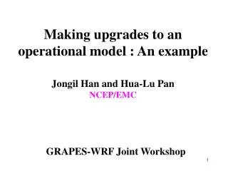
Making upgrades to an operational model : An example Jongil Han and Hua-Lu Pan NCEP/EMC. GRAPES-WRF Joint Workshop. Recent upgrade in the operational GFS (Effective at July 27 th 2010 12 UTC). Resolution increase: T382L64 (~35km) => T574L64 (~23km) Major physics change:

E N D
Making upgrades to an operational model : An exampleJongil Han and Hua-Lu PanNCEP/EMC GRAPES-WRF Joint Workshop
Recent upgrade in the operational GFS (Effective at July 27th 2010 12 UTC) • Resolution increase: T382L64 (~35km) => T574L64 (~23km) • Major physics change: • Shallow and deep convection, PBL schemes • Radiation: • SW: NCEP0 => RRTM (Rapid Radiative Transfer Model) • LW computation frequency: 3 hrs => 1 hr • SW cloud overlap: random => maximum-random overlap • Positive-definite vertical tracer transport scheme (remove negative water vapor) • Minor changes in mountain blocking parameterization
Revision of shallow cumulus convection scheme • One of long standing problems in the GFS was the systematic underestimation of stratocumulus clouds over off-coast regions in the eastern Pacific and Atlantic Oceans. • This problem has been attributed to the shallow convection scheme which uses a turbulent diffusion approach
Low cloud cover (%) (P>680hPa) ISCCP Old GFS
Old operational shallow convection scheme in the GFS (Tiedke, 1983) Kmax=5m2s-1 Seek conditionally unstable layer LCL K
Mass flux analogy(de Roode et al., 2000) : Au (updraft area)=0.5 Ad (downdraft area)=0.5 Old shallow convection scheme (Diffusion scheme) Au~0.0; Ad~1.0 Environment is dominated by subsidence resulting in environmental warming and drying. New shallow convection scheme (Mass flux scheme)
Revised shallow convection scheme • Use a bulk mass-flux parameterization same as deep convection scheme. • Separation of deep and shallow convection is determined by cloud depth (currently 150 mb). • Entrainment rate is given to be inversely proportional to height (which is based on the LES studies) and much larger than that in the deep convection scheme. • Mass flux at cloud base is given as a function of the surface buoyancy flux (Grant, 2001). This differs from the deep convection scheme, which uses a quasi-equilibrium closure of Arakawa and Shubert (1974) where the destabilization of an air column by the large-scale atmosphere is nearly balanced by the stabilization due to the cumulus.
Revised shallow convection scheme • Entrainment rate: • Siebesma et al.2003: • Detrainment rate = Entrainment rate at cloud base ce =0.3 in this study
Revised shallow convection scheme Mass flux at cloud base: Mb=0.03 w* (Grant, 2001) (Convective boundary layer velocity scale)
CTL New shallow convection scheme
Cloud depth (mb) Deep & shallow Shallow only (<150mb)
ISCCP Old shallow New shallow
Revised PBL scheme • Include stratocumulus-top driven turbulence mixing based on Lock et al.’s (2000) study • Enhance stratocumulus top driven diffusion when the condition for cloud top entrainment instability is met • Use local diffusion for the nighttime stable PBL rather than a surface layer stability based diffusion profile • Background diffusivity for momentum has been substantially increased to 3.0 m2s-1 everywhere, which helped reduce the wind forecast errors significantly
Heat flux MRF PBL Revised model (Simplified after Lock et al., 2000) (Buoyancy reversal term is neglected) where c=0.2 (Moeng et al., 1999) C=1.0 (CTEI condition) (MacVean and Mason, 1990)
Low cloud cover (%) No stratocumulus top driven diffusion With stratocumulus top driven diffusion
GFS Grid Point Storms (bull’s eye precip) • The GFS suffered from grid point storms during the convective season, which was another long standing problem in the GFS forecasts. • The old deep convection scheme did not appear to fully eliminate the instability and consequently, an explicit convective ascent occurred on the grid scale, producing unrealistically large precipitation.
Grid Point Storm 24 h accumulated precip ending 12 UTC 15 July 2009 Observed 72 h GFS Forecast
Revised deep convection scheme • Increase cloud top • - Random cloud top selection => single deepest cloud • - A convective overshooting is parameterized in terms of cloud work function • Increase maximum allowable cloud base mass flux • Include the effect of convection-induced pressure gradient force to reduce convective momentum transport (reduced about half)
Old GFS deep convection scheme (SAS) Updraft mass flux CTOP Entrainment Downdraft mass flux DL 1.0 1.0 hs h LFC 150mb Entrainment Detrainment SL 0.5 Environmental moist static energy 0.05
The overshoot of the cloud top is stopped at the height where a parcel lifted from the neutral buoyancy level with energy equal to 10% of the cloud work function (A) would first have zero energy. 0.1A A hs hc
Revised deep convection scheme Maximum cloud base mass flux [currently 0.1 kg/(m2s)] is defined for the local Courant-Friedrichs-Lewy (CFL) criterion to be satisfied (Jacob and Siebesman, 2003); Then, maximum mass flux is as large as 0.5 kg/(m2s) for T382 (35km) resolution
Revised deep convection scheme Organized entrainment (Betchtold et al., 2008) org. turb. in sub-cloud layers above cloud base
Total precipitation (grid scale+convective) Revised package Old GFS
Convective precipitation Revised package Old GFS
Total precipitation (grid scale+convective) Revised package 24 h accumulated precipitation ending at 12 UTC, July 24, 2008 from (a) observation and 12-36 h forecasts with (b) control GFS and (c) revised model
Reduction of convective momentum transport due to convection-induced pressure gradient force(Han and Pan, 2006) c: effect of convection-induced pressure gradient force c=0.0 in the current operational GFS convection scheme c=0.55 in the revision
#CASES (350) (323) (300) (275) (245) (199) (158) (129) #CASES (257) (230) (194) (163) (135) (91) (55) (27)
Medium-range forecast experiments with data assimilation • Resolution: T382L64 (about 35km at equator) • Test period: June 2 – Nov. 10, 2008 (7-day forecasts at each 00Z cycle), which includes the whole 2008 hurricane season. • A spin-up series of forecasts for the previous 19 days has been discarded from the analysis.
T574 (~23km) NH SH
500 MB Anomaly Correlation Northern Hemisphere Southern Hemisphere
#CASES (359) (331) (307) (281) (254) (205) (161) (131) #CASES (261) (233) (197) (166) (138) (92) (56) (28)
Future plan • Turbulence parameterization : moist-process conserved variable mixing (Tl and Qt) • Macro and micro physics : Ferrier scheme with partial clouds • Consistent cloud fraction formulation for macro-physics, turbulence, and radiation