Download
1 / 14
140 likes | 284 Views
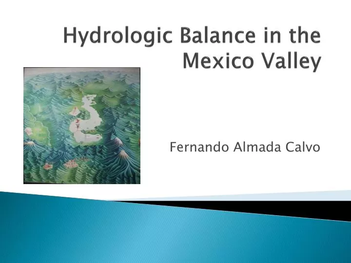
Hydrologic Balance in the Mexico Valley. Fernando Almada Calvo. What and where is the Mexico Valley? (Also called Anahuac: Nahuatl for Close to water ). Closed hydrologic system, situated in Central Mexico. Mexico City and Pachuca Area: 9,611km 2 (1.5 times the area of Delaware).

E N D
Hydrologic Balance in the Mexico Valley Fernando AlmadaCalvo
What and where is the Mexico Valley? (Also called Anahuac: Nahuatl for Close to water ) • Closed hydrologic system, situated in Central Mexico. • Mexico City and Pachuca • Area: 9,611km2 (1.5 times the area of Delaware) City of Pachuca Popocatepetl (5384 m/17664 ft) Mexico City
Why is this important? • Less that 1% of territory. • 19 million people live in the Valley (20%) • 1/3 of Mexico’s GNP is concentrated there • Density: Averaged in valley:~2,000 hab/km2 NYC :~9,000 hab/km2 Mexico City:~5,000 hab/km2
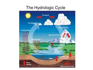
Objectives • Perform a hydrologic mass balance on the Mexico Valley • Estimate the power needed to pump water from the Cutzamala System to the Mexico Valley. Mexico Valley Outflows Inflows
Filled Raw = -
Balance diagram Surface water or in engineered systems Groundwater
Data acquisition • National Institute of Geography and Statistics (INEGI) • River shapefiles • Water bodies • National Water Commission (CNA) • Water use and consumption • Water flow in drainage system • Water technology Institute (IMTA) • Daily precipitation data (1978-1998) • Evapotranspiration • Shuttle Radar Topography Mission • DEM
Precipitation (mm/year) Precipitation: 6,347 Mm3/year
Pan Evaporation and Evapotranspiration (mm/year) Evapotranspiration: 5,001 Mm3/year (Contreras et al)
Balance diagram (Unknown or illegal use?) Evaporation from water bodies ~100Mm3/year Evapotranspiration 5,002 Mm3/year Unknown Losses ~67Mm3/year Outflow from the valley 1,861 Mm3/year (CNA) 698 Runoff ratio 0.11 Superficial Water bodies 329 539 1532 (IMTA) 210 (IMTA) Precipitation 6,347 Mm3/year 1692 Use 2,449 Mm3/year (IMTA) 647 1639 (IMTA) Groundwater DV=-992 Mm3/year Losses during use 917 Mm3/year (IMTA) Imports 600 Mm3/year (CNA)
Work to do • Locate in map reservoirs and canals of Cutzamala system. • Calculate the energy required for pumping 19m3/sec of water to the Mexico Valley. • Write Report