Download
1 / 49
490 likes | 617 Views
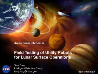
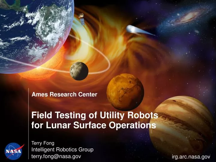
Field Testing of Utility Robots for Lunar Surface Operations. Terry Fong Intelligent Robotics Group terry.fong@nasa.gov. irg.arc.nasa.gov. Apollo Surface Operations. Jack Schmitt & LRV (Apollo 17). What’s Changed Since Apollo?. Notional Lunar Campaign (rev. 3/2008). First Three Years.

E N D
Field Testing of Utility Robotsfor Lunar Surface Operations Terry Fong Intelligent Robotics Group terry.fong@nasa.gov irg.arc.nasa.gov
Apollo Surface Operations Jack Schmitt & LRV (Apollo 17)
First Three Years 1140 days (robots on surface) During the first three years, crew is on the surface 8% of the time 87 days (crew on surface)
Lunar Surface Robotics • Before/between Human Missions • Characterize environment • Prepare for crew • Build infrastructure • Short-stay (Sortie) Missions • EVA support: expand range and capability of sorties • Off-load repetitive and time consuming tasks • Outpost Missions • Routine tasks: maintenance, ops support, survey, etc. • Heavy duty: large payload transport, construction, etc.
NASA Human-Robotic Systems Project • Research areas Surface mobility • Crew • Habitat • Robots Handling • Cargo • Payloads • Resources Human-robotinteraction (HRI) • Primary objectives • Address key technical challenges for lunar surface operations • Develop requirements & mature systems for lunar surface operations • Perform trade studies in laboratories and analog environments NASA Centers: ARC, GRC, GSFC, JPL, JSC, KSC, LaRC
HRS Field Testing • Test and validate • Technologies, systems, & procedures • Integrated mission simulations • Analogs are never 100% perfect • No place on Earth is exactly the Moon • Many factors to consider • Factors and fidelity Meteor Crater Haughton Crater Moses Lake Sand Dunes
2006 Meteor Crater Field Test • 3-16 September 2006 • Coordinated human-robot operations • ARC, JSC, JPL, & LaRC • Co-located with Desert RATS (shared infrastructure)
Lunar Short Stay Mission Simulation • ATHLETE positions Pressurized Rover Compartment (PRC) • Crew drive unpressurized rover to worksite • Crew dismount and walk to PRC to recharge suits • Centaur removes sample box (time-delayed teleop via satellite from Houston) • K10 performs autonomous “walkaround” (for remote visual inspection) 1 1 2 2 3 3 4 4 5 5
Visual Inspection • Rover-based imaging • Autonomous approach & circumnavigation • HDR gigapixel panorama • Crew (IVA or ground) analyzes images for problems K10 inspection of SCOUT Meteor Crater Field Test, Sept. 2006 M. Bualat et al. 2007. “Autonomous Robotic Inspection for Lunar Surface Operations”, FSR ’07
Basic Panorama Source: 54 images (1,600x1,200) = 99 Mpix Panorama: 90º x 40º (12,000x6,000)
HDR Panorama Source: 270 images (1,600x1,200) @ 5 stops = 494 Mpix Panorama: 90º x 40º (12,000x6,000)
2007 Haughton Crater Field Test • 10 July – 3 August 2007 • Systematic site survey with two K10 robots • 3D scanning lidar for topographic mapping • Ground-penetrating radar for resource prospecting • Multiple lunar analog sites at Haughton Crater • Remote (habitat and ground control) robot operations Haughton Crater (Devon Island, Canada) K10
Haughton Crater • Devon Island: 66,800 sq. km • Largest uninhabited island on Earth • Haughton Crater: ~20 km (diameter), ~39 Ma (Late Eocene)
Haughton Crater Haughton Crater 75º 22’ N, 89º 41’ W
K10’s at Haughton 1.3 m 1 m 0.9 m
3D Terrain Modeling K10 Red lidar survey “Fortress” formationnear HMP base camp
3D Terrain Modeling “Fortress” formation(DEM from lidar scans)
3D Terrain Modeling 1m polar grid elevation map
3D Terrain Modeling HMP base camp (1 m polar grid)
K10 GPR Survey • “Drill Hill” survey • K10 robot on-site for 3 days • HMMWV simulates pressurized rover (temporary habitat) • Resource prospecting: subsurface ground-penetrating radar scans (parallel transects with 50 m spacing) 700 m
“Drill Hill” Survey Survey plan (green) Survey boundary (blue) K10 path (black) Parallel line transects (50 m spacing, E-W, N-S) 20.5 km total traverse
Remote Operations NASAARC NASAJSC “Pressurized Rover” ARC JSC “Lunar Outpost” Ground Ops IVA Ops
Ground Control (ARC) Viz Explorer 3D terrain model Google Earth
2008 Moses Lake Sand Dunes Field Test • 1-13 June 2008 • Examine early lunar mission tasks(deploy infrastructure, site surveys, resource prospecting) • Multi-robot & coordinated human-robot activities • Experiment with various ops concepts & scenarios ATHLETE LSMS Scarab Chariot K10’s
Moses Lake Sand Dunes • 12 sq. km sand dunes • Soft soil with mixed gravel • Rolling terrain, varied slopes • Lightly vegetated • Lunar operations analog • Not lunar science analog 1 km
Moses Lake Sand Dunes Pamp’s Pit
robot Science Ops Study: Robotic Recon • Advance field work • Reduce unproductive crew time(driving, navigating, searching) • Advance scouting (station-based) • Systematic survey (transect-based) • Surface data (vs. orbital data) • Higher resolution • Oblique & close-up views (non-nadir) • Contact & subsurface measurements • Test objectives • Understand difference betweenrobotic recon and robotic exploration • Develop recon ops protocol • Assess system performance, interaction, comm. patterns, etc. robot crew
Orbital Data Apollo 15 Apollo 17 Digital Elevation Model (40 m/post) Apollo 15 3D view of DEM + ortho image Data source: Apollo Metric & Panoramic cameras (high-res scans by M. Robinson / ASU) Processing: NASA Ames StereoPipeline Registration: ULCN2005 Visible Image Base Map (10 m/pixel)
Surface Data High-res panoramic image (140x68 deg, 21K x 16K pixels) Terrain image (70 microns / pixel) Ground-penetrating radar vertical profile
Traverse Planning & Execution Baseline Traverse Plan Updated Traverse Plan Initial Planning Robotic Recon Traverse Robot Crew Orbital imagery Science objectives EVA plans Robottraverseplans Surface data 3D terrain model Science Team Ground Control Team Ground Data Systems Science Back Room Ground Data Systems
Robot Traverse Planning Tool (Site 1) Timeline view of traverse plan Data acquisition tasks Map view of traverse plan List view of traverse plan
PanCam Data (Site 1) dune crests albedovariations mottled slightlyundulatingterrain 140 x 68 deg (H x V) 6 tiles (each 10 Mpix: 3648x2736) ripples
Microscopic Imager Data (Site 1) poorly sorted, anglular grains sizes range from < 1mm to 2.6cm Analysis by M. Rice (Cornell)
EVA Planning • Approach • Robotic recon identifies & priorities sites of interest • Plan EVA traverse & activities to maximize crew productivity • Produce briefing package for crew (task map, cuff checklist, etc.) EVA suit testing at Moses Lake
EVA Planning M. Deans, B. Garry, J. Heldmann, G. Lofgren, D. Kring, P. Lee, and others …
Task Map (Site 1) Station 1 (Light Albedo) S + D Station 2 (Dark Albedo) S + D/T Station 3 (Mottled Albedo) S S = Surface Sample D = Deep Sample T = Trench D/T = Deep or Trench
EVA Traverse (Site 1) Video view from Chariot Science Backroom and CapCom
What’s Next ? • New lunar campaign • Human & robotic surface missions ~2020 • Long-duration stays & long-distance exploration • Must conserve crew time (reduce “unproductive” tasks) • Utility robots • Perform routine, repetitive, & time-consuming tasks • Dull, dirty, or dangerous • Complement and supplement human surface activity • Current research at NASA Ames • Geotechnical assessment (e.g., surface bearing capacity) • Shallow regolith excavation • Automated mobile camera
NASA Summer 2009 Internships • ESMD Space Grant • Juniors, Seniors & Graduates • Deadline: February 22 • http://education.ksc.nasa.gov/esmdspacegrant • Motivating Undergraduates in Science and Technology (MUST) • Sophomores, Juniors, & Seniors • Deadline: February 1 • http://scholarships.hispanicfund.org/applications/ • Undergraduate Student Research Project (USRP) • Sophomores, Juniors, & Seniors • Deadline: January 23 • http://www.epo.usra.edu/usrp/