Download
1 / 70
870 likes | 1.62k Views
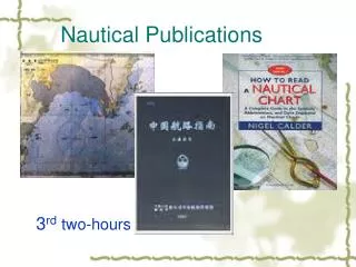
Nautical Publications. 8 th two-hours. The 8th two hours will deal with review, warm-up, the study of passages, exercises, a brief summary and homework. 1. review. Divide the students into several groups.

E N D
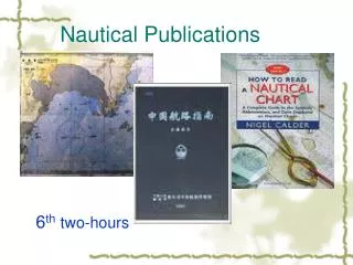
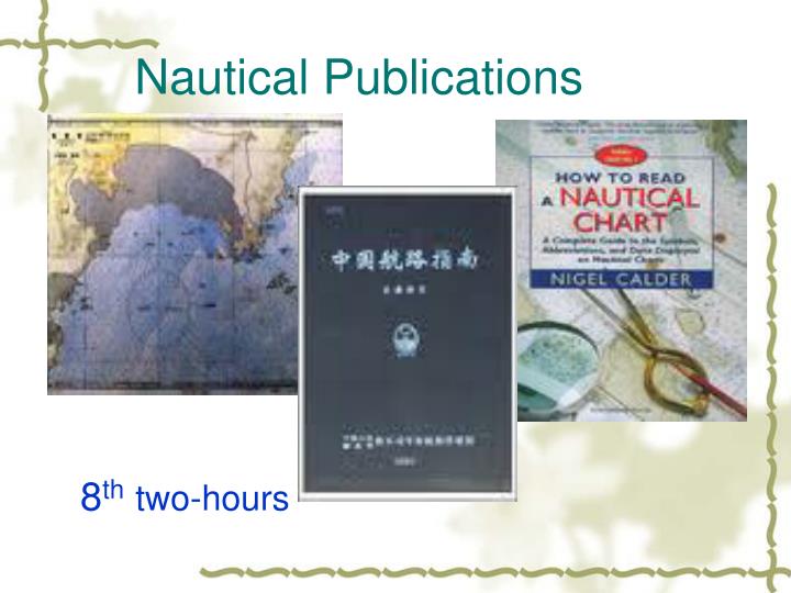
Nautical Publications 8thtwo-hours
The 8th two hours will deal with review, warm-up, the study of passages, exercises, a brief summary and homework. 1. review Divide the students into several groups. Try to discuss and summarize information about ALL, Almanacs, The Mariners Handbook (NP100), Ocean Passages for the World (NP136),Admiralty List of Radio Signals, Admiralty Sailing Directions, Admiralty Tide Tables, Admiralty Tidal Stream Atlases, Admiralty Manual of Tides (NP120).
complementary adj.补充的, 补足的 Yellow and blue are complementary colors. 黄与蓝是互补色。 complementary sequence互补序列
Admiralty Tide Tables 英版潮汐表 Admiralty Tidal Stream Atlases英版潮流地图集 Admiralty Manual of Tides 英版潮汐指南 Admiralty Tidal Handbooks 英版潮流手册
diagrammatic adj. 图表的, 概略的 diagrammatic sketch [测] 示意图 ; 略图 diagrammatic section图解剖面 ; 图解断面 diagrammatic arragnement构想草图 diagrammatic drawing简图 ; 草图 ; 示意图 diagrammatic map简图 ; 图解地图 ; 示意图 diagrammatic plan简图
neap n. 小潮, 最低潮adj. 小潮的, 最低潮的 spring [spriN] n. 大潮
Admiralty Distance Tables 英版里程表 Admiralty Maritime Communications Series 英版海上通信丛书 Catalogue of Admiralty Charts and Publications 英版海图和出版物目录 Paper Chart Maintenance Record 纸质海图更新记录 How to keep your Admiralty Charts Up-to-Date 如何保持英版海图到最新 IALA Maritime Buoyage System 国际航标协会海上浮标系统
harmonic adj. 谐和的, 和声的 n. 谐波, 和声 constant n. [数、物]常数, 恒量 Tidal Harmonic Constants: 潮汐调和常数
hydrography n.水文地理学, 水体或水体在地图上的图示 topography n. 地形学
Admiralty Tidal Handbooks (NP122 1-3) outline the Admiralty method of Harmonic tidal analysis for long and short observation periods plus a volume on datums for hydrographic surveys. Tidal Harmonic Constants - European Waters (NP160) Dover, Times of High Water and Mean Ranges (NP164)
Admiralty Distance Tables (NP350 1-3) A worldwide series of tables published in three parts and with regional sub-division and tables. The tables list the shortest distances between ports. Link tables are provided for places which are not in the same or adjacent table, plus supporting diagrams and text.
Admiralty Maritime Communications Series (NP289-NP291) This series contains essential information on maritime communications specifically for the leisure and commercial small craft and is available in easy reference format. The volumes cover the UK and the Med (NP289); the Caribbean (NP290) and the UK and the Baltic (NP291).
Catalogue of Admiralty Charts and Publications (NP131) A comprehensive reference in graphical and textual form of all Admiralty Charts and Publications worldwide (link to Admiralty Charts) listed by region. The catalogue gives full details for each chart and publication, including details of electronic charts (ARCS) and Admiralty distributors worldwide. Updated and published annually. 《英版海图和出版物总目录》,简称《总目录》,书号 NP131,由英国海军水道测量局每年年初出版。 总目录包括了全部英国海军部出版的海图及航海参考书 籍的出版情况,供航海人员用于查找和选取购置所需英 版海图和资料。
Paper Chart Maintenance Record Used for recording your Admiralty paper chart updating details. Audit pages help record Weekly Notices to Mariners and new charts and editions. Index provided to check Notices to Mariners against all Admiralty Charts. How to keep your Admiralty Charts Up-to-Date (NP294) Good chart management practice with step by step correcting techniques using real Admiralty Notices to Mariners.
IALA Maritime Buoyage System (NP735) This publication gives a description of the combined Cardinal and Lateral Buoyage system including textual and diagrammatic explanations of the five types of marks; lateral; cardinal, isolated danger; safe water and special marks.
Symbols and Abbreviations used on Admiralty Charts, Chart 5011 A convenient A4 booklet with details of Admiralty and INT symbols in full colour with information on hydrography, topography, navigational aids and services, abbreviations of principal English and foreign charts and general information on the content of Admiralty charts.
Dictation: Pick up 40 words or phrases from the vocabulary or the text for a dictation. The students are expected to hand in their dictation to the teachers to get a score as one of their daily performances or the students are encouraged to score each other.
Exercise on Page 60 I. Multiple choices.
1. While steaming slowly in the harbor, no ship is ______ to exceed the speed limited. • assumed B. appreciated • C. promised D. permitted • 2. In Admiralty Sailing Directions, STRIPES is the word used to indicate ______ marking. • horizontal B. vertical • C. diagonal D. vertical or diagonal • 3. Admiralty Sailing Directions are kept up to date by ______. • corrections B. publications • C. supplements D. alterations D D C
4. To agree with larger scale chart, latitudes taken from this chart should be increased ______ about 8 seconds. • with B. in C. by D. to • 5. On this chart only the principle ______ to navigation are shown. • equipment’s B. tools C. apparatus D. aids • 6. Many of the soundings shown on the chart are derived from ______. Undue reliance should not be placed upon them. • complete and often very poor surveys • B. correct and often very good surveys • C. inadequate and often very old surveys • D. adequate and present surveys C D C
7. Lines on a chart which connect points of equal magnetic variation are called ______. A. magnetic latitudes B. magnetic declinations C. dip D. isogonic lines 8. ______ is used when a feature remains in its existing charted position but has a change of characteristic. A. insert B. amend C. substitute D. move 9. In which source could you find the number of a chart for a certain geographic area? ______. A. Chart No. 1 B. Catalog of Charts C. IMO Practical Navigator D. IMO Light List D A B
10. Chart correction information is NOT disseminated through the ______. • A. Summary of Corrections B. Local Notice to Mariners • C. Daily Memorandum D. Chart Correction Card • 11. To ______ Admiralty Charts 438,latitudes taken from this chart should be increased by about 5 seconds. • convert to B. come to C. look at D. agree with • 12. The chart you supplied was anything ______ up to date. • A. but B. except C. beside D. apart from D D A
13. The Admiralty Notices to Mariners can be obtained ______ by Masters of vessels from any Admiralty Chart Agent. • free of charge • B. with no responsibility • C. without limitations of distribution • D. with little charges • 14. Positions read from this chart should, to agree with chart 3949, be ______ 0.03 minutes Northwards and 0.22 minutes Westwards. • shifted B. removed C. changed D. altered • 15. Amendments to Sailing Directions are given in Section ______. • A. II B. III C. IV D. V A A D
D • 16. ______ is not contained in the NM Weekly. • A. Amendments to Admiralty Sailing Directions • B. Amendments to Admiralty List of Lights and Fog Signals • C. Amendments to Admiralty List of Radio Signals • D. Supplement to Guide to Port Entry • 17. The heights and soundings of Admiralty chart are expressed ______ in Fathoms ______ in Meters. • either, or B. neither, nor • C. another, nor D. other, or • 18. ______ day,pilot flag should be displayed from main mast. • A. From B. By C. on D. With A B
A • 19. ______ objects are those which stand out clearly from the background or other objects and are easily identifiable from a few miles offshore in normal visibility. • Conspicuous B. Permanent • C. Preliminary D. Temporary • 20. Navigational warnings are published according to ______. • A. the designed area B. the designated area • C. the indicated area D. all area over the world B
II. Translate the following into English. compass rose Admiralty chart Admiralty Notices to mariners block/chartlet geographical range Annual Summary submarine cable submerged obstructions Hydrographic publications large-scale chart
buoyage system luminous range Preliminary Notices Temporary notices naval exercise nominal range navigational mark Sailing Directions Navigational warnings paper chart
III.Translate the following sentences into Chinese. • It is recommended that chart users consult Sailing Directions for details. • 2. This section contains all chart correcting notices issued by the respective countries. 建议海图使用者详细资料查阅航路指南。 这一部分包含了由各国发布的海图改正通告。
3. Compliance with all the rules is mandatory for all ships in schemes. 4. This prohibited area is bounded by a line joining the following lights. 分道通航制中所有船舶都强制遵守这些规定。 这个禁区以下列灯标连线为界。
5. Substitute a safe water spherical light-buoy for the existing light-beacon. 6. Until this occurs, it should be assumed that obstructions still exist as charted and passage inshore of the light or dolphin should not be attempted. 用现有灯立标替换安全水域球形灯浮标。 直到…,应认为图注障碍物仍然存在,不应企图 通过近岸灯标或缆桩。
Exercises from the test bank ______ are published for the correction of Admiralty Charts. A.Admiralty Sailing Directions B.Admiralty List of Signals C.Mariner's Handbook D.Admiralty Notices to Mariners ______ gives a description of the combined Cardinal and Lateral Buoyage system including textual and diagrammatic explanations of the five types of marks;lateral;cardinal,isolated danger;safe water and special marks. A.Ocean Passages for the World(NP136) B.Symbols and Abbreviations used on Admiralty Charts,Chart 5011 C.IALA Maritime Buoyage System(NP735) D.The Mariners Handbook(NP100) ______ gives daily predictions of the times and heights of high and low waters for over 230 standard and 6,000 secondary ports in the world. A.Admiralty Tide Tables B.Admiralty Tidal Stream Atlases C.Admiralty Manual of Tides(NP120) D.Admiralty Tidal Handbooks(NP122 1-3) See textbook, p58-59
______ gives listings of all lighthouses,lightships,lit floating marks(over 8m in height),fog signals and lights of navigational significance. A.Ocean Passages for the World(NP136) B.Admiralty List of Radio Signals C.IALA Maritime Buoyage System(NP735) D.Admiralty List of Lights and Fog Signals ______ is a comprehensive reference in graphical and textual form of all Admiralty Charts and Publications worldwide(link to Admiralty Charts)listed by region. A.Ocean Passages for the World(NP136) B.Symbols and Abbreviations used on Admiralty Charts,Chart 5011 C.IALA Maritime Buoyage System(NP735) D.Catalogue of Admiralty Charts and Publications(NP131) ______ offers a detailed description of tidal theory and its application to the analysis and prediction of tides and tidal streams. A.Ocean Passages for the World(NP136) B.Admiralty Tidal Stream Atlases C.Admiralty Manual of Tides(NP120) D.Admiralty Tidal Handbooks(NP122 1-3) See textbook, p58-59
______ outlines the Admiralty method of Harmonic tidal analysis for long and short observation periods plus a volume on datums for hydrographic surveys. A.Ocean Passages for the World(NP136) B.Admiralty Tidal Stream Atlases C.Admiralty Manual of Tides(NP120) D.Admiralty Tidal Handbooks(NP122 1-3) For details of these and other lights the larger scale charts and Admiralty Lists should be ______. A.considered B.consulted C.concluded D.commanded See textbook, p58-59
Important changes to charts and lights(including temporary ones),radio signals and sailing directions are listed in ______. A.Weekly Admiralty Notices to Mariners B.The Mariners Handbook(NP100) C.Ocean Passages for the World(NP136) D.Symbols and Abbreviations used on Admiralty Charts,Chart 5011 Information on the operating times and characteristics of foreign radiobeacons can be found in which publication ________. A.List of Lights B.Coast Pilot C.Sailing Directions D.List of Radiobeacons 中版<灯标表>,见航海学
Of the following,______ is not likely found in The Mariners Handbook(NP100). A.navigational hazards and buoyage,meteorological data,details of pilotage,regulations,port facilities and guides to major port entry B.information on charts C.information on operational information and regulation D.information on tides,currents and characteristics of the sea On a voyage from Capetown to London,the favorable ocean current off the coast of Africa is the ______. A.Canary Current B.Benguela Current C.Agulhas Current D.South Atlantic Current See textbook, p57
On an Atlantic Ocean voyage from New York to Durban,South Africa,you should expect the Agulhas Current to present a strong ______. A.offshore set B.onshore set C.head current D.fair or following current The Coast Radio Stations are found in ______. A.Admiralty List of Lights and Fog Signals B.Admiralty Maritime Communications C.Admiralty List of Radio Signals D.Admiralty Digital List of Lights
The daily predictions of the times and heights of high and low water for a selection of Standard Ports are given in ______. A.Admiralty Maritime Communications B.Admiralty Tide Tables C.a comprehensive guide for the yachtsman D.ALRS The information on ______ is not likely found in The Mariners Handbook(NP100). A.IALA Buoyage system B.hydrography,topography,navigational aids and their services C.basic meteorology and navigation in ice and hazards and restrictions to navigation D.information on tides,currents and characteristics of the sea
The information on ocean voyage planning with routeing details for powered and sailing vessels is likely found in ______. A.Ocean Passages for the World(NP136) B.Symbols and Abbreviations used on Admiralty Charts,Chart 5011 C.Weekly Admiralty Notices to Mariners D.The Mariners Handbook(NP100) The international number,location and/or name,geographical co-ordinates,characteristics and intensity,elevation in metres,range in sea miles and description of structure of a light can be found in ______. A.Ocean Passages for the World(NP136) B.Admiralty List of Radio Signals C.IALA Maritime Buoyage System(NP735) D.Admiralty List of Lights and Fog Signals See text book, p56-57
Admiralty list of radio signals • Admiralty lists of lights and fog signals • Admiralty maritime communication • Admiralty tide tables The Lists of Meteorological Observation Stations can be found in ______. A.ALRS B.ALL C.AMC D.ATT The major tidal streams for selected waters of North West Europe are shown in diagrammatic form in ______. A.Admiralty Tidal Stream Atlases B.Admiralty Tidal Stream Atlases C.Admiralty Manual of Tides(NP120) D.Admiralty Tidal Handbooks(NP122 1-3)
To predict the actual depth of water using the Tide Tables,the number obtained from the Tide Tables is ______. A.the actual depth B.added to or subtracted from the charted depth C.multiplied by the charted depth D.divided by the charted depth What is the use of the books of Admiralty List of Lights and Fog Signals? Their use is to ______. A.Mention signal stations and ice,storm,traffic and port signals B.Give the international numbers of lights C.Give the correction of the lights and fog signals D.Give the information on the lights and fog signals
______ chart 3994,positions read from this chart should be shifted 0.03 minutes Northward. A.To consider B.To check C.To examine D.To agree with ______ is not a position-fixing system. A.Hifix B.Hyperfix C.Trisponder D.WGS84 ______ the incomplete nature of the survey,heavy draught vessels are warned not to navigate within the 10 fathom line. A.Because B.Owing to C.Having been D.Being • 高精度定位系统 • 第三代地位系统,取代a • (短程)微波地位系统
A chart with a scale of 1:80,000 would fall into the category of a ______. A.sailing chart B.general chart C.coastal chart D.harbor chart • 航海学p86 • 分为offshore (近洋航行图),1:200000-1:990000;和ocean (远洋航行图),1:1000000-1:2900000. • 总图,小于1:3000000 • 沿岸航行图,1:100000-1:190000 • 港图,大于1:100000
A polyconic projection is based on a ______. A.Plane tangent at one point B.Cylinder tangent at one parallel C.Cone tangent at one parallel D.Series of cones tangent at selected parallels 航海学p66-68 投影按变形性质分: 1.等角, conformal 2. 等积, equalarea 3. 任意, orthographic 投影按构制地图图网分: 1.平面投影,plane projection, 如极射投影 (stereographic); 等角方位投影 (azimuthal); 心射投影(ghonomic) 2. 圆锥投影,conical projection, 如单和多 (polyconic) 3. 圆柱投影,cylindrical projection, 又分为 3.1 正圆柱,如mercator 3.2 横圆柱,如gauss 3.3 斜圆柱 • 在一点的平面切线 • 在一条平行线柱状投影 • 在一平面的锥形投影 • 在一些选好的平行线上的一系列的锥形投影
A revised print of a chart is made ______. A.after every major hydrographic survey of the area covered by the chart B.when there are numerous corrections to be made or the corrections are extensive C.when a low-stock situation occurs and minor corrections are made D.every two years to update the magnetic variation information All straight lines represent great circle tracks on a chart based on a(n)______. A.Mercator projection B.Polyconic projection C.Orthographic projection D.Gnomonic projection 航海学第90页,海图库存量少
Areas enclosed by a long and short dashed magenta line indicate ______. A.Cable areas B.Dumping grounds C.Fish trap areas D.Precautionary areas Chart legends printed in capital letters show that the associated landmark is ______. A.inconspicuous B.conspicuous C.a government facility or station D.a radio transmitter
Charts should be corrected by using information published in the ______. A.Light List B.American Practical Navigator C.Notice to Mariners D.Coast Pilot Distance along a track line is measured on a Mercator chart by using the ______. A.latitude scale near the middle of the track line B.longitude scale near the middle of the track line C.latitude scale at the midlatitude of the chart D.latitude or longitude scale at the middle of the scale
Every chart is liable to be incomplete ______. A.the final judge of the reliance the mariner can place on the information given B.its immediate importance cannot always be verified before promulgation C.through imperfections in the survey on which it is based,or subsequent alterations to the topography or sea floor D.deferring the promulgation of certain less important information Magnetic information on a chart may be ______. A.found in the center(s)of the compass rose(s) B.indicated by isogonic lines C.found in a note on the chart D.all of the above
Many of the soundings shown on the chart are derived from ______.Undue reliance should not be placed upon them. A.Complete and often very poor surveys B.Correct and often very good surveys C.Inadequate and often very old surveys D.Adequate and present surveys Navigational charts are ______ frequent changes,the important one of which are promulgated by Admiralty Notices to Mariners. A.Published with B.Combined with C.In connection with D.Subject to
On a Mercator chart,1 nautical mile is equal to ______. A.1 minute of longitude B.1 degree of longitude C.1 minute of latitude D.1 degree of latitude On chart,bearings to near objects should be used in preference to objects farther off,because ______. A.a small error in bearing or in laying it down on the chart has a greater effect in misplacing the position the longer the line to be drawn B.all scales are kept updated for vital information by Notices to Mariners C.the larger the scale of the chart,the greater the detail that can be shown on it D.the mariner using the medium scale charts for passage along a coast need not transfer on to a large scale for short distances 距离越长,测量方位或做图上的小误差对船位误差的影响越大。
On this chart only the principle ______ to navigation are shown. A.equipment's B.tools C.apparatus D.Aids Particular care is needed when navigating in the vicinity of ______ as very few of these features have been fully surveyed to modern standards to determine their correct position,full extent,or the least depth over them. A.SW of Cocos Islands B.oceanic dangers or seamounts C.undiscovered dangers D.the continental shelf 海底山