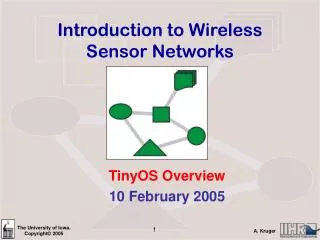
Introduction to Wireless Sensor Networks
Introduction to Wireless Sensor Networks. Telemetry and WSNs 24 January 2005. Organizational. Class Website. www.engineering.uiowa.edu/~ece195/2005/. Class Time. Office Hours. Review Questions. Explain how advances in MEMS have contributed to the development of WSNs

Introduction to Wireless Sensor Networks
E N D
Presentation Transcript
Introduction to Wireless Sensor Networks Telemetry and WSNs 24 January 2005
Organizational Class Website www.engineering.uiowa.edu/~ece195/2005/ Class Time Office Hours
Review Questions • Explain how advances in MEMS have contributed to the development of WSNs • List and briefly explain the purpose of four building blocks of a Mote. • List and briefly explain the function of the OS on a WSN node • Name and briefly explain a technological, scientific, and cultural development that have contributed to the development of WSNs • What is TinyOS? • Explain (to a non-expert) what is a mote
Telemetry • Distance measurement • Most often radio link • Military • Environmental • Industrial (SCADA) • Biological • Medical • Non-military – ISM bands
ISM Bands • The industrial, scientific, and medical (ISM) radio bands • Originally internationally for non-commercial use of RF. Limitations on data. • Today, commercial, Wireless LAN, Bluetooth, IEEE 802.xx networks. No limitations on data. • Bands • 900 MHz band (33.3 cm wavelength) • 2.4 GHz band (12.2 cm wavelength) • 5.8 GHz band (5.2 cm wavelength) • License Free, but NOT unregulated • Often Spread Spectrum, but need not be
UAV’s Wallops Island Weather
CSBUOY-NS Buoy System • Datalogger • 900 MHz wireless transceiver • 1/4 wave whip antenna • Rechargeable battery • Solar panel • ~ 1.5 km LOS • 900 MHz • Water quality, temperature
Biotelemetry • Albatross tracking • Predatory bird tracking • Whale tracking • Caribou tracking • Body composition of sea lions
Argos Satellite System • International: CNES, NASA, NOAA • Polar orbiting satellite • Ground stations • Fairbanks (AK), Wallops Island (VA) & Lannion, France • Pre-processed by the National Environmental Satellite, Data, and Information Service (NESDIS) in Suitland Maryland
Argos Applications • Fishing Management • Protecting Wildlife • Ocean and Climate • Monitoring Volcanoes • Tracking Sailboats • Tracking Expeditions • Tracking Hazardous Materials
Biotelemetry: Northern Pintail USGS Western Ecological Research Center Pinsat
Biotelemetry $5K per node and operating costs CNES, NASA, or NOAA, polar orbiting satellite 12 gram, solar PTT from Microwave Telemetry, includes GPS Argos processing center E-mail
Medical: Video Pill • Light, video camera, transmitter • Receiver strapped on patient • Swallow Video pill & standard endoscope 24 hours to travel through body The pill's view of the stomach and intestine
Asset Tracking • Terminology • Fleet tracking, Asset Tracking • Combine GPS + Radio (cell phone) • Mature: Turn-key • Marketed as a service. Companies will • Install hardware • Deal with phone companies • Provide tracking software • Monthly charge • Real-time tracking (high-end) • Locator services (low-end) • OnStar
Example of an Asset Tracking Kit Web-based software Asset Tracking Cell Modem • Commercial Cell • GPS Interface • Robust • Extended Temperature • Vibration
Supervisory Control and Data Acquisition (SCADA) • Oil, Telecommunications, Power industries, Municipal water systems • GOOGLE “SCADA Software” => 60K hits • Pressure • Temperature • Flow • Levels
Antenna Interface electronics, radio and microcontroller Soil moisture probe Mote Communications barrier Think Back -Sensor Network Server Sensor field Gateway Internet
Think Back -Sensor Network Server Watershed Sensor field Gateway Internet
Telemetry vs. Sensor Networks • Similarities • Wireless • Measurements, sensors, … • Important Differences • Network vs. non-networked • Embedded intelligence (in-network processing) vs. centralized processing • Cost • Ad Hoc vs. Specialized • New vs. Old • Genealogy (Engineering vs. CS)