Download
1 / 44
450 likes | 720 Views
MK. Land Use Planning: Integrated Coastal Zone Management. Smno.pdip.ppsfpub.nop2013. Introduction. Natural resources Over-utilization/Under-utilization Lack of guidelines for natural Resource utilization Major Conflicts Evaluation of resources

E N D
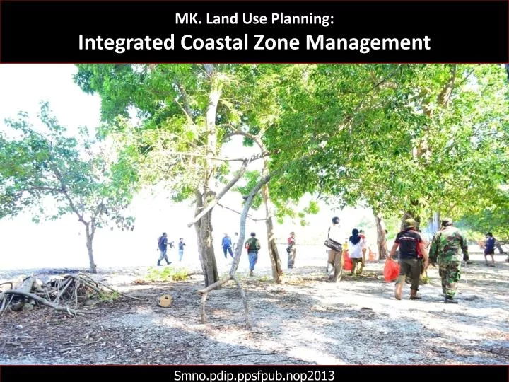
MK. Land Use Planning: Integrated Coastal Zone Management Smno.pdip.ppsfpub.nop2013
Introduction • Natural resources • Over-utilization/Under-utilization • Lack of guidelines for natural Resource utilization • Major Conflicts • Evaluation of resources • Land/Resourse use zoning-Suitability Criteria
Coastal Resources Environmental effects of overexploitation for fuelwood in nearshore coastal resources http://www.nzdl.org/gsdlmod?
Coastal Resources http://www.fao.org/docrep/003/t0708e/T0708E07.htm
Coastal Resources Examples of Positive and Negative Relationships Among Sectors. Source: Sorensen and McCreary (1990) http://www.fao.org/docrep/003/t0708e/T0708E07.htm
COASTAL RESOURCE MANAGEMENT (CRM) STATUS IN INDONESIA The main problem with existing CRM in Indonesia [in 1985] is that a central integrated and coordinated programme has not yet been established, although the basic legislation has been passed, the lead ministry identified (Population and Environmental Affairs) and a coordinating committee among the ministries proposed. Single purpose sectoral projects advocated by one line ministry (or subordinate counterparts at provincial or kabupatens level) presently do not consider the adverse CRM and environmental effects and can conflict with the programmes of other ministries (or subordinate equivalents). As a consequence, poor, uninformed, decision-making results, and coastal use options are unnecessarily compromised and resources lost. http://www.fao.org/docrep/003/t0708e/T0708E07.htm
COASTAL RESOURCE MANAGEMENT (CRM) STATUS IN INDONESIA The goals of CRM programme would be to provide the framework for resolving conflicts among single purpose proposals in a specific region, by evaluating the consequences of individual projects on other activities and selecting alternatives that maximize multiple and compatible use and minimize unnecessary foreclosures of option or losses to coastal resources. The components should be included in the programme: policy and plan formulation, training, research and development, pilot-level implementaion, dissemination of information, periodic adjustment of programme goals, and gradual expansion of the programme throughout the provinces of the country. http://www.fao.org/docrep/003/t0708e/T0708E07.htm
COASTAL RESOURCE MANAGEMENT (CRM) STATUS IN INDONESIA All the above components would be a part of both national and provincial initiatives, but most of the actual management and decision-making would occur at the provincial level while most of the important policies and guidance including those of national significance would be developed and monitored at the national level. The above components also serve as the general sequence for programme evolution. http://www.fao.org/docrep/003/t0708e/T0708E07.htm
COASTAL RESOURCE MANAGEMENT (CRM) STATUS IN INDONESIA Policy and plan formulation would refine existing policies, develop new ones, and develop implementing procedures (regulations). Coordination with conservation and development agencies would be accomplished until an integrated national plan and process is adopted. Gradually this would filter down to the provincial level. After specific regional plans and a process is established, day-to-following day CRM would be initiated at the provincial and lower levels. http://www.fao.org/docrep/003/t0708e/T0708E07.htm
A FOUR-TIER MANAGEMENT SYSTEM FOR THE COASTAL ZONE http://www.fao.org/docrep/003/t0708e/T0708E07.htm
A SEVEN-TIER MANAGEMENT SYSTEM FOR THE COASTAL ZONE http://www.fao.org/docrep/003/t0708e/T0708E07.htm
Objective • Basis for the communication and exchange of ideas • To encourage development in the most suitable areas • To define areas to promote the development • To provide a focus for research or monitoring • To define environmental capacity • To develop area-based certification • Basis for sectoral EIA or Cost Benefit analysis
EXAMPLES OF ICZM GOALS AND STRATEGIES http://www.fao.org/docrep/003/t0708e/T0708E06.htm
Forces at work on coastal resources include a variety of economic sectors and political powers, each with a stake in levels of exploitation. Creation of management measures to control exploitation and rehabilitation of coastal resources are the role of ICZM programmes. Source: Chua (1986) http://www.fao.org/docrep/003/t0708e/T0708E06.htm
Methodology • The required criteria for the objectives have been considered during the Remote Sensing and GIS analysis. • The diagnostic factors considered for suitability assessment for different vital activities depending on their respective parameters • The land suitability map was prepared to identify the suitable area for each activity
Location of Cox’s Bazar Hydrology • These rivers • swell rapidly and flow in spate for a few days at the time after heavy pre-monsoon or monsoon rainfalls in the Chittagong Hill Tracks
Mangrove • Responsible factors: Removal of forest product for fuel, shrimp farming, human settlement, salt production…………… The swamp consisted of innumerable low-lying islands, which were mostly submerged at high tide Table:Historical changes of Chokoria Sunderban mangrove forest in Cox’s Bazar coast for 100 years time scale
Land Use Map Most of the suitable areas for mangrove afforestation are currently being used for shrimp and salt production
Present Result Most of the salt beds are used for extensive shrimp culture during monsoon month Table:Present result and the existing land use pattern in the Cox’s Bazar coast
Mangrove & Shrimp • Soil type • Tidal area • soil pH • soil salinity • Land use pattern • Slope • elevation • soil texture • soil pH • organic matter • tidal area • disease problems
Salt Production & Tourism soil texture tidal area land use pattern beach type tourist accommodation transportation facilities
Conclusion • Public awareness • participation of local people, government and others……… • coastal community must be involved in the decision, planning and management processes • appropriate feedback
. Typical Economic Sectors of Coastal Countries Source: Sorensen and McCreary (1990). http://www.fao.org/docrep/003/t0708e/T0708E06.htm
. Development Activities That Can Effect Selected Important Coastal Tropical Ecosystems. Source: Maragos (1983). o Significant adverse effects likely• Adverse effects possible http://www.fao.org/docrep/003/t0708e/T0708E06.htm
…..COASTAL ECOSYSTEM... http://coastalcare.org/2010/10/un-meeting-aims-to-set-species-saving-goals-nagoya-japan/
. Temperate Coastal Ecosystems. http://ian.umces.edu/discforum/index.php?topic=107.0
. Mitigation: Ten Strategies Promote Mangrove Resilience. Apply risk-spreading strategies to address the uncertainties of climate change.: classify scheme of mangrove types and habitat zones, and categorize these by their biodiversity.Identify and protect critical areas that are naturally positioned to survive climate change.: ex. the presence of sediment-rich, macrotidalenvironments,and the availability of freshwater to compensate for increased salinity. For example, set priority to protect mangrove areas that demonstrate persistence including a range of small young and large old trees or mangrove roots with dense epibiont communities such as oysters, sponges, tunicates, and corals. https://web.duke.edu/nicholas/bio217/spring2008/klinsawat/mitigation.html
. Mitigation: Ten Strategies Promote Mangrove Resilience. Factors that allow for peat building to keep up with sea-level rise: Association with drainage systems including permanent rivers and creeks that provide freshwater and sediment Sediment rich-macrotidal environments to facilitate sediment redistribution and accretion Actively prograding coast and delta Natural features (bays, barrier islands, beaches, sandbars, reefs) that reduce wave erosion and storm surge . https://web.duke.edu/nicholas/bio217/spring2008/klinsawat/mitigation.html
. Mitigation: Ten Strategies Promote Mangrove Resilience. Factors that allow for landward migration: Mangroves backed by low-lying retreat areas (for example, salt flats, marshes, coastal plains) which may provide suitable habitat for colonization and landward movement of mangroves as sea level rises Mangroves in remote areas and distant from human settlements and agriculture, aquaculture, and salt production developments Mangroves in areas where abandoned alternate land use provides opportunities for restoration, for example, flooded villages, tsunami-prone land, unproductive ponds . https://web.duke.edu/nicholas/bio217/spring2008/klinsawat/mitigation.html
. Mitigation: Ten Strategies Promote Mangrove Resilience. Factors that enhance sediment distribution and propagule dispersal: Unencumbered tidal creeks and areas with a large tidal range to improve flushing, reduce ponding and stagnation, and enhance sediment distribution and propagule dispersal Areas with a large tidal range may be better able to adjust to increases in sea level due to stress tolerance Permanent strong currents to redistribute sediment and maintain open channels https://web.duke.edu/nicholas/bio217/spring2008/klinsawat/mitigation.html
. Mitigation: Ten Strategies Promote Mangrove Resilience. Factors that indicate survival over time: Diverse species assemblage and clear zonation over range of elevation (intertidal to dry land) Range in size from new recruits to maximum size class (location and species dependent) Tidal creek and channel banks consolidated by continuous dense mangrove forest (which will keep these channels open) Healthy mangrove systems in areas which have been exposed to large increases in sea level due to climate induced sea-level rise and tectonic subsidence. https://web.duke.edu/nicholas/bio217/spring2008/klinsawat/mitigation.html
. Mitigation: Ten Strategies Promote Mangrove Resilience. Factors that indicate strong recovery potential: Access to healthy supply of propagules, either internally or from adjacent mangrove areas Strong mangrove recruitment indicated by the presence, variety, and abundance of established mangrove propagules Close proximity and connectivity to neighboring stands of healthy mangroves Access to sediment and freshwater Limited anthropogenic stress Unimpeded or easily restorable hydrological regime Effective management regime in place such as the control of usual threats like dredging and filling, conversion to aquaculture ponds, construction of dams, roads, and dikes that disrupt hydrological regime etc. Integrated Coastal Management Plan or Protected Area Management Plan implemented and educational programs to make a better understanding of mangrove benefits as shown in figure below should be implemented. https://web.duke.edu/nicholas/bio217/spring2008/klinsawat/mitigation.html
. Mitigation: Ten Strategies Promote Mangrove Resilience. 3) Manage human stresses on mangroves. Land-use practices should be improved to decrease nutrient and sediment run-off, limit unregulated felling, eliminate the use of persistent pesticides, and increase filtration of effluent to improve water quality. 4) Establish greenbelts and buffer zones to allow for mangrove migration in response to sea-level rise, highly intense storms, and to reduce impacts from adjacent land-use practices, such as soil erosion. For example, sea dyke was built in the Red River Delta, Vietnam for the buffer zone. 5) Restore degraded areas that have demonstrated resistance or resilience to climate change. https://web.duke.edu/nicholas/bio217/spring2008/klinsawat/mitigation.html
. Mitigation: Ten Strategies Promote Mangrove Resilience. 6) Understand and preserve connectivity between mangroves and sources of freshwater and sediment, and between mangroves and their associated habitats like coral reefs and seagrasses. Via optimal hydrological and geomorphological conditions, mangrove restoration can theoretically be achieved. There is evidence that replanted mangrove forests can approach the biomass and productivity of undisturbed mangroves within 20-25 years https://web.duke.edu/nicholas/bio217/spring2008/klinsawat/mitigation.html
. Mitigation: Ten Strategies Promote Mangrove Resilience. 7) Establish baseline data and monitor the response of mangroves to climate change. https://web.duke.edu/nicholas/bio217/spring2008/klinsawat/mitigation.html
. Mitigation: Ten Strategies Promote Mangrove Resilience. 8) Implement adaptive strategies to compensate for changes in species ranges and environmental conditions. For example, in a rehabilitation project, a selection of proper species to be plant in the area with lower mangrove richness is needed to be well-monitored. For example, it is preferable to replant mangrovesthat adapt to change in soil salinits over time. Moreover, natural replenishment requires that sufficient undisturbed forests reside nearby to serve as sources of seed stock. During replanting, the characteristics of sustainable mangrove reintroduction include the poly-cultures and highly diverse cultures, resembling to the original habitat as much as possible. One of the successful scenario of mangrove rehabilitation projects along tropical coastline is the Sundarbans, Bangladesh. Mangrove ecosystem in the Sunderbans is affected by the change in precipitation with severe cyclone damage. Up until 1993, bearly 120,000 ha were planted along the bank of the Ganges and Brahmaputra Rivers. The dominant replanting trees were Sonneratiaapetala and Avicenniaofficinalis. Although there are difficulties with adaptation to change in sediment salinity, benefits have been substantial because of the reduce impact to inland areas during severe cyclone. https://web.duke.edu/nicholas/bio217/spring2008/klinsawat/mitigation.html
. Mitigation: Ten Strategies Promote Mangrove Resilience. 9) Develop alternative livelihoods for mangrovedependent communities as a means to reduce mangrove destruction. Charcoal production from coconut shells instead of from mangroves as well as traditional honey harvestingin mangroves, which encourages agroforestry and conservation of existing mangrove forests . Vietnam: seaweed farming is an income generating alternative to mangrove destruction . In North Sulawesi, Indonesia, sustainably harvested bamboo provides an alternative to over-harvesting of mangrove wood. https://web.duke.edu/nicholas/bio217/spring2008/klinsawat/mitigation.html
. Mitigation: Ten Strategies Promote Mangrove Resilience. 10) Build global, regional, and local partnerships with a variety of stakeholders ( agriculture, tourism, water resource Management, conservation and infrastructure development) to generate the necessary finances and support to respond to the impacts of climate change. Each nation should assign one or other of the following caegories to mangroves: conservation reserve, forest reserve, fisheries reserve, and alienable mangrove land. https://web.duke.edu/nicholas/bio217/spring2008/klinsawat/mitigation.html
.Jaring-jaringMakanandalamEkosistem Mangrove. http://www.waikato.ac.nz/fass/about/staff/maximus/tidal-graphics
. how to measure areas of mudflats and mangrove.. http://www.waikato.ac.nz/fass/about/staff/maximus/tidal-graphics
.... Ekosistem Mangrove …. http://www.nzdl.org/gsdlmod?
Mangrove: Ecological and economic importance. Provide food and shelter for a large and varied group of fishes and shellfish. The leaf detritus (fallen and decaying leaves) provides the base of the major mangrove community food chain. Provide protection from storm surges and high winds associated with tropical typhoons. This is important in a country that is hit by an average of 20 typhoons a year. Serve as protection against soil erosion. Soil erosion and sedimentation causes in the ocean is the number one cause of coral reef degradation. Serve as land builder through soil accretion. Sediment from the land collects among the dense roots building up the land. Trap coastal pollutants which may otherwise severely damage adjacent marine ecosystems. Serve as wildlife sanctuary. Offer aesthetic, educational and scientific values. If used on a sustained yield basis (proper harvesting), can provide timber, firewood, charcoal, pulp and paper, extractives, nipa sap, nipa shingles, cellulose xanthate, oil, medicine, resin, tea and livestock supplements. http://www.nzdl.org/gsdlmod?