Download
1 / 14
140 likes | 210 Views
Conducting an ecological triage to prioritize sub-basins based on inherent sensitivity, future threat, and responsiveness to land management scenarios in Muskegon River. Ranking and analysis to balance risk and effectiveness.

E N D
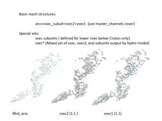
Basic reach structures: arcs<vsec_subuit<vsec2<vsec1 {use master_channels cover} Special sets: vsec subunits { defined for lower river below Croton only} vsec* {Mixed set of vsec, vsec2, and subunits output by hydro model} Nhd_arcs vsec2 (1.1 ) vsec1 (1.1)
Basic areal data structures: grids (40m) < nhd_arc sheds<vsec(1and 2) sheds< sub-basins< hec _basin sheds Special sets: 319 sub-basins Nhd_arcs vsec sub-basins HEC_basins
MREMS sub-basins 319 HUCs
Characteristic scales for MREMS database Important note: all smaller units can be summarized (directly or indirectly) at Musk sub basin level
Ranking sub basin responsesusing MREMS output Done by MREMS out variable… Inherent sensitivity… rank(std[ D mean sub-basin response {scen.D-scen.N} / D landcover pc1]) degree of future threat… rank(std[scen.D / scen.C] for values or rank(std[scen.D - scen.C]for ratios responsiveness (%change) to land management scenario rank(std[scen D –scen N]/ Scen D]
sub-basin average “inherent sensitivity” to LU change 1rst quartile 2nd quartile 3rd quartile 4rth quartile [TP] [TIN] Channel Erosion Sediment Load Q
land management “responsiveness” Biological Integrity Erosion Tot Phosphate
Channel Erosion responses to land use Change Inherent sensitivity, degree of future threat, responsiveness to scenarios Muskegon River sub-basins by quartile (darker = higher)
[Total P] responses to Land Use Inherent sensitivity, degree of future threat, responsiveness to alternate scenarios Muskegon River sub-basins by quartile (darker = higher)
Sub basin Prioritization Analysis • Parameter specific priority: balancing risk and responsiveness • Rank by parameter:( std risk * std responsiveness)
Sub basin Prioritization Analysis • Overall Ecological triage: • Average of TP, Erosion Potential, Bio Integrity ranks
Erosion_Priority Biological Integrity_Priority TP_Priority Joint _Priority
Sub-basin Land Management Triage: balancing risk and effectiveness next quartile upper quartile
Sub-basin Land Management Triage: balancing risk and effectiveness a next quartile upper quartile b