Download
1 / 34
340 likes | 450 Views
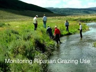
Conducted by the Ministry of Forests, this program evaluates riparian areas to determine if FRPA standards are protecting fish values. The assessment covers various indicators such as channel disturbances, aquatic connectivity, and more.

E N D
Resource Stewardship Monitoring ProgramRiparian Assessment Pilot PeterJ. TschaplinskiResearch BranchMinistry of Forests
Forest Districts Participating • Campbell River - DCR • Chilcotin - DCH • Chilliwack - DCK • Kalum - DKM • Rocky Mountain - DRM
Effectiveness Evaluation Objective for the Fish Value • Determine whether FRPA standards and practices governed by regulation are achieving the desired result of protecting fish values. • includes aquatic ecosystems and adjacent riparian areas • current focus is on streams
Evaluation Approach • Assess physical and biological conditions in streams and their riparian areas • Describe conditions with Routine-Level Checklist covering 14 indicators • Score each Indicator as “Yes = OK” vs. “No = problem” • Roll-up score = overall site condition
Roll-up Scoring System Frequency of “No” Indicators out of 14: 1. Functioning 0 - 2 No’s 2. Functioning, at Risk 3 - 4 No’s 3. Functioning, at High Risk 5 - 6 No’s 4. Non-functioning > 6 No’s
1. Channel bed disturbance 2. Channel bank disturbance 3. LWD processes (jams) 4. Channel morphology 5. Aquatic connectivity 6. Fish cover diversity 7. Moss abundance & condition 8. Fine sediments 9. Aquatic invertebrate diversity 10. Windthrow frequency 11. Riparian soil disturbance 12. LWD supply 13. Shade & microclimate 14. Disturbance-increaser plants Aquatic-Riparian Indicators
RelatingScorestoForestry • This is the hard part. • Explain stream and riparian conditions in terms of required/permitted practices. • Considerations include: 1. Tree retention standards by stream class: RRZs for S1 – S3; RMZs for S4, S5, & S6 2. Riparian ground disturbance, windthrow 3. Roads and road crossings 4. Effects from upstream areas/activities 5. Compare with “undisturbed” conditions (e.g., upstream reference sites)
RSMP Pilot Objectives • Operational test of Routine-Indicator Checklist: • Are the indicators and methods clear, practical, complete? • Do we need additional support: e.g., a field handbook, refresher training, air photos? • What have we missed: Do we need to add indicators/ questions? • Can surveys be done in a time-efficient way? • How easy is it to identify effective forestry practices or to flag problems?
SummaryObservations • Surveys done thoroughly and accurately • Be sure to fill out mandatory information fields:e.g., riparian class, year of harvest • Resources need to be found for data QA to support analyses • The following observations were important for data interpretation: • RMA retention levels (Can be obtained from photos?) • road location, crossing type, road & crossing age (pre-Code, FPC, FRPA) • Results show a mixture of riparian management and road-related effects • Some results complicated by pre-Code and pre-FRPA practices • Surveyors may benefit from a Field Handbook • Recurrent training should be made available when needed