Download
1 / 59
760 likes | 1.27k Views
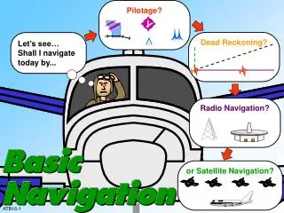
Pilotage?. Dead Reckoning?. Let’s see… Shall I navigate today by. Radio Navigation?. or Satellite Navigation?. ATB16-1. OBJECTIVES. Given an End-of-Lesson Test, and in accordance with the AC 61-23, Pilot’s Handbook, and the Aeronautical Information Manual (AIM), you will identify:

E N D
Pilotage? Dead Reckoning? Let’s see… Shall I navigate today by... Radio Navigation? or Satellite Navigation? ATB16-1
OBJECTIVES • Given an End-of-Lesson Test, and in accordance with the AC 61-23, Pilot’s Handbook, and the Aeronautical Information Manual (AIM), you will identify: • 1. Reference lines of the Earth and their purpose. • 2. Great circle route, distance, and direction measurement. • 3. Methods of time conversion and acronyms used with time. • 4. Magnetic variations and headings. ATB16-2A
OBJECTIVES • 5. Basic methods of navigation. • 6. Basic calculations for time, speed, and distance. • 7. Effects of wind on flight. • 8. Effects of altitude and temperature on speed. ATB16-2B
OBJECTIVES 9. Without references, and in accordance with AC 61-23, the Pilot’s Handbook, you will compute aircraft time, speed, and distance. ATB16-2C
REFERENCE LINES MERIDANS OF LONGITUDE PARALLELS OF LATITUDE ATB16-3
GREAT CIRCLE The equator is a great circle Any meridian is half of a great circle ATB16-4
GREAT CIRCLE ROUTE/RHUMB LINE London Great circle 3473 statute miles New York Rhumb line 3614 statute miles ATB16-5
PARALLELS OF LATITUDE 90° N 80° N 70° N 60° N 50° N 40° N 30° N 20° N 10° N 0° EQUATOR 10° S 20° S 30° S 40° S 50° S 60° S 70° S 80° S 90° S ATB16-6
MERIDIANS OF LONGITUDE 10° E 20° E 30° E 40° E 50° E 60° E 70° E 80° E 90° E 90° W 80° W 70° W 60° W 50° W 40° W 30° W 20° W PRIME MERIDIAN 10° W ATB16-7
COORDINATES MERIDANS OF LONGITUDE PRIME MERIDIAN EQUATOR PARALLELS OF LATITUDE ATB16-8
CIRCULAR MEASUREMENT • A circle = 360 degrees (360°) • 1 degree (1°) = 60 minutes (60’) • 1 minute (1’) = 60 seconds (60”) ATB16-9
ANSWER 1. 29 degrees, 40 minutes, north (latitude), 35 degrees, 53 minutes, west (longitude) 2. 45 degrees, 35 minutes, north (latitude), 82 degrees, 43 minutes, 22 seconds, east (longitude) DECODING COORDINATES • How would these coordinates be read? • 1. 29° 40’ N, 35° 53’ W • 2. 45° 35’ N, 82° 43’ 22” E ATB16-10
RESPONSE ITEM • The reference line for measuring north-south distances is the • A. great circle. • B. prime meridian. • C. equator. C. equator. ATB16-11
MEASUREMENT OF DISTANCE LATITUDE 1 MINUTE OF LATITUDE IS EQUAL TO 1 NM (MEASURED ALONG A LINE OF LONGITUDE) LONGITUDE LONGITUDE 1 MINUTE OF LONGITUDE (MEASURED ALONG A LINE OF LATITUDE) IS NOT EQUAL TO 1 NM, EXCEPT ALONG THE EQUATOR EQUATOR 0° LAT. 1 MINUTE OF LONGITUDE ALONG THE EQUATOR IS EQUAL TO 1 NM ATB16-12
CONVERTING STATUTE AND NAUTICAL MILES STATUTE NAUTICAL 1 STATUE MILE = 5280 FEET 1 NAUTICAL MILE = 6080 FEET CONVERSION FACTORS: 1. 1 NAUTICAL MILE = 1.15 STATUTE MILES 2. 1 STATUTE MILE = 0.87 NAUTICAL MILES STATUTE MILES CAN BE CONVERTED TO NAUTICAL MILES AND VICE VERSA BY USE OF THE FOLLOWING FORMULAS: NM x 1.15 = SM SM X .87 = NM EXAMPLES: 20 NM x 1.15 23 SM 50 SM x .87 43.5 NM ATB16-13
CONVERSION EXERCISE NAUTICAL MILES STATUTE MILES 1. 40 46 2. 100 115 3. 60 69 4. 200 230 5. 65 75 6. 55 63 7. 113 130 8. 92 106 9. 435 500 10. 333 383 ATB16-14
COORDINATED UNIVERSAL TIME (UTC) • The local standard time at Greenwich, England is the time reference used in aviation operations throughout the world. ATB16-15
24-HOUR CLOCK 0000 1200 1100 2300 0100 1300 12 1 1000 2200 0200 1400 11 2 10 12-hour format 0900 2100 0300 1500 9 3 4 8 0800 2000 0400 1600 5 7 6 0700 1900 0500 1700 0600 1800 ATB16-16
12 9 3 12 6 9 3 6 12 9 3 6 U.S. TIME ZONES 7:00 P.M. MOUNTAIN STANDARD TIME 6:00 P.M. PACIFIC STANDARD TIME 9:00 P.M. EASTERN STANDARD TIME 12 8:00 P.M. CENTRAL STANDARD TIME 9 3 6 120° 75° 90° 105° ATB16-17
RESPONSE ITEM The unit of measure which equals 1 nautical mile is ____ statute miles. A. .87 B. 1.15 C. 1.5 B. 1.15 ATB16-18
RESPONSE ITEM A time zone is established for every A. 15 degrees of longitude. B. 7 ½ degrees of latitude. C. 15 degrees of latitude. A. 15 degrees of longitude. ATB16-19
INTERNATIONAL TIME ZONES 165° W 150° W 135° W 120° W 105° W 90° W 75° W 60° W 45° W 30° W 15° W 0° 15° E 30° E 45° E 60° E 75° E 90° E 105° E 120° E 135° E 150° E 165° E 180° 75° N Greenwich 60° N INTERNATIONAL DATE LINE 45° N 30° N 15° N 0° EQUATOR PRIME MERIDIAN 15° S 30° S 45° S 60° S ATB16-20
U.S TIME CONVERSION FACTORS • EASTERN STANDARD +5 HOURS • CENTRAL STANDARD +6 HOURS • MOUNTAIN STANDARD +7 HOURS • PACIFIC STANDARD +8 HOURS • ALASKA STANDARD +9 HOURS • HAWAII STANDARD +10 HOURS • IF DAYLIGHT-SAVING TIME IS IN EFFECT, SUBTRACT 1 HOUR FROM CONVERSION ATB16-21
STANDARD TIME CONVERSION EXAMPLE • 11:00 AM CENTRAL STANDARD TIME +6 HOURS CONVERSION FACTOR • 1700Z IN GREENWICH, ENGLAND • 9:00 PM CENTRAL STANDARD TIME +6 HOURS CONVERSION FACTOR • 0300Z ON THE FOLLOWING DAY IN GREENWICH, ENGLAND ATB16-22A
DAYLIGHT TIME CONVERSION EXAMPLE • 11:00 AM CENTRAL DAYLIGHT TIME +5 HOURS CONVERSION FACTOR • 1600Z IN GREENWICH, ENGLAND • 9:00 PM CENTRAL DAYLIGHT TIME +5 HOURS CONVERSION FACTOR • 0200Z ON THE FOLLOWING DAY IN GREENWICH, ENGLAND ATB16-22B
RESPONSE ITEM At 1 PM DST in New York City, the time is ______ UTC. (Conversion factor is +5). A. 1600 B. 1700 C. 1800 B. 1700 ATB16-23
TYPES OF SPEED • 1. INDICATED AIRSPEED (IAS) • 2. TRUE AIRSPEED (TAS) • 3. GROUND SPEED (GS) • 4. MACH NUMBER (MACH) ATB16-24
TIME DISTANCE GROUND SPEED TIME = ATB16-25
SPEED DISTANCE TIME SPEED = ATB16-26
DISTANCE DISTANCE = SPEED TIME ATB16-27
FINGER FORMULA D D = DISTANCE R = RATE (SPEED) T = TIME DISTANCE = RATE x TIME RATE = DISTANCE ÷ TIME TIME = DISTANCE ÷ RATE R T ATB16-28
TIME, SPEED, DISTANCE EXERCISE TIME SPEED DISTANCE 1. 3+00 180 KT 540 NM 2. 1+30 90 MPH 135 SM 3. 4+30 90 KT 405 NM 4. 5+00 75 KT 375 NM 5. 0+30 176 MPH 88 SM 6. 1+30 216 MPH 324 SM 7. 9+00 150 KT 1350 NM 8. 3+15 200 MPH 650 SM 9. 1+45 240 MPH 420 SM 10. 2+15 138 MPH 270 NM ATB16-29
WIND NORTH Northeast Wind WEST EAST SOUTH ATB16-30
TAIL WIND AIR MOVING 20 KNOTS AIRSPEED 120 KTS GROUND SPEED 140 KNOTS NO WIND AIR NOT MOVING AIRSPEED 120 KTS GROUND SPEED 120 KNOTS HEAD WIND AIR MOVING 20 KNOTS AIRSPEED 120 KTS GROUND SPEED 100 KNOTS GROUND SPEED vs. TRUE AIRSPEED ATB16-31
EFFECT OF DRIFT RIVER CURRENT ATB16-32
EFFECT OF WIND ON TRUE COURSE, TRACK, AND DRIFT ANGLE WIND 360° / 20 KT DEPARTURE DESTINATION TRUE COURSE (TC) DRIFT ANGLE N WIND TRACK (TR) ATB16-33
With correction for crosswind drift effect WIND AIRCRAFT HEADING 080° 090° TRUE COURSE (TC) 10° WIND CORRECTION ANGLE DESTINATION ACTUAL TRACK TRUE HEADING (TH) TRUE HEADING IS TRUE COURSE (TC) CORRECTED FOR WIND DRIFT WITHOUT correction for crosswind drift effect 090° TRUE COURSE (TC) AIRCRAFT HEADING DESTINATION 10° DRIFT ANGLE ACTUAL TRACK 100° WIND TRUE HEADING TH = TC +/- WIND CORRECTION ANGLE (WCA) TH = 090° - 10 (LEFT CORRECTION) = 080° ATB16-34
COMBINED EFFECTS OF TEMPERATURE, ALTITUDE, AND HUMIDITY ON TAKEOFF Low Density Altitude Low temperature Low altitude Low humidity ATB16-35A
COMBINED EFFECTS OF TEMPERATURE, ALTITUDE, AND HUMIDITY ON TAKEOFF High Density Altitude High temperature High altitude High humidity ATB16-35B
QUESTION WIND 20° WIND CORRECTION ANGLE HEADING 090° TRUE COURSE TRACK 1. The wind correction angle is 20 degrees, and true course is 090 degrees. What is the true heading of the aircraft? ANSWER: 070 degrees ATB16-36
QUESTION WIND 090° TRUE COURSE 10° DRIFT ANGLE TRACK 2. The desired true course of the aircraft is 90 degrees, and drift angle is 10 degrees. What is the track of the aircraft? ANSWER: 110 degrees ATB16-37
QUESTION WIND 1. The track of the aircraft is 180 degrees, and aircraft heading is 165 degrees. What is the drift angle in degrees? TRACK HEADING DRIFT ANGLE ANSWER: 15 degrees 180° 165° ATB16-38
MAGNETICVARIATION Geographic (True) North Pole Magnetic North Pole 17° Westerly variation Easterly variation 20° 15° 10° 5° 0° 5° 10° 15° 20° 20° 20° 15° 10° 15° 5° Isogonic line Agonic line 0° 10° 5° The lines with degrees on both ends are ISOGONIC lines which connect geographic points with identical magnetic variation. ATB16-39
E 6 3 N DEVIATION The error of a magnetic compass due to magnetic influence in the structure and equipment of the aircraft DEVIATION CARD FOR MH N 030 060 E 120 150 STEER CH 003 031 061 090 122 147 • Is affected by: • Electrical system • Engine • Aircraft structure • Miscellaneous equipment near compass, etc. MAGNETIC COMPASS ATB16-40
RESPONSE ITEM The angular difference between true north and magnetic north at any given place is called A. variation. B. deviation. C. isogonic line. A. variation. ATB16-41
RESPONSE ITEM A line of equal magnetic variation is called a/an ______ line. A. agonic B. magnetic C. isogonic C. isogonic ATB16-42
RESPONSE ITEM True heading is true course corrected for effects of A. magnetic variation. B. compass error. C. wind. C. wind. ATB16-43
DEAD RECKONING • Dead Reckoning is navigation solely by means of computations based on airspeed, course, heading, wind direction and speed, groundspeed, and elapsed time. ATB16-44
WIND CORRECTION WIND DIRECTION AND VELOCITY TRUE HEADING AND AIRSPEED TRUE COURSE AND GROUND SPEED N ATB16-45
PILOT’S PLANNING SHEET PILOT’S PLANNING SHEET PLANE IDENTIFICATION DATE WIND KNOTS FROM WCA R+ L- VAR W+ E- TOTAL MILES TOTAL TIME FUEL RATE TOTAL FUEL COURSE TC TH MH DEV CH GS From: To: From: To: ATB16-46A