Download
1 / 42
420 likes | 549 Views
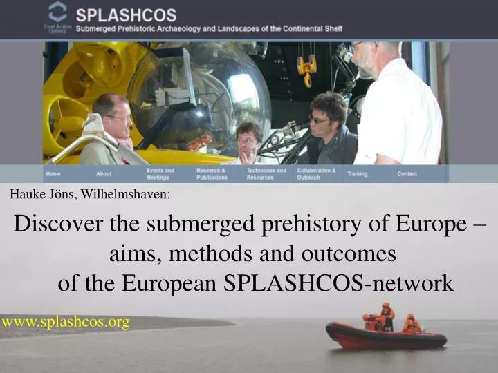
Hauke Jöns, Wilhelmshaven:. Discover the submerged prehistory of Europe – aims, methods and outcomes of the European Splashcos -network. www.splashcos.org. Streif 2004,. Streif 2004. The European Continental Shelf. 40% of the European surface is submerged!. Bailey 2011.

E N D
Hauke Jöns, Wilhelmshaven: Discover the submerged prehistory of Europe – aims, methods and outcomes of the European Splashcos-network www.splashcos.org
Streif 2004, Streif 2004
The European Continental Shelf 40% of the European surface is submerged! Bailey 2011
8250 cal BC Graphik: F. Bau (Shenann et al. 2000; van der Noort 2011) Harpune von der Lemanbank (Trawler „Colinda“) (Ward et al 2006)
The European Continental Shelf rule of thumb: ‘the higher the level, the older the site’ rule of thumb: ‘the deeper the site below sea level, the older the site’ Bailey 2011, Harff and Rosentau 2011 Jöns 2011
Fischer 2011/Andersen 2013 Tybring Vig Denmark (5400–3900 cal. BC)
Hendersen et al. 2011 Pavlopetri Greece (3000-1200 cal. BC)
Galiliand Rosen 2011 Atlit-Yam Israel (7200-6000 cal. BC)
North Frisian Wadden Sea Germany Megalithic Grave from Sylt-island (3200 cal BC) Kühn 2008 Late neolithic offering pit with scull of an ourochs found at the Hamburger Hallig (2300 cal BC) Treetrunk (1740 cal BC)
Reconstruction of the Palaeolandscape (Doggerbank) 3D-Seismik Gaffney et al. 2007 Data from offshore-industries!
These examplesindicate: • Big partsofthe European Prehistoryissubmerged offshore (common European perspective) • The sitesmaybeextraordinarywellpreserved (organic material) andmayoffercompletelynewinformationabouttheprehistoriclife • In manycasesthesitesmaybeusedaswelldatedsealevel-index pointsandare also of high interestforGeologist, OceanologistsandClimateexperts • Theyonlycanbeinvestigated in closecooperationwiththesedisciplines (Geophysics, Geology, Sedimentology, Archaeobiology, etc.). • A lotofdataisalreadyavailableandcanbeused! Transnational & interdisciplinary approach is needed as well as cooperation with the marine industry!
www.splashcos.org Chair: Geoff Bailey (York) Dimitris Sakellariou (Athens) • The project was funded for four years (2009-2013) as COST-Action • Communication, interdisciplinary exchange of experience and knowledge • to promote research on the investigation, interpretation and management of the drowned landscapes of the continental shelf • to create a structure for the development of new interdisciplinary and international research collaboration • to provide guidance to archaeologists, environmental and marine scientists, heritage professionals, government agencies, commercial organisations, policy makers and a wider public.
Splashcos – Actions • Most ofthemoney was spentforConferencesand Meetings: 1 Brussels Meeting (November 2009) 2 York Meeting (March 2010) 3 Rhodes Meeting (October 2010) 4 Berlin Meeting ( April 2011) 5 Ahtopol Meeting (May 2011) 6 Zadar Meeting (October 2011) 7 UK Meeting (Edinburgh, November 2011) 8 Amersfoort Meeting (April 2012) 9 Rome Meeting (September 2012) 10 Esbjerg Meeting (March 2013) 11 Final Conference, Szczecin (September 2013) www.splashcos.org
Splashcos – Actions and Training for Early State Researchers (ESR) 6 Training Schools (66 Persons): in Denmark, Estonia, Greece, Israel, Spain, and Malta: - underwater excavation, acoustic survey, mapping, recording and conservation, sea level modelling, and palaeoenvironmental and geochronological analysis of palaeocoastlines. 11 Short Term Scientific Missions (STSMs): involved individuals from Belgium, Denmark, Estonia, Israel, Latvia, Portugal, and UK. www.splashcos.org
Splashcos – Actions most of the work was organised by 4 Working groups: WG 1: Archaeological Data and Interpretations WG 4: Commercial Collaboration and Outreach WG 3: Technology, Technical Resources and Training WG 2: Environmental Data and Reconstructions (Geology, etc.) www.splashcos.org
WG 1: Archaeological Data and Interpretations Chair: Anders Fischer • To audit and categorise the current state of knowledge about the existence, location, and chronological range of prehistoric (Stone Age) archaeological finds on the European continental shelf. • To evaluate the potential significance of such data for the early history of human settlement and society in Europe (until 4000 cal. BC) • Recommendations for future projects Publicationof an Atlas, visualisingthesubmergedarchaeologicalsitesof Europe (in prep. by Anders Fischer et al.) www.splashcos.org
WG 2: Environmental Data and Reconstructions Chair: Jan Harff • Assemble data, or sources of data, on sea-level change, palaeoclimate, bathymetry, and related variables • Assess issues of site preservation and taphonomy • To evaluate conditions for the survival and visibility of prehistoric archaeological materials in different types of geological and oceanographic conditions and in different geographical regions of the shelf Publicationof a Handbook, giving an overviewabouttheactualresearch on thesubmerged land-scapesof Europe (in prep. byNic Flemming et al.) www.splashcos.org
WG 3: Technology, Technical Resources and Training Chairs: Ole Grøn, Tine Missiaen • Productionof a reportaboutthecapabilityofgeophysicalequipmentforarchaeologicalsurveys on submergedlandscapes • Identification of centres of expertise, laboratories, skills, equipment, technical support, and training opportunities to facilitate interinstitutional, interdisciplinary www.splashcos.org
WG 4: Commercial Collabo- ration and Outreach Chair: Julie Satchell • To establish channels of cooperation and collaboration with commercial and industrial organisations in sharing and monitoring of data www.splashcos.org
Splashcos-Databases: • - Bibliographyof all Splashcos-themes („Mendeley“, Jonathan Benjamin) • - Stable isotope database (TheisZetnerTrolle Jensen) • - New Databases forArchaoelogicaland Geological Data? No! • - But „SPLASHCOS-viewer on GeoSeas“ (Combinationofmetadatabase • and web-basedviewer) Organised by Sytze van Heteren (data-management) & Hauke Jöns (corresponding within the archaeological community, collecting and checking the national datasets) … still work in progress www.splashcos.org
Chances: • Raising public and scientific awareness for submerged landscapes and sites • Research tool on the european scale: • - sorting for sites of different (archaeological) periods or ages • - sorting for sites in different water depths • - sorting for radiocarbon dated sites • - sorting for sites with organic material • - etc. • - getting information about publications (references) and • - getting access to further online-information (url) • Mapping Tool for the planned Splashcos-Book 1 (Anders Fischer: „Atlas“) • Big Challenge: • Data needed from all countries
EMODNet Hydrography Bathymetry Sea-bed Geology Archaeology
Big Challenge: Data needed from all countries Splashcos-Network in function!
State of the art (March 2014): 2525sites from 19 countries Belgium, Bulgaria, Croatia, Cypres, Denmark, France, Germany, Greece, Ireland, Israel, Italy, Netherlands, Norway, Poland, Portugal, Sweden, Turkey, UK, Ukraine, no Splashcos-sites in their waters so far: Estonia, Latvia, Lithuania, Malta, Romania, Spain.
Mapped for „maximum waterdepths “ (Bailey 2011)
Splashcos-viewer: Structure of information Complexe site, settlment and burials, organic material well preserved (see url and references), S. Andersen, Tybrind Vig (2013)
Outline of the final phase of the project and the future: • State of the art: • There are still some datasets missing • - some Datasets are not complete: absolute • chronological dating of typochronologically • dated sites, organic material, url and references • etc. • Next steps: • Sending the actual version of the national datasets to • the national correspondants for last corrections • Installation of the Splashcos-Viewer on GeoSeas • web-system (2015)
Thanks a lot to the Correspondants Marnix Pieters Hristina Angelova Irena Radic Rossi Anders Fischer Aivar Kriiska Cyrille Billard Nena Galanidou Kieran Westley Ehud Galili Elena Flavia Valdis Berzin Algirdas Girininkas Tim Gambin Andrea Otte Hans Peeters Hakon Glørstad Prezemyslaw Krajewski Nuno Bicho Valentina Voinea Pablo Arias Björn Nilsson Hakan Oniz Garry Momber Olena Smyntyna Thanks to the Splashcos and working group chairs: Geoff Bailey Dimitris Sakellariou Nic Flemming Anders Fischer Jan Harff Tine Messian Julie Satchel Thanks for implementing the Splashcos Viewer into the GeoSeas System to: Sytze van Heteren & Dick Schaap Thanks for technical support to Moritz Mennenga thank you for listening …