Download
1 / 20
200 likes | 210 Views
This project aims to predict channel areas most likely to respond to wildfire disturbance by analyzing factors such as stream power, channel slope, hillslope gradient, burn severity, stream order, and land cover using GIS and TauDEM. The study focuses on the Dutch Creek Project Watershed and compares data obtained from Glacier National Park. The analysis reveals the spatial distribution of basin and channel characteristics that indicate severe burn areas, moderate hillslope gradient, and moderate to high stream power, which may exhibit a response to wildfire disturbance.

E N D
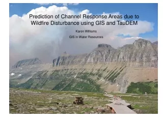
Prediction of Channel Response Areas due to Wildfire Disturbance using GIS and TauDEM Karen Williams GIS in Water Resources
Project Objective • Use spatial distribution of channel, network, and landscape characteristics to predict channel areas most likely to respond to wildfire disturbance • Stream power • Channel slope • Hillslope gradient • Burn severity • Stream order • Land cover
Geomorphic Disturbance and Response • Disturbance regime: • Landscape processes that influence the “supply, storage, and transport of water, sediment, and wood” (Benda et al, 1998) • Examples: wildfire, mass wasting, timber harvest • Response to disturbance varies with channel type, basin morphometry, land cover and use
Project Watershed: Dutch Creek Basin area = 28 sq.mi. Drains southwest to North Fork Flathead River
Project data • 10 m. cell size elevation raster data • Stream vector data • Land cover raster data • Burn severity raster data • All obtained from Glacier NP GIS person
Methods • Stream network (demnet) - TauDEM • Compared to streams layer from GNP • Created network includes more low order channels • Stream order raster (demord) - TauDEM • Channel slope – TauDEM • Slope between links reported in demnet • Classify slopes by Montgomery and Buffington (1997) • <2% = response reach • 2-4% = transport reach • > 4% = source reach • Hillslope gradient – DEM raster toTIN • Burn severity and land cover - GNP
Comparison of TauDEM and Glacier NP stream vector data • Glacier NP stream vector data created from 1:24,000 maps, digital orthoquads and aerial photos • TauDEM created more low order streams • Low order, ephemeral channels are conduits for sediment and wood delivery
Land cover raster data • Mostly coniferous forest • High severity burn in riparian coniferous forest increases frequency and extent of woody debris delivered to channel
Hillslope Gradient and Channel Slope • Much of watershed is moderate slope • Areas of steep hillslopes are more likely to be subject to mass wasting
Methods • Stream power, • The ability of channel to do work, power per unit length • Channel slope, S • Option in TauDEM: Define a feature class of nodes at which slope will be calculated • Discharge, Q • Assume the two-yr recurrence interval flood approximates the channel forming (dominant discharge) Q2 • For this region, Q2 = A^.918 * P^1.33 • A = area in sq.mi; P = mean annual precip., in. • Determine Q2 at each node
Mean annual precipitation polygon • 5 precipitation zones in watershed • Contributing area at each node apportioned by precipitation zone
Stream power and channel slope • Areas of high stream power not necessarily correlated with channel slope • Not enough nodes to be conclusive
Stream power at nodes and stream order Some nodes of high stream power occur where low order and higher order channels confluence
Based on spatial distribution of basin and channel characteristics, the identified channel areas of severe burn, moderate hillslope gradient, and moderate to high stream power may exhibit a response
Questions? Thanks to Glacier NP Dave Tarboton