Intercomparative Regional Climate Simulation Project (PIRCS): Advancing Climate Modeling
370 likes | 516 Views
The Project to Intercompare Regional Climate Simulations (PIRCS) aims to establish a common framework for evaluating regional climate models and their procedures through systematic comparative simulations. By assessing strengths and weaknesses of various modeling approaches, including dynamical downscaling and component models like hydrology and ecosystems, PIRCS supports the acceleration of scientifically-based predictive models that provide regional climate information. For inquiries, contact Co-Directors Ray Arritt, Bill Gutowski, or Gene Takle.

Intercomparative Regional Climate Simulation Project (PIRCS): Advancing Climate Modeling
E N D
Presentation Transcript
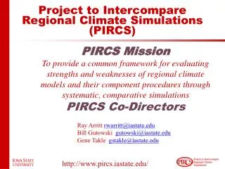
Project to Intercompare Regional Climate Simulations (PIRCS) PIRCS Mission To provide a common framework for evaluating strengths and weaknesses of regional climate models and their component procedures through systematic, comparative simulations PIRCS Co-Directors Ray Arritt rwarritt@iastate.edu Bill Gutowski gutowski@iastate.edu Gene Takle gstakle@iastate.edu http://www.pircs.iastate.edu/
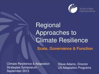
Dynamical Downscaling Global climate model Regional climate model Process models (e.g., hydrology, ecosystem) Social systems
U.S. CCSP Strategic Plan “Objective 1.6: Accelerate the development of scientifically-based predictive models to provide regional and fine-scale climate and climate impacts information” “…establish a process for coordination of regional modeling activities…” “Regional and sectoral climate and climate impacts research and modeling is a high program priority” http://www.pircs.iastate.edu/
National Research Council Review of CCSP Strategic Plan “In implementation, the CCSP should support the development and application of regional climate models to a greater extent than described in the revised plan.” NRC: Implementing Climate and Global Change Research: A Review of the Final U. S. Climate Change Science Program Strategic Plan (2004)
PIRCS Experiments 1a: 15 May-15 July 1988 1b: 1 June - 31 July 1993 1c: July 1986 - Dec 1993 Subset: Oct 1978 - Dec 1988 GCM grid: red pointsRCM grid: green,bluepoints
PIRCS Participating Groups • Danish Met. Inst. (HIRHAM4; J.H. Christensen, O.B. Christensen) • Université du Québec à Montréal (D. Caya, S. Biner) • Scripps Institution of Oceanography (RSM; J. Roads, S. Chen) • NCEP (RSM; S.-Y. Hong) • NASA - Marshall (MM5/BATS; W. Lapenta) • CSIRO (DARLAM; J. McGregor, J. Katzfey) • Colorado State University (ClimRAMS; G. Liston) • Iowa State University (RegCM2; Z. Pan) • Iowa State University (MM5/LSM; D. Flory) • Univ. of Maryland / NASA-GSFC (GEOS; M. Fox-Rabinovitz) • SMHI / Rossby Centre (RCA; M. Rummukainen, C. Jones) • NOAA (RUC2; G. Grell) • ETH (D. Luethi) • Universidad Complutense Madrid (PROMES; M.Gaertner) • Université Catholique du Louvain (P. Marbaix) • Argnonne National Lab (MM5 V3; J. Taylor, J. Larson) • St. Louis University (Z. Pan)
500 hPa Heights:Root Mean Square Difference from ReanalysisPIRCS Expt 1a (1988)
“Warming Hole” ˚C DTmax (JJA)
Refereed Publications: PIRCS Science of Climate Change • Takle, E. S., W. J. Gutowski, R. A. Arritt, Z. Pan, C. J. Anderson, R. R. da Silva, D. Caya, S.-C. Chen, J. H. Christensen, S.-Y. Hong, H.-M. H. Juang, J. Katzfey, W. M. Lapenta, R. Laprise, P. Lopez, J. McGregor and J. O. Roads, 1999: Project to Intercompare Regional Climate Simulations (PIRCS): Description and initial results. J. Geophys. Res.,104, 19,443-19,461. • Christopher J. Anderson, Raymond W. Arritt, Eugene S. Takle, Zaitao Pan, William J. Gutowski, Jr., Renato da Silva, Daniel Caya, Jens H. Christiansen, Daniel Luthi, Miguel A. Gaertner, Clemente Gallardo, Filippo Giorgi, Song-You Hong, Colin Jones, H.-M. H. Juang, Jack J. Katzfey, William M. Lapenta, Rene Laprise, Jay W. Larson, Glen E. Liston, John L. McGregor, Roger A. Pielke, Sr., John O. Roads, John A. Taylor, 2003: Hydrologic processes in regional climate model simulations of the central United States flood of June-July 1993. J. Hydrometeor.,4, 584-598.
10-yr Runs of Climate and Climate Change • Longest published ensemble RCM runs for contiguous U.S. • 5 publications on science of regional climate and climate change • 6 publications on climate change impacts. • Numerous conference & university presentations.
Broad, Community Interest • Consultation by other science programs: • RMIP, ARCMIP, MERCURE/PRUDENCE, WGNE, CLIVAR, South America projects, Africa AIACC • Consultation by private sector: • e.g., Corn Growers Assoc., Basin Electric, Soil Conservation Service, IA Assoc. of Municipal Utilities • Foundation for North American Regional Climate Change Assessment Program (NARCCAP)
Transferability Working GroupGEWEX Hydrometeorology PanelWorld Climate Research Programme Objective: Improved understanding and predictive capability through systematic intercomparisons of regional climate simulations on several continents with observations and analyses. • Build on coordinated observations from GEWEX continental scale experiments. • Provide a framework for evaluating regional model simulations of climate processes of different climatic regions. • Evaluate transferability of regional climate models, for example a model developed to study one region as applied to other, “non-native”, regions. • Examine individual and ensemble performance between domains and on individual domains.
A Vision for U.S. Regional Climate Modeling • There is well documented need for regional climate modeling beyond the CCSP plan to "Accelerate the development of..." • This urgency is driven both by the need for better science and requirements for applications. • The PIRCS and PRUDENCE experiences demonstrate the value of coordination in regional climate modeling • No U.S. agency or organization is taking leadershipto accelerate regional climate modeling.
A Vision for U. S. Regional Climate Modeling • PIRCS brings: • 10 years of experience • Commitment to lead a regional modeling effort • Motivation to coordinate with national climate change priorities. • Development of a center is potentially slow and cumbersome. • PIRCS can provide leadership within the timeframe of the normal grants program.
Implementing the Vision • Systematically examine fine-scale climate dynamics. • Coordinate U.S. comparisons. • Provide foundation for: • community member proposals • U.S. climate change assessments • Advance goals of CCSP Strategic Plan. • Provide international linkages (e.g., GEWEX)
Implementing the Vision: Issues • Ensembles • Transferability • Uncertainty, Predictability & Error Propagation • Upscaling • Feedbacks • Nesting • domain, resolution differences, input frequency, physics consistency • Stability of long simulations • Calibration
Implementing the Vision: Outcomes • Standardized framework for assessing RCMs • Regional-scale feedbacks and couplings exposed • Improved models • Guidelines for improving observational databases for model assessment • Capacity-building in RCM science and assessment • Cross-comparison with other downscaling methods
Implementing the Vision:NSF Role Questions for NSF: • How much should impacts be included and emphasized? • What NSF divisions should be linked to this vision? • What is the potential for developing, with NSF help, inter-agency cooperation toward meeting CCSP goals? • How much does US commitment to GEWEX influences NSF's priorities?
PIRCS Homepage http://www.pircs.iastate.edu
Implementing the Vision:Personnel • ISU faculty - oversight & management • 1 Postdoc - scientific coordination • 3 Graduate students - focused analyses • 3 Undergraduates - computing assistance • 1 Research associate - data management and access • External visitors
Implementing the Vision:Support • Workshops for participating modelers & output users • Supporting hardware • Data access tools (e.g., Live-Access Server) • Travel & Publication support
Precipitation Bias [mm/d]
DX = 250 km contours every 250 m
DX = 50 km contours every 250 m
DX = 10 km contours every 250 m
Possible Comparisons? Reanalysis RegCM2 OBS HadCM Cont/Scen HIRHAM HadCM Cont/Scen Driving Differences
Model & Simulation 20-km grid (120 x 150) Grell & Pagowski 1994 - 1999 5-km grid (121 x 165) May - August 1997 (after spin-up)
Without sufficient resolution, it just doesn’t look right! EST&LM