Download
1 / 20
200 likes | 230 Views
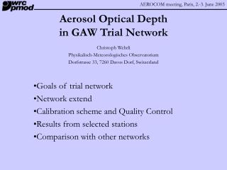
GAWPFR Network for Aerosol Optical Depth. Christoph Wehrli Physikalisch-Meteorologisches Observatorium Dorfstrasse 33, 7260 Davos Dorf, Switzerland. What is measured and how Network extent Calibration scheme and Quality Control Results from selected stations Comparison with other networks

E N D
GAWPFR Network for Aerosol Optical Depth Christoph Wehrli Physikalisch-Meteorologisches Observatorium Dorfstrasse 33, 7260 Davos Dorf, Switzerland • What is measured and how • Network extent • Calibration scheme and Quality Control • Results from selected stations • Comparison with other networks • Sustainability and perspective
WORCC mandate A World Optical depth Research and Calibration Center was proposed by GAW QA/SAC and established in 1996 at Davos through sponsoring by MeteoSwiss after BAPMoN turbidity program was abandoned in 1993. • Summary of WORCC Tasks • Development of new instrumentation, radiometric calibration, data quality control and protocols for aerosol optical depth determination. • Implementation of a trial network at 12 Global Observatories to test new instruments and calibration methods. • Train station operators in sun photometer measurements . Participating GAW stations are proposed by SAG/Aerosols in collaboration with WMO; WORCC supplies instrumentation donated by MeteoSwiss, while host stations are to provide solar tracking facility and limited manpower.
What is measured and how? • Classic extinction measurements at 4 WMO wavelengths • 368, 415, 500 and 862nm Optical depth, Ångström exponent. • Identical, precision filter radiometers PFR (manufactured by PMOD/WRC). • Continuous sampling at 1or 2 minute cadence by automated system. • Monthly data transfer to WORCC for centralized evaluation. • Quality Control flags cover solar pointing, temperature control, cloud screening, … • Hourly means archived at WDCA, Ispra; high frequency data available from WORCC upon request.
GAWPFR network sites Ny Ålesund Summit Sodankylä Polar Circle Mace Head Jokioinen Bratts Lake Lindenberg Hohenpeissenberg Jungfraujoch Ryori Izaña Waliguan Tamanrasset Mauna Loa Bukit Kototabang Alice Springs Cape Point Marambio
Precision Filter Radiometer PFR specifications • Automated, solar spectral radiometer • 4 simultaneous channels at 862, 500, 412, 368nm using IAD interference filters • Field of View: ±2.5° , slope angle 0.7° • Dimensions: Ø90 x L300mm, Mass 3 kg • Continuous, high cadence measurements • Sensor at 20±0.1°C in range –25 ÷ 35°C; internal shutter; airtight N2 flushed housing • built-in pointing and barometric sensor • Data logger with 30 day storage capacity PFR N21 at Riory, Japan
Cloud Filtering 3 different cloud flags are determined for individual samples: • Harrison & Michalsky algorithm, modified for air masses <2 • Triplet algorithm applied as moving filter on continuous samples • Optical thick (OD>3) clouds
Data Exchange Format %STATION =MaunaLoa %LATITUDE = 19.5330 %North %LONGITUDE =155.5780 %West %ALTITUDE = 3397.0 %above sea level %ZONE = 0 %UTC=logger time - Zone %STATIDENT = 11 %DATE =2000 8 10 %date containing solar noon %AIRPRESS = 666.7 %average Sun above horizon %AIRTEMP = 23.8 %instrument body %OZONE = 277.3 %climatological or actual DU %INSTRUMENT=PFR-N27 %INSTIDENT = 27 %NCHANNELS = 4 %NREADINGS =1439 %actual number of records %WAVELENGTH= 862.4 501.2 412.0 367.6 %nominal or measured %CALDATE =1999 12 27 %recalibrated at MLO %CALIBRAT = 3.4640 3.8140 3.8070 4.1030 %Extraterrestrial signal %SLOPE = +0.072 +0.050 -0.151 +0.117 %mV per day since CALDATE %O3ABS = 0.0024 0.0340 0.0002 0.0000 %Gueymard, filter averaged %RAYLSCATT = 0.0157 0.1420 0.3186 0.5128 %Bodhain at WAVELENGTH %SUNEARTH = 1.013466 % %DECLINAT = 15.11215 %EQOFTIME = 6.882 %NOON = 22.487 %LOGFILE =H:\WORCC\PFR\MaunaLoa\mlo_n27.LOG %VERSION = 2.80 %COMMENT =for column description, see PFRLEV2.HLP %END % UTC SunElv Barom 862 500 412 368 Tsens Tbody PntgV PntgH Flg 17.0000 12.513 666.2 3.2552 2.2998 1.3813 0.8234 20.49 16.11 -5.71 -7.62 0 17.0167 12.744 666.2 3.2598 2.3206 1.4054 0.8460 20.49 16.16 -5.66 -7.59 0 17.0333 12.974 666.1 3.2614 2.3376 1.4279 0.8682 20.49 16.24 -5.73 -7.57 0 17.0500 13.205 666.0 3.2687 2.3592 1.4522 0.8913 20.49 16.29 -5.73 -7.59 0 17.0667 13.435 666.1 3.2739 2.3792 1.4753 0.9146 20.49 16.37 -5.72 -7.55 0 17.0833 13.666 666.2 3.2768 2.3970 1.4984 0.9365 20.49 16.42 -5.77 -7.54 0 17.1000 13.897 666.2 3.2794 2.4140 1.5202 0.9578 20.49 16.50 -5.79 -7.54 0 17.1167 14.128 666.3 3.2809 2.4301 1.5411 0.9794 20.49 16.55 -5.84 -7.54 0 17.1333 14.358 666.2 3.2832 2.4457 1.5626 1.0002 20.49 16.62 -5.88 -7.51 0 17.1500 14.589 666.3 3.2859 2.4614 1.5819 1.0208 20.49 16.68 -5.87 -7.49 0 17.1667 14.820 666.3 3.2911 2.4806 1.6041 1.0432 20.49 16.75 -5.92 -7.46 0 17.1833 15.051 666.3 3.2933 2.4956 1.6246 1.0639 20.49 16.81 -5.93 -7.47 0 17.2000 15.282 666.2 3.2960 2.5105 1.6429 1.0842 20.49 16.86 -5.99 -7.47 0 17.2167 15.514 666.2 3.2971 2.5246 1.6628 1.1044 20.49 16.94 -6.02 -7.40 0 17.2333 15.745 666.3 3.3008 2.5399 1.6827 1.1256 20.49 17.01 -5.98 -7.42 0 17.2500 15.976 666.3 3.3044 2.5541 1.7018 1.1454 20.49 17.07 -6.06 -7.38 0 17.2667 16.207 666.1 3.3050 2.5667 1.7193 1.1645 20.49 17.15 -6.07 -7.38 0 17.2833 16.439 666.3 3.3062 2.5807 1.7371 1.1842 20.49 17.20 -6.05 -7.34 0 17.3000 16.670 666.3 3.3105 2.5960 1.7562 1.2041 20.49 17.27 -6.11 -7.36 0 Stations to WORCC: • Self-contained daily ASCII files. • Meta Data Header with keyword = parameter set. • Data Body containing standardized measure-ments with quality flags and solar elevation added. • Generated at stations by standardized software. • Submission to WDCA in NARSTO format
WORCC Calibration Hierarchy • Standard instruments are calibrated at high altitude stations (Jungfraujoch, Mauna Loa) by atmospheric extrapolation methods. • Stability of standard instruments is monitored by spectral comparison with a metrologically traceable absolute detector. • Field instruments are calibrated by comparison with WORCC standards at Davos or Langley calibration at Jungfraujoch. • Station instruments are linked to WORCC standards by travelling standards, exchange of sensors or re-calibration at Davos. • Performance is tested through intercomparison of field instruments with other, co-located networks. Launch of SIMBA98 experi-ment in Aire sAdours, F
High Altitude Calibration Sphinx Research Station at Jungfraujoch Altitude 3580m Latitude 46°32’55” N Longitude 7°59’11” E Automated solar dome of MCH • Objective, daily Langley calibrations • Robust, statistical analysis for V0 • Annual drift <1±0.15%/y
Radiometric Calibration • Spectral irradiance scale based on a cryogenic radiometer of PTB (Berlin), transferred via calibrated trap detector • Radiometric response determined every 6 months by spectral comparator facility. • Reference instrument N01 is assumed to be radiometrically stable to <±0.5% • Top_of_Atmosphere reading V0 could be determined by laboratory calibration, if an accurate (<1%) extraterrestrial solar spectrum was available.
Inter-annual Variations Baikal Fires Canadian Fires ?
MLO Comparison 2000: Methodology Mauna Loa co-location site for Aeronet and GAW/PFR • AERONET/CIMEL and GAW/PFR data compared at individual samples level • Aeronet Level2 data (380, 440, 500, 870nm) as published on internet † • GAW/PFR with interpolated calibration (drift <0.25%/year) • CIMEL channels are interpolated to WMO wavelengths of PFR by Ångström’s law using instantaneously derived wavelength exponents. • PFR one minute samples are interpolated in time to CIMEL observation scheme † with kind permission of Dr. Brent Holben, Aeronet PI, NASA/GSFC
MLO Comparison 2000: Optical Depths • N = 4705 cloud free samples compared • Wavelength: 367.6 412.0 501.2 862.4 • Mean slope: 1.0941 1.1056 1.0678 1.0531 • Mean bias : -0.0002 0.0001 -0.0005 0.0002 • RMS diff. : 0.0055 0.0043 0.0030 0.0026 Mean AOD : 0.0203 0.0163 0.0114 0.0049 • Excellent agreement within 0.005 OD at calibration site!
MLO Comparison 2000: Ångström • Averages • Alpha(Cimel): 1.81±0.5 Alpha(PFR): 1.63±0.26; • Aeronet(2000) : 1.83±0.30 • Aeronet(climat) : 1.69±0.24 • Marked differences between both radiometers, although they agree well in optical depth. • Ångström exponent is a less reliable parameter.
BLO Comparison 2001 • Five instruments operating under 4 network protocols co-located at Bratt‘s Lake were compared during 3 months in summer 2001: • Cimel (Aeronet); PFR(GAW); SP01 (MSC), 2 MFRSR (MSC and USDA) • 3 direct pointed radiometers agreed per observation within ±0.01 (2) • Significant improvements were obtained through cloud screening algorithms • Differences between 2 MFRSR were almost as large as optical depths • Significant differences in derived Ångström parameters were found McArthur, B.L.J., Halliwell, D.H., Neibergall, O.J. O'Neill, N.T., Slusser, J.R. and Wehrli, C.; Field comparison of network sunphotometers JGR 108, (D19), 4596, doi:10.1029/2002JD002964, 2003
Sustainability • GAWPFR network is in transition from trial phase to operational status. Long-term aspect requires stable structures and resources. • WORCC’s additional role as central facility for data collection, evaluation and quality assurance is under revision; resources are limited. • All 8 current stations are willing to continue measurements as in trial phase. • Distributed processing: most station would process data on-site, when supplied with automated software; some have difficulties providing additional manpower.
Future Perspectives and Questions • WORCC should focus on providing calibration services, including different instrumentation and wavelengths. • Archiving of QC measurements besides averaged results. • Network Expansion: filling gaps in global coverage. Additional GAW stations using alternative instruments? Lacking solar trackers. • Network Collaboration: with BSRN for centralized processing? With other networks: subject of this workshop.
Thank you for your attention