Download
1 / 18
180 likes | 338 Views
VALIDATION OF THE CENTRAL EUROPEAN SOIL DATABASE. International Visegrad Fund’s Strategic Grant No. 31210072. About the project (aim of the project, consortium, planned activities).

E N D
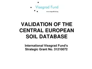
VALIDATION OF THE CENTRAL EUROPEAN SOIL DATABASE International Visegrad Fund’s Strategic Grant No. 31210072
About the project (aim of the project, consortium, planned activities) • The FP7 e-SOTER project developed a soil database located in Central Europe, covering the Czech Republic, Slovakia, Austria and the Southern part of Poland • In order to make this novel product operation a through validation process has to be carried out • The aim of this project is to support this action with organized joint field data collection campaigns int he four countries to create a harmonized field data based validation dataset for the finalization of the database. • Replace the traditional soil maps, and is appropriate to answer specific soil related questions and provide inputs for several interdisciplinary models on a national and on the regional level • Originally only Hungary and the Czech Republic were presented in the e-SOTER consortium, which we have extended in this project to Slovakia and Poland to achive the full coverage of the region. • The planned activities: • Field data harmonization, soil description, and validation database developement requires joint field trips having representatives from all participating countries. • The planned field trip lenght is 5 days each, and each countries will organize one. 20-25 soil pits per countries will be visited and described by the team and data will be recorded and compiled into a validation dataset. • The dataset will be used for statistical validation and for correcting the potentially emerging problems of the database. Typicalcorrelation and interpretation problems will be discussed and reported in a joint scientific paper. • Based on the finding a new version of the dataset will be created and published jointly in the four countries.
The project consortium • Miskolci Egyetem - University of Miskolc • Miskolc, Miskolc-Egyetemváros, 3525 Hungary • www.uni-miskolc.hu • Ceská zemedelská univerzita v Praze Czech - University of Life Sciences Prague • Kamýcká 129, Praha, 165 21, CZ • www.czu.cz • Výskumný ústav pôdoznalectva a ochrany pôdy - VUPOP Bratislava - Soil Science and Conservation Research Institute • Gagarinova 10, Bratislava, 827 13, SK • www.vupop.sk • Uniwersytet Mikolaja Kopernika - Nicolaus Copernicus University • Gagarina 11, Torun, 87-100, PL • www.umk.pl
Project website • http://www.uni-miskolc.hu/~soil/
Budget for the partners • Important issues: • Only 10 percent of the total budget can be paid in cash! Money should move by bank transfer ! • Receipt on meals have 52 percent extra tax in Hungary! • Receipts are to be addressed to the UNIVERSITY OF MISKOLC, 3515 MISKOLC-EGYETEMVÁROS, HUNGARY or the local partner. All receipts have to be sent to us reimbursement as a package with aninvoice letter.
Events and dates • Hungarian field trip: 15/10/2012 – 19/10/2012 • Slovakian field trip: 12/11/2012 – 16/11/2012 • Polish field trip: 15/04/2013 – 19/04/2013 • Czech field trip: 13/05/2013 – 17/05/2013
Major steps of the planning • Random site selection • Unbiased adjustments of the sites considering the feasibility of sampling • will be describbed by Péter • Diging soil profile in the selected location and augering four sites 100 meters from the profile to the North, East, South and West • Profile desciption, identification of the diagnostic features, • Doing the same for the augered samples • Recording everything!!!!!!!!!
Hungarian field trip • Locations: • Apagy • Pród • Békés • Martfű • Jászkarajenő • Kadarfalva • Gátér • Üllés • Mélykút • Bátya • Szárazd • Töreki • Barnag • Seregélyes • Vértesszőlős • Esztergom • Nőtincs • Pásztó • Jászfelsőszentgyörgy
Hungarian field trip • Locations: • Apagy • Pród • Békés • Martfű • Jászkarajenő • Kadarfalva • Gátér • Üllés • Mélykút • Bátya • Szárazd • Töreki • Barnag • Seregélyes • Vértesszőlős • Esztergom • Nőtincs • Pásztó • Jászfelsőszentgyörgy