Download
1 / 40
400 likes | 595 Views
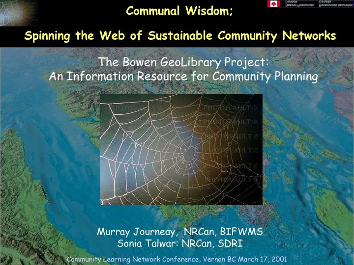
Communal Wisdom;. Spinning the Web of Sustainable Community Networks. The Bowen GeoLibrary Project: An Information Resource for Community Planning. Murray Journeay, NRCan, BIFWMS Sonia Talwar: NRCan, SDRI. Bowen Island: A Community in Transition. Bowen as an Edge Community The Challenge

E N D
Communal Wisdom; Spinning the Web of Sustainable Community Networks The Bowen GeoLibrary Project: An Information Resource for Community Planning Murray Journeay, NRCan, BIFWMS Sonia Talwar: NRCan, SDRI Community Learning Network Conference, Vernon BC March 17, 2001
Bowen Island: A Community in Transition • Bowen as an Edge Community • The Challenge • The Vision • The Plan • Local Initiatives • Regional Initiatives Community Profile Community Learning Network Conference, Vernon BC March 17, 2001
Bowen GeoLibrary Project • The question of community sustainability ultimately requires a geographic context. • Our premise is that individuals need a familiar and understandable frame of reference in which to assess the complex interrelationships between the ecological, social and economic systems of which they are a part. • This framework (a shared sense of place) is a necessary step toward developing a meaningful understanding of what sustainability may mean in the context of a community, and for making informed decisions about a collective future. Community Learning Network Conference, Vernon BC March 17, 2001
Bowen GeoLibrary Project • Our intent is to build an operational digital library of geospatial information (GeoLibrary) for Bowen Island; one that will support community based learning and research on local issues of ecological, social and economic health, and that will help promote a culture of public engagement and informed decision making within our community. Community Learning Network Conference, Vernon BC March 17, 2001
What is a Distributed Geolibrary? • A geolibrary is a digital library filled with geographically referenced information and knowledge resources for a distinct area or footprint on the earth’s surface • A geolibrary is distributed if its users, services, metadata and information assets can be integrated across many distinct locations. Digital Libraries:Creation, Access, Use of Knowledge World Wide Web:Access to Information Internet:Basic Connectivity From National Academy of Science Publication“Distributed GeoLibraries”, 1999 Community Learning Network Conference, Vernon BC March 17, 2001
Bowen GeoLibrary Project • Our longer term vision is to build an integrated learning resource network and decision support framework for managing broader collections of information and knowledge resources within our community, and for analyzing alternate scenarios by which sustainable conditions might be achieved within the foreseeable future. Community Learning Network Conference, Vernon BC March 17, 2001
Bowen GeoLibrary Project The goal is to develop the capacity of this integrated system to serve not only as a lens to into our own community, but as a window into the neighboring GVRD and Islands Trust regions, of which we are a part. Community Learning Network Conference, Vernon BC March 17, 2001
Public Information, Civic Dialogue and Effective Governance (Global Knowledge Conference, 1995) • New information technologies create unprecedented opportunities for sharing information, fostering dialogue, and providing public officials -- and individuals and communities -- with tools for effective governance . • They can help to create a "public space" where disparate communities of interest coalesce around a national conversation on shared objectives. • Yet they also raise fundamental questions about the role of and access to information, about the responsibility of the media, about governance and civic dialogue. Community Learning Network Conference, Vernon BC March 17, 2001
Ingredients of a “Sustainable Community” Pacific Resources Center (Crawford et al., 2000) Thesis • Readiness: communities will learn for change at a pace and a level that is manageable by actively participating in their own processes. • Community capacity building: altering the relationship between government, communities and industry. Relationships change from one of doing things for communities to doing things with them. • Integrated decision making: processes that enrich and do not replace existing governance structures. Community Learning Network Conference, Vernon BC March 17, 2001
Ingredients of a “Sustainable Community” Tim O’Riordan, 1998) • Reliable wealth.This means core wealththat is continuous, durable and self-generating, not undermined by environmental damage. To the greatest extent possible, wealth should be locally generated and consumed. Benefits are returned to where wealth is generated and monies are re-invested. (e.g. sustainable forestry) • Stewardship, a systematic bias to protect and care for vulnerable eco-systems • Empowerment, meaning not so much gathering or transferring power, as increasing civic awareness and democratic involvement. The idea is to generate self-respect, give legitimacy and ensure accountability. Community Learning Network Conference, Vernon BC March 17, 2001
Ingredients of a Learning Resource Centre Pacific Resources Center (Crawford et al., 2000) • Learner centered; a place where people are supported as they go through the learning steps of analyzing their situation, hearing a new idea, seeking information about it, integrating it into their lives and evaluating it. • Accessible;a place where individuals can obtain useable information about their community and surrounding regions, and • Independent;at arms length from any one agency or organization, yet connected with them, and available for use by individuals and groups at various stages of readiness. Community Learning Network Conference, Vernon BC March 17, 2001
Government Online: The “Broadcast” Model Objective • Canadians online (internet access through schools and libraries, CANARIE) • Promote e-commerce • Increase availability of Canadian-produced content (i.e. online courses, cultural collections, and health information, etc.) • Put government information & services on internet 24/7 (Gov’t online) • Smart communities – to connect municipal government to local residents and businesses. • Connect Canada to rest of world – attract investment to Canada Community Learning Network Conference, Vernon BC March 17, 2001
Community Networks: The “Pull” Model Objective Build the capacity of Canada's Aboriginal, rural, coastal and northern communities who wish to use Computer-based geospatial information, and the Internet to improve their ability to plan and make decisions towards a sustainable future. Principles • Control by the communities • Mentoring (support) • Partnerships Community Learning Network Conference, Vernon BC March 17, 2001
NRCan Sustainable Communities Initiative Specific elements of the program • Understand the community's vision • Help define a Pilot projectin support of a major community requirement • UpgradeComputer systems: geospatial, Internet • Identify sources ofdataand method of acquisition • Train members of the community • Provide catalyst for partnerships and opportunities • Disseminate knowledgegained (within the community; to other communities) • SCI Portal:sci.gc.ca or via the GeoConnections site Community Learning Network Conference, Vernon BC March 17, 2001
NRCan Sustainable Communities Initiative Community profile • Strong Community Leadership support: vision andcommitment • Prepared to provide & fund day-to-day Project Manager • Facing important planning or decision-making issues • Willing to adopt Web/GIS: Trainee deployment plan • Willing to consider the establishment of an Internet Community Access Program (CAP) site • Representative of a significant group of communities • Willing to shareexperience with other communities Community Learning Network Conference, Vernon BC March 17, 2001
NRCan Sustainable Communities Initiative • YUKON • Na-Cho Nyak Dun • Central Yukon SCI • N.W.T. • Liidlii Kue • DehCho Tribal C. • Norman Wells • NUNAVUT • Kugluktuk • B.C. • Gitxsan Nation • Bowen Is. • Quadra Is. • Shuswap Tribal C. • L’Heidli T’enneh Community Learning Network Conference, Vernon BC March 17, 2001
NRCan Sustainable Communities Initiative Land Use Planning Process Identify sensitive harvesting and cultural areas Identify sensitive wildlife areas Identify high timber potential areas Identify high mineral potential areas Identify high oil and gas potential * Overlay maps, make decisions and prepare land use plan (Adapted from Exploratory Study by Liidlii Kue FN) Community Learning Network Conference, Vernon BC March 17, 2001
NRCan Sustainable Communities Initiative Social, Economic, and Demographic Factors Identify job creation needs and skill levels Identify job creation potential in natural resources sectors Balance job creation goals between sectors to meet needs and economic diversification Integrate with land use zoning decisions to ensure respect for traditional uses if land is made available for job creation (Adapted from Exploratory Study by Liidlii Kue FN) Community Learning Network Conference, Vernon BC March 17, 2001
NRCan Sustainable Communities Initiative Opportunities for Partnership GIS Infrastructure • Equipment: Hardware, Software • Basic training, Apprenticeship • Methodology: Pilot project Human Activity • Economic studies • Community Planning • Sustainability issues Community Learning Network Conference, Vernon BC March 17, 2001
What is a GIS? • A Geographic Information System (GIS) is a computer-based tool for mapping and analyzing the physical world around us and for exploring the relationships between processes and events that shape our environment, both local and global • An integrated collection of hardware, software, data, people and methods designed to manage and analyse large amounts of geographically-referenced information Community Learning Network Conference, Vernon BC March 17, 2001
Is it like a CAD system? • Sort of….. • Computer Assisted Drawing (CAD) systems evolved to create designs and plans of buildings and infrastructure. This activity required that components of fixed characteristics be assembled to create the whole structure. • These systems require few rules to specify how components can be assembled and very limited analytical capabilities. CAD systems have been extended to support maps but typically have limited utility for managing and analyzing large geographic databases. Community Learning Network Conference, Vernon BC March 17, 2001
Is it a Database management system? • Sort of…. • Database Management Systems (DBMS): specialize in the storage and management of all types of data including geographic data. • DBMS’s are optimized to store and retrieve data and many GIS’s rely on them for this purpose. They do not have the analytic and visualization tools common to GIS. Community Learning Network Conference, Vernon BC March 17, 2001
So…. What’s the difference? • GIS’s are closely related to several other types of information systems, but it is the ability to manipulate and analyze geographic data that sets GIS technology apart. • The concept of Topology Community Learning Network Conference, Vernon BC March 17, 2001
GIS Skills • The ultimate success of a GIS is measured not by its physical components, but by its ability to respond to the needs of the people it was designed to serve. These people need to have a basic understanding of how the system works, but most importantly, • must have the ability to conceive and pose questions about the information contained in the GIS, and • must be capable and willing to make choices about to manipulate and analyze the information. Community Learning Network Conference, Vernon BC March 17, 2001
GIS Skills • “Doing GIS” with any collection of hardware/software tools requires some key skills: • Finding information and knowing what to do with it (or the will to figure it out as you go) • Thinking geographically… understanding spatial patterns and relationships • Being able to use computers effectively, and coping with the chaos and frustration that goes along with navigating this exponential learning curve • a good sense of humor Community Learning Network Conference, Vernon BC March 17, 2001
How GIS works….. • A GIS stores information about the world as a collection of thematic layers that can be linked together by geography. • This simple but extremely powerful and versatile concept has proven invaluable for solving many real-world problems from tracking delivery vehicles, to recording details of planning applications, to modeling global atmospheric circulation. Community Learning Network Conference, Vernon BC March 17, 2001
How GIS works….. • Geographic information contains either an explicit geographic reference such as a latitude and longitude or national grid coordinate, or an implicit reference such as an address, postal code, census tract name, forest stand identifier, or road name. • These geographic references allow you to locate features, such as a business or forest stand, and events, such as an earthquake, on the Earth's surface for analysis. Community Learning Network Conference, Vernon BC March 17, 2001
GIS Data Models • Geographic information systems work with two fundamentally different types of geographic models--the "vector model" and the "raster model." • Raster Data: • Grid Cells • Vector Data: • Points • Lines • Polygons Community Learning Network Conference, Vernon BC March 17, 2001
GIS Data Models • Vector Model: In the vector model, information about points, lines, and polygons is encoded and stored as a collection of x,y coordinates. • The location of a point feature, such as a bore hole, can be described by a single x,y coordinate. • Linear features, such as roads and rivers, can be stored as a collection of point coordinates. • Polygonal features, such as sales territories and river catchments, can be stored as a closed loop of coordinates. Community Learning Network Conference, Vernon BC March 17, 2001
GIS Data Models • The raster model has evolved to model such continuous features. A raster image comprises a collection of grid cells rather like a scanned map or picture. • Both the vector and raster models for storing geographic data have unique advantages and disadvantages. Modern GIS’s are able to handle both models. Community Learning Network Conference, Vernon BC March 17, 2001
The Bowen GeoLibrary Project Community Learning Network Conference, Vernon BC March 17, 2001
Sustainable Development Research Institute, UBC The Georgia Basin GeoLibrary:Providing a context of understanding for integrated decision making RES #52natural resourcesdecision making Sonia Talwar, John Robinson, Murray Journeay, Rob Harrap, Michael Walsh, Dave Biggs, Kevin McNaney, Boyan Brodaric, Bruce Kay Community Learning Network Conference, Vernon BC March 17, 2001
The Georgia Basin GeoLibrary Project • Sustainable Development Mandate • A process of integrated decision making on issues of social, economic and ecological well-being; one that must operate simultaneously at, national, regional and local levels of government • how can we enhance human well-being while protecting ecological health at the regional and community level ? Community Learning Network Conference, Vernon BC March 17, 2001
The Georgia Basin GeoLibrary Project Summary of Key Points • individuals need a familiar and understandable frame of reference in which to assess the complex interrelationships between the ecological, social and economic systems of which they are a part. • This framework (a shared sense of place) is a necessary step toward developing a meaningful understanding of what sustainability may mean in the context of a region or community, and for making informed decisions about a collective future. Community Learning Network Conference, Vernon BC March 17, 2001
The Georgia Basin GeoLibrary Project Objectives:Develop the necessary conceptual framework for a Web-based digital library that will seamlessly integrate natural and social science information (GIS maps, images, and text) into a comprehensive information resource to support sustainability research, community-focused decision making and public consultation activities in the Georgia Basin region of western Canada. The Opportunity:Building a linkage between future scenario modelling tools (QUEST) and digital library technologies provides an opportunity to develop operational procedures for better integrating natural science and socio-economic information for purposes of sustainability modeling and land-use planning. Community Learning Network Conference, Vernon BC March 17, 2001
Digital Library Design Space From Marchionini and Fox, 1999 Technology Community Networking, storage, retrieval, interoperability A region or group of people who share common ecological socio-economic, cultural, political & legal issues Content Services The guts: data, observations, information, maps, images, texts, video, audio Functionality, search, browse, providing replies to queries, mechanisms to encourage and simplify greater participation from users Community Learning Network Conference, Vernon BC March 17, 2001
The Georgia Basin GeoLibrary project Data Model Development Connectivity Information Stewardship Data Acquisition Community Learning Network Conference, Vernon BC March 17, 2001
The Georgia Basin digital library project Community Consultation Dynamic Linkage with QUEST Knowledge Discovery Semantic Interoperability Data Model Development Community Learning Network Conference, Vernon BC March 17, 2001
Community Learning Network Conference, Vernon BC March 17, 2001
The Georgia Basin GeoLibrary Project April 2000-March 2002 Research areas • Geolibrary framework: identification of core concepts and develop mechanisms to articulate relationships and convey meaning between information sets pertinent to sustainability for the region. • Decision support: Establish useful connection to decision support tools (QUEST) by developing scientific reasoning protocols to translate relevant information across disciplines and between natural and social sciences. • Design and evaluation: user preferences and requirements that influence system design, case studies at local and regional scale. Community Learning Network Conference, Vernon BC March 17, 2001