Download
1 / 15
150 likes | 320 Views
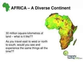
Mapping of cropland areas over Africa combining various land cover/use datasets Food Security (FOODSEC) Action Monitoring Agricultural ResourceS (MARS) Unit Institute for Environment and Sustainability (IES) Joint Research Centre (JRC) – European Commission

E N D
Mapping of cropland areas over Africa combining various land cover/use datasets • Food Security (FOODSEC) Action • Monitoring Agricultural ResourceS (MARS) Unit • Institute for Environment and Sustainability (IES) • Joint Research Centre (JRC) – European Commission • Christelle Vancutsem, Francois Kayitakire, Jean-Francois Pekel, Eduardo Marinho
Context Agriculture monitoring and early warning RS time series NDVI anomalies Vegetation Index profile extraction Pasture & Crop Masks
… … 2008 2009 multi-annual mask Objective • Map cropland areas at 250m • « STATIC » • Expert-based combination of existing datasets • At the global scale (17) • with emphasizing on Africa (10) • « DYNAMIC » • Every year • Sub-saharien african countries • Identify potential cropland areas • Analyse the inter-annual variability • From MODIS time series
Crop mask • 10 sources • Landsat-based: • - SADC 1990-1995 (CSIR) • - CUI 1988 (USGS) • - LULC 2000 (USGS) • - Woody Biomass 2002 (World Bank) • - Africover 2000 (FAO) • - LC Senegal 2005 (GLCN, FAO) • - LC Mozambique 2008 (DNTF) • - MODIS-derived Crop mask 2009 • (JRC, MARS) • Low/medium resolution: • - Globcover 2005-2006 (ESA) • - RDC LC 2000 (UCL)
Static crop mask • 10 sources • Data preparation • Selection of cropland classes • Combination of datasets • Regularly updated
Validation • JRC contributes to the improvement of the tool: • as beta-tester (7 experts) • providing SPOT VGT NDVI profiles
Validation With agriculture.geo-wiki.org • Two validation datasets: • For all Africa, one point every degree • (IIASA)2942pts • 2. For Niger-Nigeria (Foodsec), • onepointevery 40km • 649pts (200 pts overlap) • total 3591 pts • withoutoverlap Comparison with two existing crop masks: Fritz et al. (2011) and Pittman et al. (2010)
Validation Agreement (%) between experts for each category of crops taking into account the category concerned only (% of agreement 1cl) and the neighbouring classes (% of agreement 3cl) 130 points Niger-Nigeria
Validation Comparison between the 3 crop masks and two validation datasets Niger-Nigeria window Africa JRC IIASA MARS IIASA Pittman et al. MARS IIASA Pittman et al. >50% 65.15% 30.26% 21.3% 69.6% 49.8% 17.3%
Conclusion • Combination of the best existing datasets available (static mask) • - half of the African countries covered by high and medium resolution-derived products • - validation shows that the product better agrees with the validation dataset than other existing crop masks • - need of up-to-date information and feedback from users ! • - in continuous improvement (global) • Training and validation datasets with agriculture.geo-wiki.org • - Reliable and user-friendly collaborative tool- Allows sharing data and expertise between experts in a win/win approach- As powerful as the number of user is growing • - Allows a high productivity of the interpreter
Thank you Global Cropland Map (JRC-MARS, 2011)
Static crop mask • 10 sources • Data preparation • From feature to Raster • Reprojection • Resampling at 250m • Translation in the LCCS legend (5cl) • Cultivated and managed areas • Post-flooding or irrigated croplands • Rainfed croplands • Mosaic cropland (50-70%)/vgt • Mosaic vgt / cropland (20-50%)
Static crop mask • 10 sources • Data preparation • Selection of cropland classes • By default, crops >50% • IF crops <50% • Selection by experts based on • comparison with HR imagery (GE) • - Globcover 20-50% in equatorial countries - CUI 30-50%
Static crop mask • 10 sources • Data preparation • Selection of cropland classes • Data combination • When different sources: • 1) Comparison with high resolution imagery (GE) & Analysis by experts • 2) Rules: • 1st priority to the highest resolution • 2nd priority to the most recent
Static crop mask • 10 sources • Data preparation • Selection of cropland classes • Combination of datasets • Possible issues • Out-dated • Global LC data (Globcover) • Spatial inconsistencies • Spatial resolution 250m not “real”