Download
1 / 65
680 likes | 1.18k Views
Chapter 8: Political Geography. The Cultural Landscape: An Introduction to Human Geography. Where are States Located. Concepts of Political Geography Nation People with shared cultural identity

E N D
Chapter 8: Political Geography The Cultural Landscape: An Introduction to Human Geography
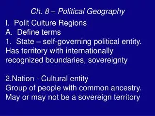
Where are States Located • Concepts of Political Geography • Nation • People with shared cultural identity • State—A politically organized territory with a sovereign government that is recognized by the international community. • The term “country” is a synonym for “state.” The term state, as used in political geography, does not refer to the 50 regional governments inside the US. The 50 states in US are subdivisions w/in a single state. • Nation-State • Recognized political unit where the territory of the state coincides with the area settled by a certain group of people (certain ethnicity…)
Examples of 20th Century Nations • Nation • Many people are becoming more loyal to nation than to their state. The “war on terror” is the US fighting an enemy that has no border but is linked by its radical Islamic views. • Nations are usually located w/in the borders of a country. Different nations include Koreans, Kurds, Basques, & Flemish. • Kurds (Middle East) • One of the largest nationalities in the world without their own state. They are located Turkey, northern Iran, and northern Iraq. The majority of Kurds speak their own language and practice Islam. • Basques (Europe) • A fiercely independent group living in the Pyrenees Mountains. Most live in Spain, but small numbers live in SW France. They have their own language, Euskara. Basque separatists have resorted to terrorism to try to gain independence in hopes of gaining their own nation-state.
Examples of 20th Century Nations • Flemish (Europe) • Live in north Belgium. Their official language is Flemish (also called Dutch) and they are distinct from the Walloons of Belgium who reside around Brussels and whose official language is French. • About ¾ of Flemish are Roman Catholic, which separates them from many other northern Europeans, who tend to be Protestant. • Flemish separatists would like their country to be called Flanders • Palestinians (Middle East) • Estimated 9.5 million people; most live in the West Bank, Gaza Strip, and the Golan Heights of Israel. • A Palestinian has been defined as any person who was living in Palestine prior to 1947. With the creation of Israel in 1948, many Palestinians fled to neighboring countries (Jordan, Syria, Lebanon). • A Palestinian country could be created in Israel to ease tensions in this hostile region.
Examples of States and Nation-States • State • Earth is divided into just under 200 countries. These countries are more correctly termed states. • In the past century, the number of states has increased by over 100. • Nation-States • Denmark, Germany, Greece, Ireland (Europe) • Denmark—a small Scandinavian country who all speak Danish as their primary language. Outside of Denmark, only a small section of northern Germany also speaks Danish. • Israel, Iran, Turkey (Middle East) • Japan (Asia) • Within Japan, 99.5% of the people are ethnic Japanese.
How has pursuit of nation-state ideal caused conflict? • Conflict in Northern Ireland and Belgium (Europe) • Northern Ireland—conflict between the Protestants and Roman Catholics. • Belgium—conflict between the Flemish and the Walloons • Conflict in Israel and Lebanon (Middle East) • Israel—conflict between the Jewish and Palestinians • Lebanon—conflict between the Muslims and the Christians • Conflicts in Europe and Middle East occurred as a desire for independence, land, and to be governed by people who share their ideology.
Almost all habitable land belongs to a country today • In 1940, there were only about 50 countries • Today, there are 192 countries (as evidenced by UN membership)
UN Members—Greatest increase in sovereign states has occurred in Africa. Breakup of USSR and Yugoslavia stimulated the formation of more new states during early 1990s.
Where are States Located • Korea: One State or Two? • A colony of Japan until Japan was defeated in WWII. • After WWII, Korea was divided into two sections at 38th parallel. • North Korea—Communist gov’t, South Korea—Democratic gov’t • North Korea invaded South Korea in 1950, which began a 3 year war that ended w/ a cease-fire near the 38th parallel. • Both Korean governments are committed to reunite the country into one sovereign state. • North Korea hurt progress by building nuclear weapons when it lacked the ability to provide its citizens w/ food & electricity. • In 1992, UN admitted N. & S. Korea as separate nations.
North and South Korea A nighttime satellite image recorded by the US Air Force shows the illumination of electric lights in South Korea, whereas North Korea has virtually no electric lights, a measure of its poverty and limited economic activity.
Where are States Located? • China and Taiwan: One State or Two? • Most other countries consider China and Taiwan as separate countries. • However, China’s gov’t claims that Taiwan is a part of China. • This situation arose from a civil war in China during the late 1940s between the Nationalists and the Communists. After losing, the Nationalists fled to Taiwan (1949), 120 miles off Chinese coast. • Until they could defeat the Communists, the Nationalists argued they could continue to govern one island of the country. • Until 1971, the US regarded the Nationalists as the official gov’t of China, so many Americans opposed acknowledging that China was under control of the Communists. • 1999—Taiwan’s president announced the Taiwan would regard itself as a sovereign independent state. • Taiwan is now the most populous state not in the United Nations.
Where are States Located? • Polar Regions: Many Claims • The South polar region contains the only large landmasses on Earth’s surface that are not part of a state. • Several states claim portions of the region, and some claims are overlapping and conflicting. • US, Russia, and other countries do not recognize the claims of any country in Antarctica. • The Antarctic Treaty, signed in 1959, provides a legal framework for managing Antarctica. States may establish research station but no military activities are permitted.
Antarctica is the only large landmass that is not part of a sovereign state. It comprises 5.4 million square miles, which makes it 50% larger than Canada.
Where Are States Located? • Varying sizes of states • State size varies considerably • Largest state = Russia • 11 percent of the world’s land area • Smallest state = Monaco • It is only 0.6 square miles. • It is a Microstate = states with very small land areas • About two dozen microstates in the world • If Russia were the size of a piece of paper, then a microstate would be the size of a single letter on the page.
The concept of dividing the world into a collection of independent states is a new concept. • Prior to 1800s, Earth’s surface was organized in other ways, such as city-states, empires, and tribes. Much of Earth was unorganized territory. • Development of states can be traced to ancient Middle East in an area known as the Fertile Crescent. The modern movement to divide the world into states originated in Europe. • Ancient & Medieval States • Ancient Fertile Crescent—formed an arc between Persian Gulf and Mediterranean Sea. Situated at the crossroads of Europe, Asia, and Africa, it was a center for land & sea communications in ancient times. • First states to evolve in Mesopotamia were city-states, which were sovereign states that comprise a town & surrounding countryside. • Walls clearly identified boundaries of city-states. Periodically, one city would gain military dominance & form an empire. Mesopotamia was organized into a succession of empires by Sumerians, Assyrians, Babylonians, & Persians. Egypt emerged as a separate empire to the west of the Fertile Crescent.
Where are States Located? • Early European States • Political unity reached its height during the Roman Empire, which controlled most of Europe, North Africa, & SW Asia. • Roman Empire collapsed in the 5th century after a series of attacks by people living on its frontiers & because of internal disputes. • The European portion of the Roman Empire was fragmented into a large number of estates owned by competing kings, dukes, barons, & nobles. • Around year 1100, a handful of powerful kings emerged as rulers over large numbers of these European estates. • This consolidation formed the basis for the development of states such as England, France, and Spain. • Most of central Europe, notably Germany & Italy, remained fragmented into a large number of estates until the 19th century.
Where are States Located? • Colonies • Colony—A territory that is legally tied to a sovereign state rather than being completely independent. • European states came to control much of the world through colonialism, which is effort by one country to establish settlements in a territory and to impose its political, economic, and cultural principles on that territory. • European states established colonies elsewhere for 3 basic reasons: • Promote Christianity, Extract useful resources, Establish relative power through the number of their colonies. Summarized as God, gold, & glory. • Colonial era began in 1400s, when European explorers sailed westward for Asia but encountered and settled in Western Hemisphere instead. • Eventually, European states lost most of these colonies in Western Hemisphere through independence movements. • European states then turned their attention to Africa and Asia. European colonization of Asia and Africa is termed imperialism, which is control of territory already occupied and organized by an indigenous society, whereas colonialism is control of previously uninhabited or sparsely inhabited land.
Colonial Possessions 1914—At outbreak of WWI, European states held colonies in much of the world, especially in Africa and Asia. Most of the countries in the Western Hemisphere at one time had been colonized by Europeans but gained their independence in 18th or 19th centuries.
Colonial Possessions 2006—most remaining colonies are tiny specks in the Pacific Ocean, too small to appear on the map. The most populous current colony is Puerto Rico, a Commonwealth of the US, with 4 million residents on an island of 3,500 square miles. Puerto Ricans are citizens of US, but do not participate in US elections and are not represented in Congress.
European Colonialism • Colonialism - a physical action in which one state takes over control of another, taking over the government and ruling the territory as its own. Two Waves of European Colonialism: 1500 - 1825 1825 - 1975
Stateless Nations • Sovereignty-complete control over a territory’s political & military affairs. Some nations do not have their own state-this can lead to conflict. • Palestinians are the most well known example—a stateless nation in conflict with Israel over territory. • Kurds-about 20 million people live in Kurdistan, which covers 6 states, since the 1991 Iraq War-Kurdish Security Zone has been virtually independent.
Why Do Boundaries Between States Cause Problems? • Shapes of states—Countries have one of five basic shapes: • Compact: Efficient • Distance from center to any boundary does not vary significantly. Ideal compact state would be a circle w/ capital in center. • Elongated: Potential Isolation • Long & narrow shape (ex: Chile)—A region located at an extreme end of the region may be isolated from the capital. • Prorupted: Access or Disruption • An otherwise compact state w/ a large projecting extension. Proruptions are created to provide access to a resource or to separate two states that otherwise would share a boundary ((ex: Afghanistan (see next slide)).
Prorupted State—The otherwise compact state of Afghanistan has a proruption approximately 200 miles long and as narrow as 12 miles wide. The British created this proruption to prevent Russia from sharing a border with Pakistan.
Why Do Boundaries Between States Cause Problems? • 5 Basic Shapes of Countries (continued) • Perforated States: South Africa • Describe a state that completely surrounds another state • South Africa completely surrounds Lesotho, so Lesotho must depend almost entirely on south Africa for import and export of goods. • Fragmented States: Problematic • These states include several discontinuous pieces of territory • 2 kinds of fragmented states: Those that are separated by water (ex: Indonesia which comprises 13,677 islands between Pacific and Indian Oceans) and those that are separated by an intervening state (ex: Panama which was divided by the Panama Canal Zone until 1999).
Shapes of States in S. Africa Compact—Burundi, Kenya, Rwanda, & Uganda Elongated—Malawi & Mozambique Prorupted—Namibia & Democratic Republic of Congo Fragmented—Angola & Tanzania. Colors show the European colonial rulers in 1914.
Why Do Boundaries Between States Cause Problems? • Types of boundaries • Physical—coincide w/ significant features of the natural landscape • Desert boundaries—The Sahara has generally provided to be a stable boundary separating North and South Africa. • Mountain boundaries—Argentina & Chile agreed to be divided by the crest of the Andes Mountains. • Water boundaries—Historically, they are good protection against attack from another state. Law of the Sea (signed by 158 countries) has standardized the territorial limits of countries to claim rights to bodies of water and the rights for countries to fish (exclusive rights to fish w/in 200 miles of coast).
Physical Boundary: Andes Mountains Boundary between Chile and Argentina
Why Do Boundaries Between States Cause Problems? • Types of Boundaries (continued) • Cultural—follow the distribution of cultural characteristics. • Geometric Boundaries—Part of US boundary w/ Canada is a 1,300 mile straight line along 49 degree north latitude. • Religious Boundaries—Religious differences often coincide w/ boundaries between states. Example: British partioning of India—Hindus got India & Muslims got Pakistan. • Language Boundaries—After WWI, leaders of victorious countries met at Versailles Peace Conference to redraw the map of Europe. Language was the most important criterion the allied leaders used.
Geometric Boundary: Aozou Strip—The boundary between Libya and Chad is a straight line, drawn by European countries early in the 20th century when the area comprised a series of colonies. Libya, however, claims that the boundary should be located 100 kilometers to the south and that it should have sovereignty over this strip.
Left-the Demilitarized Zone between NorthKorea & South Korea is heavily defended by both sides Bottom left-the US-Canadian border is the longest undefended border in the world. Bottom right-the Rio Grande forms the border between Mexico and the United States which is porous enough to allow millions of illegal immigrants to cross.
Why Do Boundaries Between States Cause Problems? • Cyprus’s “Green Line” Boundary • Cyprus, 3rd largest island in Mediterranean Sea, contains two nationalities—Greek and Turkish. • When Cyprus gained its independence from Britain in 1960, its constitution guaranteed the Turkish minority a substantial share of elected offices. • After a series of attempts from both sides to take control of the government, the northern part of the Island declared itself the independent Turkish Republic of Northern Cyprus, but only Turkey recognizes it as a separate state. • A wall was constructed between the two areas, and a buffer zone patrolled by the UN was delineated across the entire island. • The two nationalities had previously mingled. However, after the wall was established, the two nationalities became geographically isolated.
Why Do Boundaries Between States Cause Problems? • Types of Boundaries (cont’d) • Frontier—A zone where no state exercises complete political control. It is a tangible area, whereas a boundary is an invisible, imaginary line. • Frontier provides an area of separation, but a boundary brings two neighboring states into direct contact, increasing the potential for violent face-to-face meetings. • Almost universally, frontiers between states have been replaced by boundaries. Ex: Most of the borders between Saudi Arabia and its neighbors remained frontiers until recently.
Frontiers in the Arabian Peninsula Fig. 8-8: Several states in the Arabian Peninsula are separated by frontiers rather than precise boundaries.
Law of the SeaNot on PP Guide but include in Notes! • Starting in 1982, the oceans of the Earth have been regulated by a treaty known as the Law of the Sea, established by the UN Convention. This convention set up rules regarding water boundaries and rights of usage for Earth’s oceans. • Under this treaty, the coastal state has: • Exclusive fishing rights and sovereignty over a territorial sea of up to 12 nautical miles from its coast. • Limited jurisdiction over a territorial sea up to 24 nautical miles from its coast (the right to enforce laws of immigration, sanitation, hot pursuit). • An exclusive economic zone (EEZ) of up to 200 nautical miles off its coast for natural resource exploration and exploitation.
Why Do Boundaries Between States Cause Problems? • Boundaries inside states • Within countries, boundaries are drawn to separate different ethnicities or to provide an advantage to a political party. • Unitary states • Places most power in hands of central gov’t • Works best in nation-states characterized by few internal cultural differences and a strong sense of national unity. • B/c it requires effective communications w/ all regions of the country, smaller states are more likely to adopt it. Unitary states are more common in Europe. • Federal states • Allocates strong power to units of local gov’t w/in a country. • Under this system, local gov’t boundaries can be drawn to correspond w/ regions inhabited by different ethnicities. • More suitable for large states (i.e. Russia, India, Canada, Brazil) • Globally, there is a trend toward federations.
The U.S. Federal Government – Allows states within the state to determine “moral” laws such as death penalty, access to alcohol, and concealed weapons. Minnesota’s concealed weapons law requires the posting of signs such as this on buildings that do not allow concealed weapons.
Why Do Boundaries Between States Cause Problems? • Electoral geography • Boundaries within the United States are redrawn periodically to ensure that each district has approximately the same population. • In most US states, the job of redrawing boundaries is entrusted to the state legislatures. The political party in control of the state legislature naturally attempts to redraw boundaries to its own benefit. This process is known as gerrymandering. Gerrymandering takes 3 forms: • Wasted vote—spreads opposition supporters across many districts but in the minority. • Excess vote—concentrates opposition voters in a few districts. • Stacked vote—links distant areas of like-minded voters through oddly shaped boundaries. • SC ruled gerrymandering illegal in 1985 but did not require dismantling of existing oddly shaped districts. • Through gerrymandering, only about 1/10 of congressional seats are competitive.
Wasted Vote—In all of these diagrams, Party A has 52% and B has 48%. This type spreads opposition supporters across many districts as a minority. If Party A controls the redistricting process, it would win the election by putting 13 Party A voters and 12 Party B voters in each district, thus winning all 5 districts.
Excess Vote—Concentrates opposition supporters into a few districts. If Party B controls the redistricting process, it could do this by putting 13 of its voters and 12 of Party A voters in four of the five districts and concentrating 17 party A voters and only 8 Party B voters in the 5th District, thereby giving Party B the likelihood of winning four of five districts.
Stacked Vote—Links distant areas of like-minded voters through oddly shaped boundaries. If Party A controls the redistricting process, the trend is for state legislatures to create three districts each with 15 of its voters and 10 of Party B’s voters and two districts both with 10 of its voters and 15 of Party B’s voters. That way, all 5 districts are safely in possession of one party, with a majority of three for Party A and two for Party B.
Iowa—A state that does not have gerrymandered congressional districts. Each district is relatively compact and boundaries coincide w/ county boundaries.
North Carolina—Democrats gerrymandered congressional districts to concentrate Republican voters. Democrats won 8 of NC’s 13 seats in 2008, although Democrat Barack Obama won NC by only 0.4%.
Florida Republicans gerrymandered congressional district boundaries to concentrate Democratic voters. Republicans won 15 of Florida’s 25 seats in 2008, although President Obama carried the state by a comfortable margin of 205,000 votes (2.5%).
Supernationalism • Supernationalism • Political, economic, and/or cultural cooperation among national states to promote shared objectives. • Tendency for states to give up political power to a higher authority in pursuit of common objectives. • Some examples of supernationalism: • European Union, NAFTA, United Nations, NATO, Warsaw Pact, League of Nations, Arab League
Supernationalism • What are some ways in which supernationalism has changed the political and economic geography of Europe? • Created a larger market (greater trade, reduced tariffs) • Greater international influence (more political/economic power) • Open borders (for labor/tourists) • Common currency • Common policy (resources, trade, environment, military) or Loss of control over individual policy • Has made war less likely
Supernationalism (States Cooperating) • Political and military cooperation • During Cold War era (late 1940s to early 1990s), global and regional organizations were established to prevent a 3rd world war. • The United Nations (est. 1945) • Established after WWII, it is the most important global organization • Plays an important role in trying to separate warring groups in a # of regions. • UN tries to maintain strict neutrality • Despite its shortcomings, the UN represents a forum where virtually all states of the world can meet & vote on issues w/o resorting to war.
Regional Military Alliances • Era of Two Superpowers • Before WWI, there were 8 superpowers, so no state could dominate. • During Cold War era, US and USSR were world’s superpowers. • To maintain strength outside their countries, both US & USSR established military bases in other countries. • Because so much power was concentrated in these 2 countries, the world became comprised of 2 camps, one for USSR & one for the US • Military Cooperation in Europe • After WWII, most European states joined NATO (for US) or Warsaw Pact (for USSR). For NATO allies, the objective was to prevent USSR from overrunning West Germany & other smaller countries. • After Soviet Union collapsed, Warsaw Pact disbanded, and # of troops under NATO command decreased. Many East European countries joined NATO to provide an important sense of security against any future Russian threat.