Download
1 / 22
220 likes | 436 Views
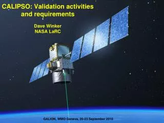
Climate Quality Observations from Satellite Lidar Dave Winker, NASA LaRC, Hampton, VA. 28 April ‘06. Initial Thoughts. Propose that lidar can provide climate-quality measurements with extremely good stability and sufficient accuracy Two ways to look at lidar and climate data records (CDRs):

E N D
Climate Quality Observations from Satellite Lidar Dave Winker, NASA LaRC, Hampton, VA 28 April ‘06
Initial Thoughts Propose that lidar can provide climate-quality measurements with extremely good stability and sufficient accuracy Two ways to look at lidar and climate data records (CDRs): • CDRs can be constructed from lidar (cloud, aerosol) measurements • Lidar measurements can be used to intercompare with CDRs derived from other instruments/systems or assess underlying assumptions of retrievals Lidar allows direct measurements of some parameters • Pre-launch characterization, but not calibration per se • ‘self-calibrating’ in a sense: avoids traditional calibration concerns
Primary Space Lidars for Earth, So Far Focus is on cloud and aerosol measurements Won’t discuss DIAL, Doppler, etc.
Climate Dataset Requirements: Clouds • To directly observe climate change, stable and accurate cloud measurements are necessary • The2002 Satellite Calibration Workshop defined cloud measurement requirements for climate datasets (NISTIR 7047; Ohring, et al., BAMS, 2005):
The response of low-cloud cover to CO2 doubling For DT ~ 0.2 K per decade, D(cloud cover) ~ 0.2 - 0.4%/decade One ‘IPCC’ climate model Change in low cloud amount w/ 2X CO2 Another ‘IPCC’ climate model The model-to-model spread is a measure of ‘uncertainty’ and it is thought to be largely governed by uncertain climate ‘feedbacks’ that all involve cloud processes. CMIP – year 70 mean of a 1% per year increase in CO2 minus the control (fixed CO2)
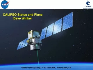
CALIPSO 705 km, sun-synchronous orbit Three co-aligned instruments: • CALIOP: polarization lidar • 532 nm || and ^, 1064 nm • 2 x 110 mJ @ 20 Hz • 1-meter telescope • 0 – 40 km altitude, 30 - 60 m • IIR: Imaging IR radiometer • WFC: Wide-Field Camera
CALIPSO Payload 1-meter receiver telescope CALIOP Lidar Transmitter/ boresight system
Cloud Detection/Height Cloud and aerosol layers identified by contrast with molecular background Sea surface establishes reference for height measurements Adaptive threshold: b’total (measured) b’air (from model)
CALIOP Layer Detection Sensitivity Clouds with t ≥ 0.01 could be climactically significant, should be monitored (assuming 300 m layer and Sc = 20)
Lidar vs. 95 GHz Radar for Cloud Detection • Lidar is sensitive to the thinnest clouds, easily detects water clouds • Cloud-profiling radar (CPR) is insensitive to small droplets and low concentrations of ice crystals Radar-lidar composite from CRYSTAL-FACE (26 July) blue: lidar-only, yellow: radar-only, green: both Lidar + CPR: best approach for cloud base:
2-l Improves Cloud-Aerosol Discrimination Separation of cloud and aerosol using c’ = b’1064/b’532 To a large degree, cloud and aerosol can be separated by scattering strength, but there are two problem areas: • There is a region of overlap in scatter strength where 2-l measurements are necessary. • Attenuation by upper layers will cause lower cloud layers to be classified as aerosol. c’ Integrated scatter
Detection of Multiple-layers Vertical distribution of highest cloud-top vs. all detected cloud tops (Tropics) LITE: 45% of cloudy returns reached surface 75% reach top of boundary layer (2 km) 80% mean cloud cover
Accuracy is driven by spatial sampling Example: cloud cover • Nadir-pointing lidar can achieve required accuracies at seasonal-zonal scales • Cross-track measurements would enable monitoring at regional scales Fowler et al., 2000: 4o x 5o, monthly RMS uncertainty in cloud cover for nadir-only observations
Cloud Ice/Water Phase • The threshold temperature dividing mixed-phase and ice clouds is not well known • Ice/water partitioning is an important modulator of the climate sensitivity in climate models • Direct, vertically resolved observations of ice/water phase are needed to address this issue (Fowler and Randall, 1996: J. Clim. 9, 561) Lidar can directly sense particle sphericity - Backscatter from liquid droplets retains the incident polarization - lidar depolarization = P^ /P|| - Backscatter from ice crystals is depolarized (typically 20-40%) Back- scatter Depol
Cloud optical depth • Radiative forcing is most sensitive to changes in thin clouds (t < 1), and clouds with optical depths as small as 0.01 need to be monitored • Lidar provides direct measurement of optical depth of ‘thin’ cirrus • Optical depth from layer transmittance (for t < ~3) • Corrections for multiple scattering may be required
HSRL: Direct measurement of AOD Climate requirement for aerosol optical depth (AOD): - Accuracy: 0.01 (~ 7%) - Stability: 0.005 (~ 3%) HSRL has molecular and Mie channels, providing direct measurement of aerosol attenuation
Instrument Requirements for Clouds The required measurements can be obtained from current (CALIPSO), planned (EarthCare) satellite lidars and suitably-designed follow-ons: • Vertical resolution: 30-150 meters • Two-wavelengths (for cloud/aerosol discrimination) • Depolarization (for ice/water phase) • Exact wavelengths and instrument sensitivity need not be the same
Mission Considerations • Sun-synchronous polar orbit preferred • Good latitude coverage • Provides sampling at constant local time of day • Precessing orbit • Biases the diurnal cycle into the record • Rapidly precessing orbits have low inclination angles: limited global coverage • Slowly precessing orbits • Precession through 24 hours in 1 year: preserves interannual variability but prevents monitoring changes on shorter timescales • Prefer to fly with other instruments • Provide acquisition of simultaneous, coincident CDRs • Allow intercomparison/cross-calibration • Due to inherently high stability of lidar measurements, overlap between instrument data records may not be required • Needs to be tested
Issues/Opportunities • How to relate lidar cloud cover to passive cloud cover • High lidar sensitivity gives higher cloud fraction than passive • How to relate lidar cloud top to passive cloud ‘top’ • Lidar profiles cloud to optical depth of 3-5 (the portion which interacts radiatively in the thermal IR) • Expand definition of ‘cloud height’ to include multilayer cloud height • Can we stitch together data records collected at different equator crossing times? • Poor spatial sampling of nadir-viewing lidar • Restricts climate-accuracy monitoring to large space-time scales • Scanning or multi-beam lidar provides improved statistics
Notional Multi-beam Concept • “Simple” backscatter lidar in formation with NPOESS or other platform • Accuracy improved by adding multi-beam lidar with cross-track coverage • For cloud monitoring, want independent samples • Widely spaced measurements are more efficient