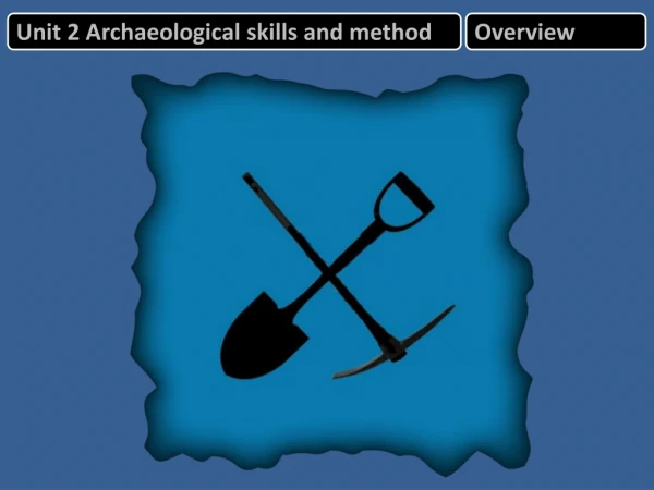
Unit 2 Archaeological skills and method
430 likes | 462 Views
Unit 2 Archaeological skills and method. Overview. Unit 2 Archaeological s kills and method. The e xam. 1 hour 45 minutes 9 0 marks Section A ( 60 minutes) Source response ( 6–8 questions ) (60 marks) Read introduction and source booklet answer all questions 1 minute per mark

Unit 2 Archaeological skills and method
E N D
Presentation Transcript
Unit 2 Archaeological skills and method The exam 1 hour 45 minutes 90 marks Section A (60 minutes) Source response (6–8 questions) (60 marks) Read introduction and source booklet answer all questions 1 minute per mark Section B (45 minutes) Chose one question from 3. Use lots of examples (including the sources and Unit 1 material)
Unit 2 Archaeological skills and methods Process [1] Reconnaissance [2] Excavation [3] Recording Formation Process [4] Analysis [5] Dating
Site formation processes Artefacts Humanly made or modified portable objects, such as stone tools, pottery and metal weapons. Features Humanly modified components of a site or landscape, such as hearths, postholes, and storage pits - non-portable artefacts. Ecofacts Ecofacts are non-artefactualorganic and environmental remains. These include human skeletons, animal bones and plant remains, and also soils and sediments. Archaeological sites Places where artefacts, features, structures, and organic and environmental remains are found together. Places where significant traces of human activity are identified.
The importance of context Immediate matrix Material surrounding it, usually some sort of sediment such as gravel, sand, or clay Provenience Horizontal and vertical position within the matrix Association Occurrence together with other archaeological remains, usually in the same matrix Primary context The original position of an artefact or feature before any human or natural disturbance Secondary context When an artefact or feature is taken out of its original position
Formation processes Cultural processes The formation process is the way in which finds came to be buried and what happened to them after they were buried. Q: Make a list of the different ways an artefact may come to be in the archaeological record and then what might happen to it after burial. Use these images to explain the importance of the formation process.
Formation processes Cultural processes 1 3 Bifacial point in haft Hammerstone Waste Acquisition Use 4 2 Broken bifacial point Finished bifacial point Waste Disposal Manufacture
Formation processes Natural processes Natural formation processes such as river action can disturb or destroy the primary context of archaeological material. Here we will focus on that material itself, and the natural processes that cause decay. Inorganic materials The most common inorganic materials to survive archaeologically are stone, clay and metals. Organic materials Survival of organic materials is determined largely by the matrix (the surrounding material) and by climate (local and regional). Occasional influence of natural disasters such as volcanic eruptions. The matrix and climate can determine the survival of organic materials. • Extreme conditions • Waterlogged environments • Dry environments • Cold environments
[1] Reconnaissance (A) Desktop survey Sites and Monuments Record (SMRs) or the National Monuments Record (NMR) offices. Historic Environment Records (HERs), including information on historic buildings and designed landscapes. Historical documents: Known documents are archived or recorded in the County Records Office. Sources have also been catalogued in a volume of the Victoria County History (VCR). Legal documents:Records of ownership such as Anglo-Saxon charters or court records, wills and inventories which can be linked to particular buildings may provide lists of contents. Tax records:These are particularly valuable in helping to identify landowning units and their economic uses. Economic records:Order and sales books, estate agents’ bills. Pictorial records:Paintings, engravings and photographs Written accounts:Descriptions of places in books, diaries and travelogues.
[1] Reconnaissance (A) Desktop survey • Archaeological records: • Early excavation or survey results • Local collections of finds and reports • Details of previous archaeological work and stray finds for much of Britain are held in local SMRs. • Oral accounts:Farmers may be able to identify areas where building rubble has been ploughed up or where dressed stones have been removed. • Maps: Particular value in tracking changes through time (settlement shape and location, boundaries, land units, fields and hedges. • Early maps • Ordnance Survey (OS) maps • From the 1880s – by examining a succession of maps for any area, changes in land use and the built environment can be easily seen. • Maps used in archaeological • A 1:2500 map allows you to identify individual metre squares with a grid reference. These maps are held in county or district planning offices.
[1] Reconnaissance (B) Surface survey • Non-destructive visual surveys at ground level • Recording standing buildings • Detailed studies of the material and construction techniques of • Laser scanning is used in some buildings which are covered with lichen to see how they are constructed. • Written description, CAD (computer-aided design) based recording of every brick or stone. • Example: Defence of Britain project, which collected records on surviving defensive monuments of the Second World War.
[1] Reconnaissance (B) Surface survey – fieldwalking Fieldwalking, or surface collection, involves systematic collection of artefacts from the ploughed soil. Density scatters of particular materials such as building rubble or broken pottery enable specific sitesto be identified. Ceramics and worked stone are the most commonly gathered but metal, bone and burnt stone are often also collected. Sampling Not everything will be collected, particularly when building rubble is involved. For instance, will all ceramics be collected or just diagnostic pieces? Decisions also have to be taken about the width of transects or size of grids. Timing Ideally ploughed soil should have been broken down by weathering and recent rain will have cleared dust from the surface. Walkers either proceed along a transect in a series of stints or search a grid. Grids tend to be used when total coverage of a field is required. The material collected is bagged and tagged with the number of the grid or stint for processing and analysis.
[1] Reconnaissance (B) Surface survey – fieldwalking • Processing • Once washed and identified, finds are counted for each grid or stint. • Plotted on a distribution map to show patterns and concentrations. Computer displays using GIS geographic information system. • Key strengths • Relatively cheap way of surveying large areas. • Helps establish the function and period and provide insights into location and exchange. • Can indicate the spread and foci (centre point) of evidence. • Limitations • Only really useful on arable land at certain times in the agricultural cycle. • Medieval manuring practices transferred much domestic refuse to the plough-soil. • Different materials behave differently in the same soil. Some material migrates further than others. Not always a good indication of settlement. • Differential collection by different fieldwalkers.
[1] Reconnaissance (B) Surface survey – other methods Shovel pit testing can take place in woods, pasture and gardens where fieldwalking is impossible. Coring and augeringare also used to sample the subsoil. This can provide a snapshot of stratigraphy and the sample can be examined for artefactual or environmental evidence. Probing, which involves driving a rod into the ground, is more useful for tracing shallow buried features such as walls on known sites.
[1] Reconnaissance (C) Geophysical and geochemical Geochemical surveys: detect human activity by chemical changes in the soil (organic phosphate) Geophysical surveys: detect features through physical differences in the soil Resistivity surveys: electric current passed through the ground to detect features Magnetometer surveys: detect changes to the magnetic field – indicating human activity Caesium vapour magnetometer surveys: pumps caesium vapour (sensitive to magnetic variations) Metal detector – useful for detecting metal objects to about 15cm Ground penetrating radar (GPR): sends a pulse of energy and records the length of time taken and strength of return signal Sonar: acoustic sensing – useful for detecting underwater features
[1] Reconnaissance Geochemical survey Used to locate areas of past human activity by detecting differences in the chemical properties of the soil. All living things produce organic phosphate as waste or through decay. Samples of soil are tested for levels of phosphate measured. Concentrations of organic phosphate may indicate settlements or animal enclosures.
[1] Reconnaissance Geophysical surveys Detect features through their physical differences with the surrounding soil. Most common techniques detect magnetic and electrical anomalies. Shift in emphasis among archaeologists in favour of preservation rather than excavation, these techniques are now commonplace. The manufacture of increasingly reliable instruments for archaeology has seen magnetometry become a standard technique.
[1] Reconnaissance Resistivity surveying • Differences in the ability of different soils to conduct electricity. • Detected by passing an electric current through the ground and comparing readings. • More moisture = better conductivity. A buried ditch or grave will generally retain water better than the surrounding soil. • A buried wall or road will conduct poorly and therefore resist the current more than the surrounding soil. • Clay retains moisture well, so differences in resistance between the soil and buried ditches or pits may be impossible to detect. • Applies to many soils if they become waterlogged in wintertime. • Plants, rocks and variations in the depths of soils can also create misleading readings. Geophysical surveys
[1] Reconnaissance Magnetometer surveying The earth’s magnetic field is generally uniform in any one place. However, local magnetic distortions can be caused by past human activity. Topsoil contains iron oxide. In some forms its crystals are magnetic. A ditch which has filled up with topsoil will contain more iron oxide than the surrounding area. Its fill will therefore be slightly different magnetically and may be detected by sensitive, modern magnetometers. A second type of distortion is caused where topsoil has been subject to considerable heat. This erases the magnetic properties of the iron oxides. When the soil cools the iron oxides become permanently magnetised. Since this field changes over time the sites of kilns and hearths appear as magnetic anomalies. Geophysical surveys
[1] Reconnaissance Magnetometer surveying To be able to detect anomalies, the magnetic background of the soil has to be measured and magnetometers calibrated against it. The measuring of this magnetic susceptibility of the topsoil can also be used as a crude but rapid survey technique in its own right. Magnetic hotspots suggest areas of past settlement or industrial activity, which could be surveyed using other methods. Sensitive magnetic instruments are easily disturbed by iron, including nails, pipes and wire fences as well as the zips and piercings of the archaeologist. A further limitation can be background interference from magnetic bedrock or where a long period of occupation has left a magnetic layer over a wide area. Sandy and clay soils often do not provide sufficient contrast. Fluctuations in the earth’s magnetic field also have to be taken into account. It requires considerable skill and experience to interpret the results. Geophysical surveys
[1] Reconnaissance Magnetometer surveying Caesium vapour (CV) magnetometers Many times more sensitive than conventional magnetometers and more commonly used in Germany and Austria. Typically several machines are used close together on a large wooden handcart. They work by pumping caesium vapour and taking rapid measurements at around 25cm intervals. This alkali is so sensitive to minute variations in magnetism that it can detect and define the edges of buried features formed by traces of magnetite. This iron oxide (Fe3O4) is concentrated in the remains of the bacteria which consumed the wooden structures such as posts which once stood there. At £40,000 per machine and perhaps four machines on a cart, this technique is expensive. Geophysical surveys
[1] Reconnaissance Metal detectors Useful for metal objects down to about 15cm. Provide information in advance of digging such as the position of burial deposits. Skill is required to avoid time being wasted exploring buried slag or modern metal debris. Geophysical surveys Similarly they can sweep areas in advance of detailed geophysics to identify concentrations of metal that might distort readings.
[1] Reconnaissance Ground penetrating radar (GPR) Aerial versions can highlight buried landscapes and rivers. GPR works by transmitting pulses of energy into the ground and recording the time taken and strength of the return signal. This can indicate the density and depth of buried deposits. Data based on different energy wavelengths can be plotted as a series of ‘time slices’ to build up a 3D picture of buried remains. Geophysical surveys
[1] Reconnaissance Dowsing This is a traditional method by which skilled dowsers use wooden rods to detect water or archaeology underground. None of these methods are particularly useful on waterlogged sites. Their value is often in pinpointing or exploring features rather than finding new sites. Geophysical surveys
[1] Reconnaissance Sonar A form of acoustic sensing. Side-scan sonar measures sound waves as they ‘bounce back’ and can map the seabed and reveal the depth and form of sunken structures. Geophysical surveys Bosing is a crude form of acoustic sensing used on land. It involves hitting the ground with a mallet and listening for variations in resonant sounds. These may indicate buried ditches or walls.
[1] Reconnaissance Site survey • EDM • Pointed at objects to measure distances • Ensures accurate scaling in groups • TST • Reads distance, level, latitude and longitude • All in one, but expensive • GPS • Satellite locator • Gives precise grid references and location • Clinometer • Measures the angle of a slope • Used in tandem with tape measure and ranging poles
[1] Reconnaissance Site survey • Tape measure • Fine measurement • Distance between certain objects • Dumpy level • Establishes or checks points are on the same horizontal plane • Uses spirit level and telescope • Ranging poles • Measure the height of an object • Used in tandem as markers for clinometer
[1] Reconnaissance (D)Aerial survey • Vertical aerial photography • Oblique aerial photography • Satellite imaging • Airborne Lidar(light detection and ranging) Main features identified • Cropmark sites • Soil mark sites • Shadow sites
[1] Reconnaissance Verticals What are aerial photographs used for? Show traces from features such as Roman roads, lost settlements, forts, villas, canals and old river beds, earthworks. What are verticals? Camera pointing straight down at the ground (verticals) with the aircraft flying along grid lines. Usually high altitude. Where would you find RAF archive photographs? Housed at the NMR centre at Swindon (400,00 obliques / 2.4 million verticals). Types of aerial survey
[1] Reconnaissance Verticals • What is the main value of vertical aerial photographs? • Main value is in planning and illustrating sites – especially where dimensions are known including their contours • Stereoscopy can provide a 3D effect • Photogrammetric mapping • What limitations do verticals have? • Often taken from high altitude not as clear view as obliques • Not usually taken for specific purpose of archaeology reconnaissance • Difficult to measure contours Types of aerial survey
[1] Reconnaissance Obliques • What are oblique photographs? • Taken of points of interest from a high angle to reveal contours and shadows • Taken from low-flying aircraft with the picture taken at an angle to the ground • Outline the main strengths and limitations of using oblique photographs • Most widely used in archaeology to locate sites and illustrate features • Gives good coverage • Can help give a 3D image • Difficult to use for mapping • Can reveal features invisible from the ground – but can miss features if their signatures are not visible from the air Types of aerial survey
[1] Reconnaissance Obliques Oblique air photograph of the deserted medieval village at Goxhill, Humberside. Note the medieval ridge and furrow ploughed field at the top, the hollow ways and the deserted building platforms. The features have survived because the area was used for pasture and never ploughed. Once ploughed all this would have disappeared.
[1] Reconnaissance Shadow sites • When is the best time to photograph shadow sites? • In low sun early or late in the day – sites can spring to life • Shadows will be cast at right angles to the sun’s rays • Different time of the year can reveal different features – winter often the best (low sun and short vegetation) • A dusting of snow can also enhance site features • What can shadow sites illustrate? • Shadow sites usually the most visible archaeological feature • Can also be seen on the ground • Any site with lumps or bumps will cast shadows • Best used for illustrating existing sites and locating details within them
[1] Reconnaissance Identifiable features – cropmarks • Cropmark sites some of the best indicators of buried features • Variation in height of crop, colour and vigour of growth can help find features • Cropmarks will change throughout the growing seasons • How are cropmarksformed? Use a diagram to illustrate your ideas • Positive crop marks • In damp soil (buried ditch or pit) vegetation will be more vigorous – this appears darker from the air • Negative crop marks • Over a buried building or wall – thinner and shorter vegetation • What are parch marks? • Where the sun burns grass on buried walls
[1] Reconnaissance Identifiable features – cropmarks • What factors may limit the usefulness of cropmarks? • Cropmarks may only show for a few days a year. • Some only show up in drought conditions. • They don’t show up on clay or areas of deeper topsoil. • They do not show up as well in some crops, for example beans. • Geological features such as periglacial cracks / modern • field drainage and underground pipelines also create • crop-marks. • Best time to take them in corn and wheat is when • they turn from green to yellow.
[1] Reconnaissance Identifiable features – cropmarks These drawings show how an Iron Age ditch, forgotten and filled in by time and weather, becomes a buried archaeological feature revealed by crops growing greener and taller. Part of a double ditch of the Roman frontier, the very edge of the empire in Germany. Visible as a cropmark.
[1] Reconnaissance Identifiable features – soil marks What are soil marks? Evidence of ploughed-out monuments can occur as soil marks. On chalk, the dark brown of ditch infill will contrast with the chalk rubble of a bank and the lighter brown of the plough soil. At Flag Fen, a Roman road appeared as an orangey stripe against the black peat soil. Soil marks are sharpest in winter when vegetation is low. They are at their clearest immediately after ploughing. Frost sometimes melts more slowly on buried stone. After rain, buried walls will retain moisture longer.
[1] Reconnaissance Satellite Satellites currently active which operate at a resolution that may be suitable for archaeological research. These include IKONOS, Quickbird, WorldView, GeoEye. Online tools such as Google Earth and Bing Maps are providing imagery to a wider audience. Types of aerial survey
[1] Reconnaissance Airborne Lidar • Use of Lidar (light detection and ranging) • Uses an aircraft, whose exact position is known (GPS) • Laser scanner rapidly pulses beams to the ground • A digital surface model is created Types of aerial survey • Tree canopies can be eliminated • Can be used under conditions that are less than optimum
Exam questions Study Figure 1 and use your own knowledge. Explain why the Roman road can be seen between the arrows. (8 marks) This was a familiar topic, although the presence of a negative crop mark was not. Most students were able to produce at least a level two answer and the best answers focussed on the negative crop mark and how it was formed, rather than giving untargeted generic accounts of why crop marks appear per se. Some students discussed all three types, often in detail, but did not use the clues in the source to work out which type of mark was actually relevant and therefore could only produce a generic answer. Very few students were able to use the source explicitly. As with last year, a number of students misidentified crop marks as either soil marks or earthworks and limited their marks to level two. Figure 1: Aerial photograph showing the Roman road (between the arrows) between Pumsaintand Llandovery
Exam questions Study Figure 1 and use your own knowledge Explain why the Roman road can be seen between the arrows. (8 marks) (Target AO1 8; AO2 0) L1: Generic response on aerial photography. If correct type also identified give 2. 1–2 L2: Generic explanation of crop marks or sound explanation of shadow sites or soil marks. (Limited generic explanation with passing reference to source = 4 marks.) 3–4 L3: Sound explanation of crop marks with reference to the source. 5–6 L4: Sound explanation of cropmarkswith explicit reference to the source. (Must mention negative crop marks for 8 marks.) 7–8
Exam questions This was a familiar topic, although the presence of a negative cropmarkwas not. Most students were able to produce at least a level two answer and the best answers focused on the negative cropmarkand how it was formed, rather than giving untargeted generic accounts of why cropmarks appear. Some students discussed all three types, often in detail, but did not use the clues in the source to work out which type of mark was actually relevant and therefore could only produce a generic answer. Very few students were able to use the source explicitly.A number of students misidentifiedcropmarksas either soil marks or earthworks and limited their marks to level two.