Maintenance, Review, and Update of the U.S. National Standard for the Classification of Wetlands
180 likes | 210 Views
This proposal outlines the scope and objectives for the maintenance and review of the U.S. National Standard for the Classification of Wetlands. The proposal explains that there will be no changes to the definition of wetlands or regulatory jurisdiction, and no changes to the hierarchical structure of the classification system.

Maintenance, Review, and Update of the U.S. National Standard for the Classification of Wetlands
E N D
Presentation Transcript
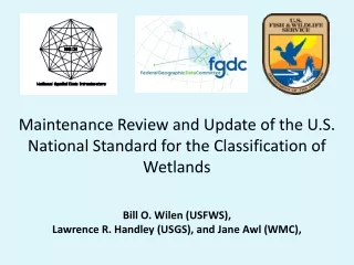
Maintenance Review and Update of the U.S. National Standard for the Classification of WetlandsBill O. Wilen(USFWS), Lawrence R. Handley (USGS), and Jane Awl (WMC),
FGDC–STD-004-1996 Second Edition 2013 DRAFT Classification of Wetlands and Deepwater Habitats of the United States Adapted from Cowardin, Carter, Golet, LaRoe 1979 Wetlands Subcommittee Federal Geographic Data Committee
Status of the NSDI Wetlands Layer USFWS Wetlands Geodatabase contains over 35,600 7.5-minute map areas in a seamless ArcSDEgeodatabase. • As of October of 2012: • 81% of the conterminous U.S. • 34% of Alaska • 100% of the windward islands of Hawaii • 76% of Puerto Rico and the U.S. Virgin Islands • 100% of Guam and Saipan in the Pacific Trust Territories http://www.fws.gov/wetlands/Layer/Status-Information.html
What are the FGDC National Standards for Wetlands? Wetlands Classification Standard (WCS) Classification of Wetlands and Deepwater Habitats of the United States (Cowardin et al, 1979) endorsed by FGDC in 1996 http://www.fgdc.gov/standards/projects/FGDC-standards-projects/wetlands/index_html Wetlands Mapping Standard (WMS) endorsed by FGDC in 2009 (FGDC-STD-015-2009) http://www.fgdc.gov/standards/projects/FGDC-standards-projects/wetlands-mapping/2009-08%20FGDC%20Wetlands%20Mapping%20Standard_final.pdf
Related FGDC Standards: • Wetlands Mapping Standard, FGDC-STD-015-2009 http://www.fws.gov/wetlands/_documents/gNSDI/FGDCWetlandsMappingStandard.pdf • Coastal and Marine Ecological Classification Standard (CMECS) http://www.fgdc.gov/standards/projects/FGDC-standards-projects/cmecs-folder • Soil Geographic Data Standard, FGDC-STD-006-1997 • National Vegetation Classification Standard (Version 2), FGDC-STD-005-2008 • Information Technology—Geographic Information Framework Data Content Standard, Part 5: Governmental unit and other geographic area boundaries, http://www.fgdc.gov/standards/projects/FGDC-standards-projects/framework-data-standard/GI_FrameworkDataStandard_Part5_GovernmentalUnitBoundaries.pdf
Other Related Practices: • A System for Mapping Riparian Areas in the Western United States (Dick 2009),http://www.fws.gov/wetlands/_documents/gOther/SystemMappingRiparianAreasWesternUS2009.pdf. See further documentation on riparian area standards at http://www.fws.gov/stand/standards/dl_riparian_WWW.html • Primary Indicators Method. Tiner, R. W. 1993. The primary indicators method—a practicalapproach to wetland recognition and delineation in the United States.Wetlands 13(1): 50-64. (This method is typically used for verifying Service Wetland Database wetlands on the ground),http://www.fws.gov/wetlands/_documents/gOther/PrimaryIndicatorsMethod.pdf • National Hydrography Dataset (NHD) maintained by the USGS at http://nhd.usgs.gov/ • Canadian Wetland Inventory maintained by Agriculture and Agri-Food Canada (AAFC) at http://www.cwi-icth.ca/ • RAMSAR Classification for Wetland Type maintained by Convention on Wetlands (Ramsar, Iran, 1971) at http://www.ramsar.org/ris/key_ris_types.htm • Guidance for Benthic Habitat Mapping: An Aerial Photographic Approach maintained by the U.S. NOAA Coastal Services Center. Available for download at http://www.csc.noaa.gov/benthic/mapping/pdf/bhmguide.pdf • Comer, P., D. Faber-Langendoen, R. Evans, S. Gawler, C. Josse, G. Kittel, S. Menard, M. Pyne, M. Reid, K. Schulz, K. Snow, and J. Teague. 2003. Ecological Systems of the United States: A Working Classification of U.S. Terrestrial Systems. NatureServe, Arlington, Virginia, http://www.natureserve.org/library/usEcologicalsystems.pdf
WCS Working Group 1,2,3 1 Core Members: • Ralph Tiner, FWS • Elaine Blok, FWS • Bill Wilen, FWS, NWI • Frank Golet, Retired • Jo Ann Mills, FWS • Ky Ostergaard, INDUS Corp • Pamela Blasdell, INDUS Corp • Jane Awl, WMC • Margarete Heber, EPA • Larry Handley, USGS • Rebecca Allee, NOAA • Marti McGuire, NOAA • Myra Price, EPA • Jon Soderberg, COE • Jeanne Christie, ASWM • Robb Macleod, Ducks Unlimited* • Tom Dahl, FWS • Dawn Browne, Ducks Unlimited 2 Over 20 additional Reviewing Members received WCS Working Group emails and conference call invitations. 3 A Review Copy of the Working Draft was sent to over 1000 Stakeholders in 2012.
Key Participating Organizations(Partial List) U.S. Fish and Wildlife Service (USFWS) U.S. Geological Survey (USGS) National Oceanic Atmospheric Agency (NOAA) Environmental Protection Agency (EPA) Army Corp of Engineers (COE) Association of State Wetland Managers (ASWM) Wetland Mapping Consortium (WMC) Ducks Unlimited Inc. (DU)
Proposal for the Maintenance and Review of the National Wetland Classification Standard (WCS) • Scope: • There will be no changes to the definition of wetlands or regulatory jurisdiction. • There will not be any changes in the hierarchical structure of the classification system nor changes to the top three levels of the hierarchy including System, Subsystem, and Class.This means that there will not be any changes in the categories of wetlands that have been used to produce in the four reports to Congress of the status and trends in the conterminous United States. This continuity will also provide wetlands categories that have been monitored for 60 years to EPA’s National Wetland Condition Assessment.
Actions 2010 • Core Working Group members were initially drawn from the Wetland Mapping Standard Working Group. • Proposal for the Maintenance and Review of the National Wetland Classification Standard (Objective, Scope and Timeline) developed and submitted to FGDC (approved in February 2010) http://www.fgdc.gov/standards/projects/FGDC-standards-projects/maintenance-review-wetlands-classification-std/Public-version-of-classification-maintenance.doc/view • Invitations for Reviewing Members of Working Group announced beginning in March 2010. • WCS Working Group Conference Calls were held in 2010-2012. • Reformatting of wetland classification standard document to be consistent with more recently endorsed standards. • Development of Wetland Classification Image Gallery to update the reference image collection (and replace the original collection of black and white plates). www.wetlandgallery.cnlworld.org • Initiated coordination on the related standard Draft Coastal and Marine Ecological Classification Standard (CMECS) http://www.fgdc.gov/standards/projects/FGDC-standards-projects/cmecs-folder/cmecs-index-page
Actions 2011 - 2012 • WCS Working Group Conference Calls continued in 2011-2012, focusing on technical issues and documentation. • Work continued to expand the Wetland Classification Image Gallery to update the reference image collection (and replace the original collection of black and white plates). www.wetlandgallery.cnlworld.org. A new gateway website (Calling All Wetlands) was added to provide for streamlined image submission (especially for school groups and other volunteers). http://callingallwetlands.cnlworld.org/index.html • Continued coordination on the related standard Draft Coastal and Marine Ecological Classification Standard (CMECS) in 2011 and 2012. http://www.fgdc.gov/standards/projects/FGDC-standards-projects/cmecs-folder/cmecs-index-page • Review and revision of document by original author Frank C. Golet. • Additional Reviewers were added in 2012. • Working Draft—Classification of Wetlands and Deepwater Habitats of the United States was sent to over 1000 reviewers in February 2012. • Continued revision of Working Draft based on comments received and original author input.
Outreach • State/Tribal/Federal Wetland Coordination Meeting, March 2010 (Wilen, Awl) • National Wetlands Monitoring and Assessment Work Group (NWMAWG) meeting, December 2010 (Awl) • Society of Wetland Scientists (SWS), June-July 2010 (Awl, Wilen) • National Wetlands Newsletter, September-October 2010 (Awl, Wilen, Allee, Handley, Heber, Blasdell, Galbraith, Lang) • Society of Wetland Scientists (SWS) SAC/MAC joint regional meeting, March 2011 (Awl) • State/Tribal/Federal Wetland Coordination Meeting, March 2011 (Awl) • American Society for Photogrammetry and Remote Sensing (ASPRS), May 2011 (Handley) • Coastal Zone Conference, June 2011 (Handley) • Coastal and Estuarine Research Federation (CERF), November 2011 (Handley) • Wetland Mapping Consortium (WMC) Webinar, January 2012 (Wilen, Awl) • State/Tribal/Federal Wetland Coordination Meeting March 2012 (Wilen) • International Association for Ecology (INTECOL)/Society of Wetland Scientists (SWS), June 2012 (Awl, Wilen, Handley, et al)
National Wetlands NewsletterSeptember-October 2010, (32:5) pages 10-17 and 36-37
Revised Wetlands Classification Standard • Wetland/Deepwater boundary • Growing Season • Geospatial Seam • Nontidal Water Regimes • Tidal Water Regimes (to brighten the line) • .
Proposed Update to Reference Images Wetland Image Gallery The Wetland Image Gallery is a compilation of wetland images and corresponding information for the FGDC maintenance review of the current Wetland Classification Standard. The gallery provides an image framework for the classification of various possible wetland and deepwater habitats. The intent is to support, update, and add new images as examples to complement the classification scheme within the Classification of Wetlands and Deepwater Habitats of the United States. http://www.wetlandgallery.cnlworld.org
WCS Training & Collaboration • U.S. Fish and Wildlife Service (USFWS) Wetland Mapping Training http://www.fws.gov/habitatconservation/nwi/wetlands_mapping_training/index.html • Association of State Wetland Managers (ASWM) http://aswm.org/ • Wetland Mapping Consortium (WMC) http://clic.cses.vt.edu/WMC/
Main Page of the Wetland Classification Image Gallery