Download

1 / 58
580 likes | 727 Views
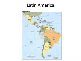
Latin America spans roughly 8 million square miles, covering regions from the U.S.-Mexico border to Argentina's southern tip. Known for its Spanish and Portuguese linguistic heritage, this vast area is divided into Middle America, the Caribbean, and South America. The topography features rugged mountains, such as the Andes, and broad plateaus like Brazil's Highlands. Moreover, Latin America is rich in natural resources, including oil, minerals, and agricultural lands. The region's climate varies significantly, encompassing tropical rainforests, savannas, and arid deserts.

E N D
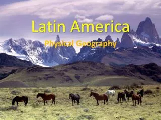
Latin America Unit Three Chapter Eight
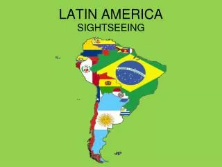
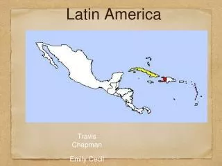
1.Colombia 20.Belize 2.Honduras 21.Haiti 3.Costa Rica 22.Dominican 4.Brazil Republic 5.Suriname 23. Uruguay 6.Peru 24. French Guiana 7.Guatemala 25. Guyana 8.Mexico 26. Puerto Rico 9.Paraguay 27. Bahamas 10.El Salvador 11.Cuba 12. Argentina 13.Nicaragua 14.Venezuela 15.Ecuador 16.Bolivia 17.Jamaica 18.Panama 19.Chile
A Vast Region • Latin America covers 8 million square miles, from the United States-Mexico border to the southern tip of Argentina in South America. • “Latin America” refers to the languages (Spanish and Portuguese, derived from Latin) spoken in this geographic region. • Geographers divide L.A. into 3 regions: Middle America, the Caribbean, and South America.
Mountains and Plateaus • Rugged landscape is result of location on the Pacific Ring of Fire. • Mexico’s Sierra Madre and the Central Highlands in Central America rise above the landscape of Middle America. • Caribbean islands are part of the Central Highlands mountain range.
Mountains and Plateaus • Andes Mountain ranges run along the western edge of South America, and are the world’s longest mountain range (4,500 miles). • Southern Argentina includes a combination of hills and lower flatlands that form a plateau, known as Patagonia. -Brazil consists of broad plateaus, such as the Mata Grosso Plateau and the Brazilian Highlands.
Lowlands and Plains, Water Systems • Narrow coastal lowlands surround the Gulf of Mexico, Caribbean Sea, and the Atlantic and Pacific coasts of South America. • Inland areas of South America hold vast grasslands that provide wide grazing for beef cattle. • These areas also support tropical crops, such as bananas; plains areas favor ranching and the growing of grains such as corn and wheat.
Water Systems • Amazon River- serves as main transportation route, and provides hydroelectric power. • Lake Titicaca in the Andes of Bolivia in Peru is the world’s highest navigable lake. • http://news.mongabay.com/2006/0317-reuters.html
Natural Resources • Significant natural resources include minerals, forests, farmlands, and water. • Major deposits of oil and natural gas are found along the Gulf of Mexico and southern Caribbean Sea. • Mexico and Venezuela are leading petroleum producers. • Venezuela’s Orinoco River area contains 11 % of the world’s gold. • Brazil is also rich in gold, and Peru and Mexico are known for their silver deposits.
Natural Resources • Chile is the world’sleading exporter of copper. • Geographic inaccessibility, lack of capital, and social and political divisions hinder fuller development and distribution of natural resources in Latin America.
Climate and Vegetation Regions Most of Latin America lies between Tropic of Cancer and the Tropic of Capricorn; thus, much of its area has a tropical climate. However, there is a great variety of climates in the region. 1. Tropical Regions- Mexico, eastern central America, some Caribbean islands, and such parts of South America as the Amazon Basin have a tropical rain forest climate and vegetation, with hot temperatures and abundant rainfall occurring year-round.
Climate and Vegetation Regions 2. The Rain Forest- Amazon Basin, Earth’s largest rain forest, covers one-third of South America and has trees that form a dense canopy that soars as high as 130 Ft. over the forest floor. 3. Tropical Savanna- coast of southwestern Mexico, most Caribbean islands, and north-central South America, the grasslands have hot temperatures, abundant rainfall, and a dry season lasting several months.
Climate and Vegetation 4. Humid Subtropics- southeastern South America, with short and mild winters, long, hot, and humid summers. 5. Desert and Steppe Areas- parts of Northern Mexico and the southwestern climate of South America have desert climates and vegetation; in Chile the rain shadow effect of the Andes has produced the dry, arid Atacama Desert, whereas other areas have a steppe climate, with hot summers, cool winters, and light rainfall.
http://www.photos4travel.com/travel-guides/chile/pictures/atacama-desert-poolhttp://www.photos4travel.com/travel-guides/chile/pictures/atacama-desert-pool