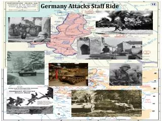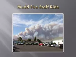

Mudd Fire Staff Ride
E N D
Presentation Transcript
Leader’s Intent • Through a PowerPoint presentation participants will have a broad understanding of the Nevada fire situation during August, 2006 thereby beginning the process of gaining Situational Awareness to be used in development of an evolving Risk Analysis process.
WELCOMETO AN INTERACTIVE LEARNING EXPERIENCE Introduction: The Mudd fire started on August 23, 2006 at approximately 14:59 PST. Interagency suppression forces were dispatched to the reported fire, 10 miles North of Elko, NV along State Route 225. Rapid fire growth and rugged topography dictated the need for several access routes into the emerging incident. With ground resources rendezvousing at different points around the fire, coordination of suppression tactics became increasingly difficult. The conditions and events that occurred during the Initial Attack phase of the Mudd Fire would, in the end, lead to a fire entrapment situation. What do I need to bring with me? Student Workbook IRPG Writing Utensil Water Backpack Hiking Boots GPS Unit Course Map Radio or Mobile Phone 4WD Vehicle Positive Attitude!
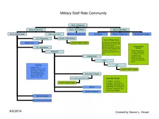
Stand #3 Stand #1 Stand #2 Elko via 5th Street
Elko “Sno-Bowl” Highway 225 Stand #1 Parking
Stand #3 Elko “Sno-Bowl” Stand #2 Parking
Imagine you were there! * Note any pertinent details relevant to your improved Situational Awareness. * Identify possible hazards and think of ways to mitigate these hazards. * Continually update your complexity analysis as new information is gathered.
Nevada Fire Situation • In June, spring rains ended. The jet stream retreated north and a ridge of high pressure took its place. Nevada had what the National Weather Service called a “heat wave”, with Reno setting a record of 102 degrees on June 25th. The ridge persisted through July with well above normal temperatures creating a very unstable atmosphere…and consequently numerous occasions of lightning. Unusually high temperatures and several lightning outbreaks combined for over a million burned acres by the end of the season. (Western Great Basin 2006 Season Summary) • After 5 straight years of drought (winter 1998- summer 2004), Nevada had two years of exceptionally wet winters: 2004-2005 and 2005-2006. As a result, the U.S. Drought Monitor showed virtually all of Nevada out of drought classification for the entire 2006 fire season. (Western Great Basin 2006 Season Summary)
Nevada Fire Situation • The Western Great Basin (WGB) set a new wildland fire record in 2006. 135 large fires were reported, 2.5 times the 10 year average of 54, surpassing the previous record of 113 large fires set in 1999. 20 of those large fires were over 10,000 acres each. Initial attack efforts were successful about 91% of the time factoring in the number of large fires that were contained within 24 hours. The five year average for IA efficiency is 95% based on number of large (>300 acres) compared to total number of fires. (Western Great Basin 2006 Season Summary) • The total of 1,348,871 acres burned in the WGB represented 13% of the total acres burned nationally, second only to the Southern Area which accounted for 26% of all acres burned. Those acres burned are historically second in number for the WGB only to the 1.6M+ acres that burned in 1999*. (Western Great Basin 2006 Season Summary) • *Recall the Sadler Fire in 1999
Northeast Nevada Fire Situation • Elko County took the brunt of the fire season with 235 fires (19% of the state’s fires) and nearly 1,000,000 acres burned (68% of the state’s acres and 10% of the national total). (Western Great Basin 2006 Season Summary)
Fire Behavior Fire Behavior Forecast for the East Humboldt Complex for 8/23/2006. (37 miles to the ESE) 1 Hour Fuels = 2% 10 Hour Fuels = 3% 100 Hour Fuels = 5%
Sagebrush - Live Fuel Moisture @ 88%(Adobe Creek) 75%-100% - Fires will exhibit EXTREME FIRE BEHAVIOR. Extreme rates of spread and moderate to long range spotting will occur. Engines and dozers may be best used to back up firing operations, and to protect structures. Indirect attack must be used to control these fires. Fires will burn actively through the night. Air turbulence caused by the fire will cause problems for air operations.
Fire WX Forecast RED FLAG WARNING FOR GUSTY WINDS AND LOW RH TEMPERATURES 84 – 94 HUMIDITY 6 – 11% WINDS 15 – 20 GUSTS 35 – 45 HAINES - 6