Download
1 / 16
160 likes | 302 Views
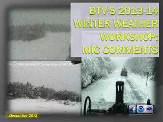
Severe Weather Program @ BTV MIC Comments v. 2013. BTV Severe Weather Workshop May 2, 2013. 30 minutes – Moving NE @ 18kts – 344 km 2. 60 min – Moving E @ 41kt – 9683 km 2. 2013 Goals/Expectations. Get more experience with Dual-Pol in the warning process

E N D
Severe Weather Program @ BTV MIC Commentsv. 2013 BTV Severe Weather Workshop May 2, 2013
2013 Goals/Expectations • Get more experience with Dual-Pol in the warning process • See great potential for narrowing down location of hail cores for warnings, SVSs and SPSs • Evaluate Precip Estimates
2013 Goals/ExpectationsNo Big Changes From Previous Years • Warn based on the meteorology and expected impact • Never assume any place is totally uninhabited, they are just harder to get reports from • Include reports in SVSs
2013 Goals/ExpectationsNo Big Changes From Previous Years • Be proactive in advertising potential big severe weather days • NWSChat, EM notifications, Web Headlines, Social Media • Meet/Exceed GPRA • Tornado • detection/warning remains tough • 3 year average: • POD 0.25 FAR 0.92 Lead Time: 3 minutes 4 events • Need to really learn from each case • Flash Flooding • 3 year average • POD 0.79FAR 0.39 Lead Time: 64 minutes • Keep in mind hydro concerns are watched during severe outbreaks – may take 3 eyes on radar
2013 Goals/ExpectationsNo Big Changes From Previous Years • Team Approach to Situational Awareness • short term person should be on it, but during core grid editing it can be easy to lose focus. • rest of the group has to stay engaged – regardless of what shift duties you have • Review Severe Weather Operations Plan • ESTF critical leading up to an event • During the event don’t lose the forest for the trees • Warnings always take precedence over routine • But DON’T over-use this as an excuse
2013 Goals/ExpectationsNo Big Changes From Previous Years Primarily directed toward the Leads: • 1. Be proactive with ensuring adequate staffing • Always better to have too many people, than not enough • Phone call load, Sudden equipment issues, Extra eyes on hydro • Seriously consider Public Information Officer position (refer to SWOP) • Facebook, Twitter, NWSChat, EM Briefings • 2. Radar Proficiency for all – Spread the ‘hot seat’ experience
Science into Service • Apply information learned today to your situational awareness AND warning decision making processes • Ensure your science-based forecasts & warnings are meet customer needs • Type of threat (what) • Locations expected to be impacted (where) • Timeframe of the threat (when) • Please, please keep ALL “Whys” to only Forecast Discussions
Science into Service • Perform your own post-event assessments in order to learn from your actions • Don’t need to be formal • Put together case studies to share with the staff and public • Collective knowledge to help us all
And Remember….. • It could be… • Waterspout over the Lake coming ashore at the Waterfront • Squall line at 11 pm on July 4th
And Remember….. OR…….. • It could be… • Waterspout over the Lake coming ashore at the Waterfront • Squall line at 11 pm on July 4th