Download
1 / 26
270 likes | 473 Views
Learn how to effectively integrate geography into primary school curriculum, plan and assess geography lessons, and utilize available resources and activities. Develop understanding of Earth's features, diverse places, and interaction between human and physical processes. Cultivate knowledge of local and global geography, map reading skills, and use of geographical tools. Explore significant human and physical features, weather patterns, and fieldwork techniques. Enhance graphicacy, develop geographical skills, and engage in geospatial inquiry and fieldwork.

E N D
Develop an understanding of the primary geography curriculum • How to plan geography into a skills based and cross curricular curriculum • Understand how to plan and assess geography • To look at resources available and practical activities to use in the classroom Today’s aims Standards: 1b, 2d, 3a, 3b, 5a, 5b, 6a
Knowledge about diverse places, people, resources and natural and human environments • Understanding of the Earth’s key physical and human features • The interaction between human and physical processes • Formation of landscapes and environments New Curriculum
Knowledge about the world, the UK and their locality • Subject specific vocabulary • Begin to use geographic skills to enhance their local knowledge Key Stage 1
Name and locate the world’s seven continents and five oceans • Name, locate and identify characteristics of the four countries and capital cities of the UK and surrounding seas. • Study a small area of the UK and in a contrasting non-European country – human and physical similarities and differences • Seasonal and daily weather patterns in the UK • Location of hot and cold places in the world • Use world maps, atlases and globes when studying places • Use 4 compass directions • Use aerial photos, devise simple map and construct a simple key • Fieldwork and observational skills
Should extend their knowledge from the local area to include the UK, Europe, North and South America • Location and characteristics of a range of significant human and physical features • Develop their geographical tools and skills to enhance their locational and place knowledge Key Stage 2
Locate the worlds countries – focus on Europe and North and South America – key physical and human features, countries and major cities • Countries and cities of the UK – human and physical characteristics, key topographical features, land use patterns and how it has changed • Locate Equator, Northern and Southern Hemisphere, Tropics of Cancer and Capricorn • Similarities and differences of a region in the UK, a European country and a region within North or South America
Climate zones, vegetation belts, rivers, mountains, volcanoes, earthquakes, water cycle • Types of settlement, land use, economic activity, distribution of natural resources • Use maps, atlases, globes and digital/computer mapping to locate and describe • Use the eight points of a compass, four and six-figure grid references, symbols and keys, use of OS maps • Fieldwork to observe, measure and record human and physical features
The Geographical association has picked out 4 main aspects of the new curriculum • Where places are • Maps • Where we live • Physical geography Key aspects
Graphicacy – the skill of interpreting pictorial forms • To develop these skills children use signs, symbols, diagrams and photos, as well as using maps, atlases and globes. • KS1 using photos and introducing maps • KS2 using a variety of maps • KS3 should be confident in atlases and OS maps • Photos give us information about scale, shapes or forms, size, distance and are a powerful tool in geography but this skill needs to be taught Geographical Skills
Location grids • Plan views • Colour • Words • Lines • Symbols • Numbers • Scale • Compass direction • Progression Key skills in maps
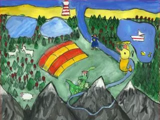
First hand observations – drawing a map of what we can see, where objects are in relation to one another. • Mental or cognitive maps – a map of a place we know e.g. The route home, how to get to the church. • Imaginative maps – maps made from a story or imaginative play. • Maps from second hand sources – using an aerial photo to create a map. Making Maps
As adults we rarely use a globe but it is the image of a 3D image which is essential for understanding. • Children need experience of a globe at a young age even though the understanding of what it is comes later. • Atlases and globes should be used side by side – both provide unique spatial information. Atlases and Globes
Geographical enquiry • Asking their own questions to find out what places are like and how they change • Manage their own learning, handle issues objectively and use skills with a real purpose • Stages in an enquiry • 1. Awareness raising/stimulus • 2. Generating questions • 3. collecting and recording information • 4. processing the gathered information • 5. drawing conclusions from this data • 6. sharing the learning • 7. Evaluation
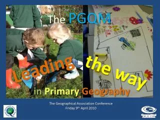
Fieldwork • Develops observational skills • Skills of recording, analysis, deduction and an enquiring mind • Fieldwork give the children a real practical opportunity to see, hear, feel and understand for themselves
When planning think about the following • What am I teaching (Context) • How am I going to teach this • What do I need to know • What will the children learn from this • How will this build on from previous learning • How will I deal with misconceptions Planning
An increase in breath of studies – gradual extension of content, places themes and environments • An increase in the spatial scale – shift from local, small scale to more distant, regional, national, continental and global • Development of skills • More opportunity for children to look at economic, political and environmental issues Progression through the Key Stages
The attainment target for the 2014 National Curriculum no longer describe the outcomes we expect of pupils. • Attainment target: by the end of each key stage, pupils are expected to know, apply and understand the matters, skills and processes specified in the relevant programme of study. • Schools now have the freedom to devise their own approach • Assessment needs to be carefully planned into teaching activities - identifying the next steps in learning. • Effective assessment is an ongoing process, in which pupils and teachers develop awareness of their strengths and weaknesses. Assessment
Types of Assessment Formative/AfL: • day-to-day (often informal) assessments; looking forward • identify pupils’ current understanding • give feedback to prompt action/improvement by pupils • help teachers plan how to help pupils develop next. Summative/AoL: • long-term (usually formal) summing-up of progress; looking backward • providing information • Formal recognition of achievement • Based on geography benchmarks • Reported to parents and next teacher/school
Interactions between people and their environments • Fieldwork is essential. Again start in your local area and then move further away • Shows other people’s opinions and values • Eco-schools, healthy schools, forest schools • Looking after our school • Caring for animals • Looking after water • New buildings – local resources • Local flooding • Tourism • Rainforest • New road construction • How do you think your area/school will look like in 10 years time? Environmental/sustainability
School grounds Local area Streets , roads, buildings Local shops Parks Water features Transport links Local viewpoints New developments Service provisions • Different building materials • Dating the buildings on a map • Using map keys • Finding pleasant/boring areas around school • Making up routes around the school • Sketching views from the site • Improving/changing the site • Seasonal changes on the site Local Studies
Aerial photos – make the link between real world and maps Aerial Photographs
Distant Localities More reliance on Secondary sources – books, video clips, Internet KS1 – may approach another locality by cross curricular links – food, seaside, Barnaby Bear Must continue to develop the skills Must develop their knowledge and understanding of place Main physical and human features Avoid making a inaccurate, biased or over-simplified picture of the place
Globe – what the world looks like • Atlases – Maps of the world • Local maps • Freehand or sketch maps • Mental or cognitive maps • Imaginative maps • Scaled maps • Ordnance Survey maps Maps
Photographs of: • Your school • Local area • Old calendars • Postcards Photographs
Some stories have maps at the beginning • Descriptions of settings • Some will have a geographical theme • Can use books as a geography resource for activities Stories