Weather Maps
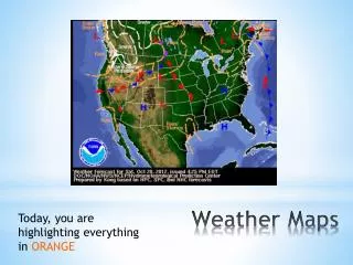
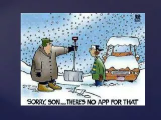
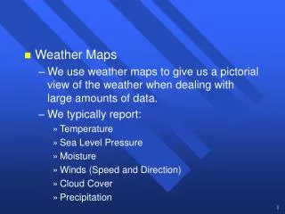
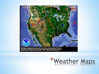
Weather Maps. Weather maps are used to show current weather conditions in an effort to predict future weather conditions. You need to know what each symbol means and how to interpret them to forecast the weather. Weather Maps. Cold Front Symbol.

Weather Maps
E N D
Presentation Transcript
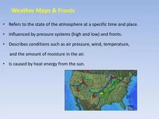
Weather maps are used to show current weather conditions in an effort to predict future weather conditions. • You need to know what each symbol means and how to interpret them to forecast the weather. Weather Maps
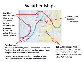
Cold, dense air is moving toward warm, less dense air. • The warm air is pushed up to cool and form clouds as the cooler air replaces it. • The air on the front side of the boundary line is warmer than the air on the back side of the boundary line. • These fronts are usually fast moving and bring stormy weather and heavy precipitation followed by clearing skies and higher pressure. Moves in the Direction of the Triangles
Warm air is moving toward cold air. • The warm, less dense air slides over the cold, more dense air. • The air on the front side of the boundary line is cooler than the air on the back side of the boundary line. • These fronts usually move slowly and bring steady rain or snow over many days. Moves in the Direction of the Semi-Circles
These fronts occur when neither the cool or warm air masses are strong enough to replace each other. • They tend to stay in an area for a long period of time, often bringing long periods of precipitation and clouds. Stay in One Area
Cooler, dense air close to the surface of the Earth. • Surrounded by winds flowing in a clockwise direction. • Usually brings dry conditions and fair skies. Moves toward Low Pressure
Let’s practice. • Remove the lid from the bottle. • Now, replace the lid. • What direction did you turn the lid to tighten it? • Did the lid move up or down? • This is a way to remember high pressure. High Pressure Simulation
Warmer, less dense air above the Earth’s surface • Surrounded by winds moving in a counterclockwise direction. • Associated with the formation of storms. High pressure will move toward low pressure.
Let’s practice. • Remove the lid from the bottle. • What direction did you turn the lid to loosen it? • Did the lid move up or down? • This is a way to remember low pressure. Low Pressure Simulation
Why does the Earth have weather? How do weather maps show how global patterns of atmospheric movement influence local weather? Reflection Questions