Download
1 / 5
0 likes | 9 Views
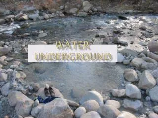
Discover the hidden wealth beneath the surface with our comprehensive ground water survey services. Unlock the potential of your water resources today!

E N D
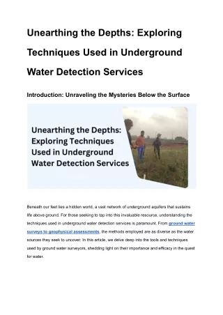
Unearthing the Depths: Exploring Techniques Used in Underground Water Detection Services Introduction: Unraveling the Mysteries Below the Surface Beneath our feet lies a hidden world, a vast network of underground aquifers that sustains life above ground. For those seeking to tap into this invaluable resource, understanding the techniques used in underground water detection services is paramount. From ground water surveys to geophysical assessments, the methods employed are as diverse as the water sources they seek to uncover. In this article, we delve deep into the tools and techniques used by ground water surveyors, shedding light on their importance and efficacy in the quest for water.
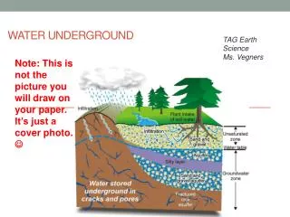
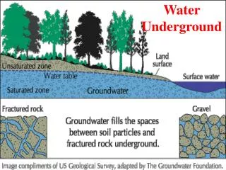
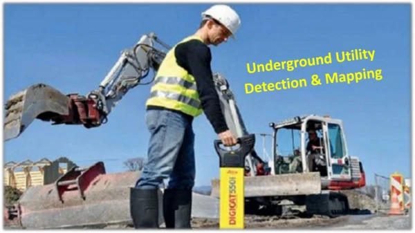
The Art of Ground Water Surveying: Mapping the Subterranean Landscape Understanding Ground Water Surveys Ground water surveys form the bedrock of underground water detection services, providing a comprehensive overview of the subterranean landscape. Through a combination of geological mapping, hydrological analysis, and geophysical surveys, ground water surveyors identify potential water sources and assess their viability for extraction. The Role of Geophysical Surveys At the heart of ground water surveys lie geophysical techniques, which offer insights into the composition and characteristics of underground formations. Methods such as electrical resistivity tomography (ERT), ground penetrating radar (GPR), and seismic refraction surveys enable surveyors to delineate aquifers, detect water-bearing structures, and assess subsurface conditions with precision. Ground Water Survey for Borewell Installation: Optimizing Water Well Placement Optimizing Borewell Placement For those drilling borewells, the success of the endeavor hinges on strategic well placement. Ground water surveys play a pivotal role in this process, guiding drillers to optimal locations where water is abundant and accessible. By identifying areas of high permeability, favorable geological features, and potential groundwater flow paths, surveyors help maximize the yield and longevity of borewells. Mitigating Risk and Ensuring Sustainability Beyond mere water detection, ground water surveys serve as a safeguard against potential risks and environmental concerns. By conducting thorough assessments of subsurface
conditions and hydrological dynamics, surveyors mitigate the risk of borewell failure, groundwater depletion, and contamination, thereby promoting sustainable water management practices. Harnessing the Power of Geophysical Techniques: Tools of the Trade Electrical Resistivity Tomography (ERT) ERT involves measuring the electrical resistivity of subsurface materials to delineate geological structures and aquifer boundaries. By transmitting electrical currents into the ground and recording voltage measurements at multiple points, surveyors can create detailed 2D or 3D images of underground formations, aiding in water resource assessment and management. Ground Penetrating Radar (GPR) GPR utilizes high-frequency electromagnetic pulses to penetrate the subsurface and detect changes in material properties. Widely used for mapping buried objects and geological features, GPR is particularly effective in identifying shallow aquifers, geological faults, and underground utilities, offering valuable insights for water well siting and construction. Conclusion: Navigating the Depths with Expertise and Precision In the quest for underground water, knowledge is power. By harnessing the techniques of ground water surveying and geophysical exploration, we unlock the secrets hidden beneath the Earth's surface, tapping into a vital resource essential for life and livelihoods. At Bhoojal Survey, we combine cutting-edge technology with decades of expertise to provide unparalleled ground water survey services in India. With our comprehensive approach and commitment to excellence, we stand ready to help you navigate the depths and secure the water resources your project demands.
FAQs (Frequently Asked Questions) How long does a ground water survey typically take? The duration of a ground water survey depends on various factors, including the size of the area being surveyed, the complexity of the geological formations, and the techniques employed. Generally, surveys can range from a few days to several weeks. Can ground water surveys detect the quality of water as well? While ground water surveys primarily focus on identifying the presence and location of underground water sources, they can provide insights into certain water quality parameters, such as salinity levels and contamination risks, through geochemical analysis and hydrological modeling. Are ground water surveys necessary for all water-related projects? Ground water surveys are essential for projects involving borewell installation, groundwater extraction, irrigation planning, and groundwater recharge initiatives. By providing valuable information about subsurface conditions and water availability, surveys help optimize project outcomes and mitigate risks. is ground water survey effective with Satellite Survey? Yes, ground water surveys can be effective when combined with satellite surveys. Satellite surveys provide valuable data on surface features, such as topography and land use, which can indicate potential areas of groundwater accumulation or recharge. However, they may not directly measure groundwater levels or quality. Groundwater surveys, on the other hand, involve direct measurements such as drilling wells, installing piezometers, or using geophysical methods to assess groundwater resources underground. By integrating data from satellite surveys with ground-based measurements, scientists can obtain a more comprehensive understanding of groundwater dynamics, aiding in effective management and conservation strategies.
How Bhoojal Survey & Recharging can help you with ground water survey in India At Bhoojal Survey & Recharging, we specialize in providing comprehensive ground water survey services tailored to the unique needs of our clients across India. Leveraging state-of-the-art technology, advanced geophysical techniques, and a team of seasoned experts, we deliver accurate, actionable insights to support your water-related projects. Whether you're drilling a borewell, planning irrigation infrastructure, or managing groundwater resources, trust Amicus Growth Advisors to navigate the complexities of underground water detection with precision and expertise.