Download
1 / 5
0 likes | 25 Views
Explore the advantages of Satellite Surveys over Traditional Surveys in our comprehensive comparative study. Unlock insights for informed decision-making.

E N D
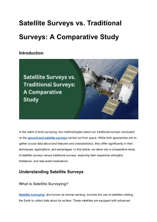
Satellite Surveys vs. Traditional Surveys: A Comparative Study Introduction In the realm of land surveying, two methodologies stand out: traditional surveys conducted on the ground and satellite surveys carried out from space. While both approaches aim to gather crucial data about land features and characteristics, they differ significantly in their techniques, applications, and advantages. In this article, we delve into a comparative study of satellite surveys versus traditional surveys, exploring their respective strengths, limitations, and real-world implications. Understanding Satellite Surveys What is Satellite Surveying? Satellite surveying, also known as remote sensing, involves the use of satellites orbiting the Earth to collect data about its surface. These satellites are equipped with advanced
sensors, such as cameras and radar systems, capable of capturing detailed images and measurements from above. How Satellite Surveys Work Satellite surveys operate on the principle of remote sensing, where electromagnetic radiation emitted or reflected from the Earth's surface is detected and analysed. The satellite sensors capture data across various wavelengths, allowing for the creation of multispectral images that reveal different features and properties of the land. Applications of Satellite Surveys Satellite surveys find diverse applications across industries, including: ● Environmental Monitoring: Tracking changes in land cover, detecting deforestation, and monitoring natural disasters such as wildfires and floods. Urban Planning: Mapping urban areas, monitoring infrastructure development, and assessing land use patterns. Agriculture: Monitoring crop health, predicting yields, and optimizing resource management practices. Archaeology: Identifying archaeological sites, mapping ancient landscapes, and monitoring heritage sites for preservation. ● ● ● Understanding Traditional Surveys What are Traditional Surveys? Traditional surveys involve physical measurements and observations conducted on the ground using surveying instruments such as total stations, levels, and GPS receivers. Surveyors traverse the land, taking precise measurements of distances, angles, and elevations to create detailed maps and plans. Techniques Used in Traditional Surveys Traditional surveying techniques include: ● Triangulation: Determining the position of points by measuring angles between lines.
● Traversing: Establishing control points and measuring distances and angles along a series of interconnected survey lines. Leveling: Determining the elevation of points relative to a reference datum using a level instrument. ● Applications of Traditional Surveys Traditional surveys are commonly used in: ● Construction: Setting out building foundations, aligning structures, and conducting as-built surveys. Land Development: Subdivision planning, boundary delineation, and land parcel mapping. Engineering: Designing infrastructure projects, such as roads, bridges, and utilities. Mining: Conducting topographic surveys, monitoring mine sites, and planning resource extraction activities. ● ● ● Comparative Analysis: Satellite Surveys vs. Traditional Surveys Advantages of Satellite Surveys ● Wide Area Coverage: Satellite surveys can capture data over vast areas in a single pass, making them efficient for regional-scale mapping and monitoring. Remote Accessibility: Satellite imagery can be acquired from remote or inaccessible regions, eliminating the need for physical presence on the ground. Temporal Consistency: Satellites provide regular and consistent data acquisition, allowing for long-term monitoring and trend analysis. Multispectral Capabilities: Satellite sensors can capture data across multiple wavelengths, enabling the analysis of various land features and properties. Cost-Effectiveness: Satellite surveys often offer a cost-effective solution for large-scale mapping projects compared to traditional surveys. ● ● ● ● Advantages of Traditional Surveys ● High Precision: Ground-based surveys can achieve higher accuracy in measurements, especially in areas with challenging terrain or obstructions. Detailed Information: Traditional surveys provide detailed information about specific points or features on the ground, allowing for precise engineering and construction planning. ●
● Real-Time Feedback: Ground Water Surveyors can observe and adjust measurements in real-time, ensuring accuracy and quality control during data collection. Flexibility: Traditional surveying techniques can adapt to various environmental conditions and project requirements, offering versatility in field operations. Legal Validity: Ground-based surveys are often required for legal purposes, such as boundary disputes, property transactions, and land registration. ● ● Conclusion In conclusion, both satellite surveys and traditional surveys play indispensable roles in land surveying and spatial data collection. While satellite surveys offer the advantages of wide area coverage, remote accessibility, and cost-effectiveness, traditional surveys excel in precision, detailed information capture, and legal validity. The choice between the two methods depends on the specific project requirements, scale, accuracy, and budget considerations. Ultimately, a combination of satellite and traditional surveying techniques may offer the most comprehensive approach to land surveying and mapping tasks. FAQs (Frequently Asked Questions) Which surveying method is more accurate: satellite surveys or traditional surveys? Traditional surveys tend to offer higher accuracy in measurements, especially for detailed and precise applications. However, satellite surveys provide broader coverage and are suitable for regional-scale mapping and monitoring. Are satellite surveys more cost-effective than traditional surveys? Satellite surveys are often more cost-effective for large-scale mapping projects due to their ability to capture data over vast areas in a single pass. However, the cost-effectiveness depends on factors such as project scale, accuracy requirements, and data processing needs. Can satellite surveys be used for legal purposes such as property boundary disputes? While satellite surveys can provide valuable information for preliminary assessments, ground-based surveys are typically required for legal purposes such as boundary surveys, property transactions, and land registration.
How Bhoojal Survey & Recharging Can Help You with Satellite Survey Services in India Bhoojal Survey & Recharging offers comprehensive satellite survey services in India, leveraging advanced satellite imagery and remote sensing technologies to meet your land surveying and mapping needs. Our experienced team delivers accurate and reliable data for diverse applications, including environmental monitoring, urban planning, agriculture, and infrastructure development. Contact us today to learn more about our satellite survey solutions and how we can support your projects.