Download

1 / 30
310 likes | 557 Views
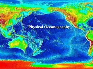
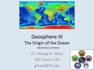
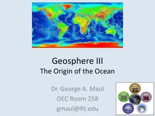
2.2 The Origin and Structure of the Ocean Basins. The Earth is a world of constant transformation, where even the continents move A. Early Evidence of Continental Drift 400 years ago Sir Francis Bacon noted the continental coasts of the Atlantic fit together like pieces of a puzzle

E N D
2.2 The Origin and Structure of the Ocean Basins • The Earth is a world of constant transformation, where even the continents move • A. Early Evidence of Continental Drift • 400 years ago Sir Francis Bacon noted the continental coasts of the Atlantic fit • together like pieces of a puzzle • Later suggested the Americas might have been once joined to Europe and Africa • Geologic formations and fossils matched from opposing sides • Alfred Wegner gave hypothesis of Continental Drift in 1912 • Suggested that all the continents had once been a supercontinent, named • Pangea • Started breaking up ~180 mil years ago
B. The Theory of Plate Tectonics • Could not explain how the continents moved • The Theory of Plate Tectonics explains it all • Continents do drift slowly around the world
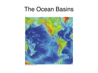
Discovery of the Mid-Ocean Ridge • After WWII sonar allowed detailed maps of the sea floor • They discovered the mid-ocean ridge system • A chain of submarine volcanic mountains that encircle the globe, like seams on a baseball • The largest geological feature on Earth • Some of the mountains rise above sea level to form islands, e.g. Iceland • The mid-Atlantic ridge runs down the center of the Atlantic Ocean and follows the curve of the opposing coastlines • Sonar also discovered deep trenches
Significance of the Mid-Ocean Ridge • Why are they there? How were they formed? • Lots of seismic and volcanic activity around • the ridges and trenches • Rock near the ridge is young and gets older • moving away from the ridge • There is little sediment near the ridge, but it • gets thicker moving away
Found symmetric magnetic bands on either side of the ridge which alternate normal and reversed magnetism
Creation of the Sea Floor • Huge pieces of oceanic crust are separating at the • mid-ocean ridges • Creating cracks called rifts • Magma from the mantle rises through the rift • forming the ridge • The sea floor moves away from the ridge
This continuous process is called sea-floor spreading • New sea floor is created • This explains why rocks are older and sediment is thicker as you move away from • the ridge • This also explains the magnetic stripes found in the sea floor
Sea-Floor Spreading and Plate Tectonics • The crust and part of the upper mantle form the • lithosphere • 100 km (60 mi) thick, rigid • It’s broken into plates • May be ocean crust, continent crust, or both • The plates float on a fluid layer of the upper mantle called the asthenosphere.
At mid-ocean ridges the plates move apart • If the plate has continental crust it carries the continent with it • Spread 2-18 cm/year • This explains continental drift • As new lithosphere is created, old lithosphere is destroyed somewhere else • Some plate boundaries are trenches where one plate sinks • below the other back down into the mantle and melts
At mid-ocean ridges the plates move apart • If the plate has continental crust it carries the continent with it • Spread 2-18 cm/year • This explains continental drift • As new lithosphere is created, old lithosphere is destroyed somewhere else
Some plate boundaries are trenches where one plate sinks below the other back down into the mantle and melts • Called subduction • Trenches are also called subduction zones • The plates colliding can be ocean continent • ¨ Ocean plates always sinks below • ¨ Produces earthquakes and volcanic mountain ranges; e.g. Sierra Nevada
The plates colliding can be ocean ocean • ¨ Earthquakes and volcanic island arcs; e.g. Aleutian • Islands • The plates colliding can be cont cont • ¨ Neither plate sinks, instead they buckle • ¨ Producing huge mountain ranges; e.g. Himalayas • A third boundary type is shear boundary or transform fault • The plates slide past each other • Causes earthquakes; e.g. San Andreas Fault
Two forces move the plates • Slab-Pull theory - the sinking plate pulls the rest • behind it • Convection theory – the swirling mantle moves • the plate
Geologic History of the Earth • 1. Continental Drift and the Changing Oceans • 200 mil years ago all the continents were joined in Pangea • It was surrounded by a single ocean called Panthalassa • 180 mil years ago a rift formed splitting it into two large continents
Laurasia – North America and Eurasia • Gondwana – South America, Africa, Antarctica, India, and Australia • The plates are still moving today • Atlantic ocean is growing, Pacific is shrinking
The Record in the Sediments • Two types of marine sediments: • Lithogenous – from the weathering of rock on land • Biogenous – from skeletons and shells of marine organisms • ¨ Mostly composed of calcium carbonate or silica • Microfossils tell what organisms lived and past ocean temperatures
Climate and Changes in Sea Level • The Earth alternates between interglacial (warm) period and ice age (cold) periods • Sea level falls during ice ages because water is trapped in glaciers on the • continents
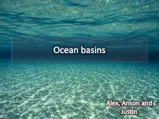
2.3 The Geological Provinces of the Ocean • Two main regions of the sea floor • Continental margins – the submerged edge of the continents • Deep-sea floor
Continental Margins • Boundaries between the continental and ocean crust • Consists of shelf, slope and rise • 1 The Continental Shelf • The shallowest part • Only 8% of the sea floor, but biologically rich and diverse • Large submarine canyons can be found here • Ends at the shelf break, where it steeply slopes down
2 The Continental Slope • The edge of the continent • Slopes down from the shelf break to the deep-sea floor • 3 The Continental Rise • Sediment accumulates on the sea floor at the base of • the slope
Active and Passive Margins • Active margin – the subducting plate creates a trench • Narrow shelf, steep slope, and little or no rise • Steep, rocky shorelines • Passive margin – no plate boundary • Wide shelf, gradual slope, and thick rise
Deep-Ocean Basins • 10,000-16,000 ft • Abyssal plain - flat region of the sea floor • Seamounts – submarine volcanoes • Guyots – flat-topped seamounts • Both were once islands, but now covered with water • Trenches – the deepest part of the ocean • Mariana Trench is 36,163 ft deep
The Mid-Ocean Ridge and Hydrothermal Vents • At the center of the ridge, where the plates pull apart, is a central rift valley • Water seeps down through cracks, gets heated by the mantle, then emerges through hydrothermal vents 350oC (660oF)
Dissolved minerals from the mantle, like sulfides, are • brought up • Black smokers form when minerals solidify • around a vent • Marine life, including chemosynthesizers, exist • around hydrothermal vents