Download
1 / 19
200 likes | 543 Views
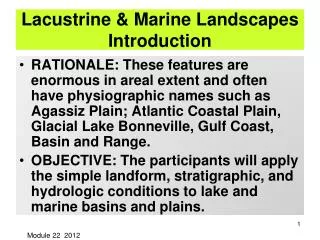
Lacustrine & Marine Landscapes Introduction. RATIONALE: These features are enormous in areal extent and often have physiographic names such as Agassiz Plain; Atlantic Coastal Plain, Glacial Lake Bonneville, Gulf Coast, Basin and Range.

E N D
Lacustrine & Marine LandscapesIntroduction • RATIONALE: These features are enormous in areal extent and often have physiographic names such as Agassiz Plain; Atlantic Coastal Plain, Glacial Lake Bonneville, Gulf Coast, Basin and Range. • OBJECTIVE: The participants will apply the simple landform, stratigraphic, and hydrologic conditions to lake and marine basins and plains. Module 22 2012
LACUSTRINE SOIL SYSTEMS Lake deposits are altered to soil when the lake dries (becomes subaerial). “Playas” or dry lakes usually have with some salinization. Water fluctuations from dry to ? THE STUDENT CAN RELATE STRANDLINES TO LAKE LEVELS; IDENTIFY GEOSEQUENCES ACROSS LAKE BASINS; IDENTIFY BEACH, NEAR-SHORE AND OFF-SHORE SEDIMENTS. THE STUDENT WILL LIST THE PROBLEMS THAT WILL BE ENCOUNTERED WITH WATER WHEN CITING LANDFILLS IN LAKE PLAINS and be prepared to report on the given site as favorable or unfavorable for a “hazardous landfill”. Module 26
VFSL SCL CL FSL ANISOTROPYFOSSTON, MN SOLID WASTE AREA Kh is HORIZONTAL FLOW. Kv is VERTICAL FLOW. Kh/Kv = 8000 Slope is west, where is the largest potential for Contamination? At depth or north, south, or west. Land Fill Kh = 1.2x10⁻³ Saline soils AQUIFER AQUITARD Kv = 1.5 x 10⁻⁷ 10 MILES 16 kM 25
Geomorphology – wave-energy landforms to quiet water landforms; Playa landforms when dry. Stratigraphy – high energy sediments to fine sediments and evaporities if desiccated. Hydrology strongly related to topographic or sediment sequences and evapotransporation at edges of wet areas. Also large areas create areas with local recharge-discharge differential ponding. Soils strongly reflect the above three principles. Lacustrine and Marine Summary
WAVE INFLUENCED EDGESMAP UNITS FROM KOSSUTH CO., IA STRANDLINE WAVE-CUT ESCARPMENT WAVE-BUILT TERRACE 138B OFF-SHORE 511 WAVE-CUT TERRACE 73C2 62D • Lower gradient enhances infiltration. • Coarse textures enhance infiltration and groundwater movement. • Fine-textures in the pond interior retard discharge.
HAYFIELDS THROUGH 50’S DUCK POND (WETLAND) 1969 RED ARROWS POINT TO HIGHEST STRANDLINE; BLUE ARROWS TO THE PROMINENT STRANDLINES. LONG LAKE-SOMETIMES HAYFIELD AND SOMETIMES DUCK POND 9 AUG 1969
LONG LAKE IS THIS HAY-FIELD A WETLAND • IS THIS WETLAND A LAKE OR A WETLAND? 1998 REALLY GOOD WALLEYE FISHING
0 20 40 60 SAND SANDY SiL SiCL SILTY CLAY LOAM 4 LACUSTRINE SEQUENCE CASS, COUNTY, ND GLACIAL LAKE AGASSIZ on 9000 YBP Surfaces LACUSTRINEGEOSEQUENCE A-HORIZON, %Organic Carbon • Major Strandlines • Herman • Tintah • Norcross • Campbell 2 Y = 0.064x + 1.1 r=0.96 % CLAY 0 Richardson and Edmonds 1987 Beach; Near-shore; Off-shore
LACUSTRINE SEQUENCE FOR DEVILS LAKE, ND MOLLISOL ENTISOL 1445’ ELEVATION BEACH Gravel Sand loams SiCl SiC NEAR SHORE OFF-SHORE SiCL SiC Strandline Elevations 1554’ <Upland Mollisols 1445’ <Entic Mollisols 1426’ Entisols Elevation 1940 1400’
WATER SURFACE ELEVATION DEVILS LAKE jlr jlr JLR jlr NORTH DAKOTA STATE WATER COMMISSION - 20 June 05 48.56 feet
East Bay Devils Lake, ND Note the soil patterns SCARP STRANDLINE(2)
Lallie and Lallie SalineFINE, SMECTITIC, CALCAREOUS, FRIGID VERTIC FLUVAQUENTSa Cross-Section Illustrating Off-Shore Sediments Non-saline Saline Water Wet Meadow Shallow Marsh Deep Marsh As the water rises or falls with climatic changes, the salt ring moves up or to the upland or opposite. If the water dries completely a salt pan (playa) occurs. HYDROLOGY of the ring is water movement by matric and saturated flow followed by evapotranspiration.
PROBLEM SITE FOR A HAZARDOUS LANDFILLDOWNER, MN SITE Pit, Gravel & 245 508 PERMANENT LAKE
PROBLEM: LACUSTRINE SITE A consultant from the east was hired by the Minnesota DNR to locate a hazardous landfill site. The criteria boiled down cannot be in a recharge area (wow- what does that leave!). The water table must be deep and the soils cannot be prime farm land. Notes: 1. the water near the interstate had water standing about where it is marked on the image throughout the 1988 to 1992 droughti.e. the water table is shallow. 2. Salinization was observed by the ditches along the interstate. The pits, gravel are in a beach located well above the west side or the map. Map unit 245 is the Lohnes series. 3. 508 (Wynmere) produces champion yields of sugar beets, the most profitable crop in the areai.e. these are prime farm Land. 4. At 2.5 m and deeper an aquitard of SICL occurs. 5. The surface according the consultant are fine textured “clays”. This area back when conventional tillage was common on the 508 and 60 units, the interstate was shut down by blowing sediments. Guess what the texture according to Hjulstromis? Slope is from NE to SW with an aquifer over and aquitard. Using the soil descriptions, soil map, and the topographic map, create a cross-section that illustrates the likely hydrology. Then list the problems of using this site. What is the real basic problem of using discharge sites for landfills?
The Wyndmere series consists of very deep, somewhat poorly drained, moderately rapidly permeable soils formed in calcareous moderately coarse and coarse glaciofluvial and glaciolacustrine deposits. These soils are on delta, outwash and glaciolacustrine plains, and on beach ridges. Slope ranges from 0 to 3 percent. Mean annual air temperature is 42 degrees F, and the mean annual precipitation is 19 inches. TAXONOMIC CLASS:Coarse-loamy, mixed, superactive, frigid AericCalciaquolls (Colors are for moist soil unless otherwise stated. Where described, the soil was moist throughout.) Ap--0 to 8 inches; black (10YR 2/1) fine sandy loam, very dark gray (10YR 3/1) dry; weak coarse subangular blocky structure parting to moderate medium granular; slightly hard, very friable; many roots; strong effervescence; moderately alkaline; abrupt boundary. (Combined A horizons 6 to 11 inches thick) ABk--8 to 15 inches; very dark gray (10YR 3/1) fine sandy loam, gray (10YR 5/1) dry; weak coarse prismatic structure parting to weak coarse angular blocky; slightly hard, very friable; common roots; strong effervescence; moderately alkaline; gradual wavy boundary. (0 to 8 inches thick) Bk--15 to 26 inches; gray (10YR 5/1) fine sandy loam, light gray (10YR 6/1) dry; weak coarse prismatic structure parting to weak coarse angular blocky; slightly hard, very friable; few roots; violent effervescence; moderately alkaline; gradual wavy boundary. (6 to 36 inches thick) C1--26 to 44 inches; light olive brown (2.5Y 5/4) fine sandy loam, pale yellow (2.5Y 7/4) dry; few fine prominent dark reddish brown (5YR 3/2) redoximorphic concentrations; weak coarse subangular blocky structure parting to weak coarse granular; slightly hard, very friable; strong effervescence; moderately alkaline; gradual boundary.
The Lohnes series consists of very deep, well drained, rapidly permeable soils that formed in coarse and medium sands. These soils are on glacial lake and outwash plains and have slopes ranging from 0 to 15 percent. Mean annual air temperature is 39 degrees F, and mean annual precipitation is 18 inches. TAXONOMIC CLASS:Sandy, mixed, frigid EnticHapludolls TYPICAL PEDON:Lohnes loamy coarse sand--native grass. (Colors are for dry soil unless otherwise stated) A--0 to 16 inches; very dark gray (10YR 3/1) loamy coarse sand, black (10YR 2/1) moist; weak subangular blocky structure; soft, very friable, slightly sticky and nonplastic; many fine roots; neutral; gradual wavy boundary. (10 to 20 inches thick) AC--16 to 30 inches; dark grayish brown (10YR 4/2) loamy coarse sand, very dark brown (10YR 2/2) moist; weak medium and fine subangular blocky structure; loose, very friable, slightly sticky and nonplastic; common roots; neutral; gradual wavy boundary. (0 to 20 inches thick) C1--30 to 47 inches; brown (10YR 5/3) coarse sand, dark brown (10YR 4/3) moist; single grain; few fine faint dark yellowish brown (10YR 4/4) redoximorphic concentrations in the lower part; loose, nonsticky and nonplastic; few very fine roots; slightly alkaline; gradual wavy boundary. C2--47 to 60 inches; grayish brown (2.5Y 5/2) coarse sand, dark grayish brown (2.5Y 4/2) moist; common fine faint dark yellowish brown (10YR 4/4) redoximorphic concentrations in upper part, and common fine distinct brownish yellow (10YR 6/6) redoximorphic concentrations in lower part; single grain; loose, nonsticky and nonplastic; strong effervescence; moderately alkaline.