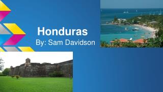
Honduras
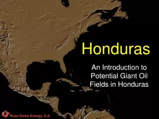
Rose Dome Energy, S.A. Honduras. An Introduction to Potential Giant Oil Fields in Honduras. Overview. Rose Dome Energy presents an exciting new play in Honduras Large Cretaceous basin that has never been drilled Tela Basin or the Western Honduras Basin Covers some 5700 square miles

Honduras
E N D
Presentation Transcript
Rose Dome Energy, S.A. Honduras An Introduction to Potential Giant Oil Fields in Honduras
Overview • Rose Dome Energy presents an exciting new play in Honduras • Large Cretaceous basin that has never been drilled • Tela Basin or the Western Honduras Basin • Covers some 5700 square miles • Exploration target is Cretaceous and Jurassic sediments • Field work shows 17,000 feet of measured section in Mesozoic & early Tertiary basin • Field work indicates some 9-10 anticlines along geanticline trend
Background • Field work on the area encompassed three to four years • Studies of area continued for several years • Many academic studies and mapping of the area • Three large anticlines have been mapped in the field. • Located on the west end of the anticlinorium • This anticlinorium is referred to in this presentation as the Mills Anticlinorium
Anticlinorium • Two anticlines surveyed near the town of Atima contain 8,000 and 13,000 acres of closure respectively • Effective vertical thickness ranges from 1,000 to 2,000 feet • Average dip on the flanks is 25 degrees • The terrain is very mountainous but the mapped anticlines are near a paved road
Geology - Structure • The anticlines are simple, large structures • But, the detailed stratigraphy is complex • The structures were formed in Late Oligocene or early Miocene • Collectively, the structures are big enough to yield major oil fields i.e. hundreds of millions or billions of barrels of oil • With the current price of oil, the smaller anticlines would be very profitable • Most probably, other anticlines will map out as targets for exploration
Anticlinorium • It is difficult to see the anticlines from landsat pictures as the terrain is covered with vegetation and severely dissected by erosion • Field work is necessary for checking of data
Anticline Trend Unmapped anticlines 9
Geology • No intrusive or extrusive rocks have been seen in the Mesozoic of Honduras • No sedimentary Paleozoic rocks in Honduras • Paleontological control is fair to good • In the Cretaceous section, rudistid and other reef forming fossils have been documented • Good porosity was noted in this part of the Cretaceous sediments
Jimilie Structure Naranjito Structure Atima Structure M Mapped Structures over Digital Terrain Map 11
Jimilie Cross-section Naranjito Cross-section A Atima Cross-section Line of cross sections. Structure Map of three large anticlines Structure Map of Three Anticlines Map is actual field Map 13
Tectonics - Chortis Sub-plate • The Chortis sub-plate contains most of Honduras and the northern part of Nicaragua • Originally located on the Pacific side of southwestern Mexico • It rotated around the southern edge of Mexico and became part of the Caribbean Plate • The American Plate and the Caribbean Plate came together in Oligocene time
Tectonics - Structure • The plate movements, with some strike slip activity, formed the Mills Anticlinorium in upper Oligocene or Miocene times • In addition to the Mills Anticlinorium several other anticlines to the northwest have been noted but not mapped (see map of area) • The Chortis Plate is shown as red on next slide
American Plate Caribbean Plate Diagram showing American Plate and Caribbean Plate. American Plate continues to move westwards. 25
Magnetic Data - Honduras • The following two slides contain magnetic data of Honduras • The basic recorded digital data of the magnetic survey is not available • Nevertheless, the magnetic data show that the Atima Block is on a Magnetic high trend, with the highest reading on the Atima Block • Thus, this data may indicate a basement high with younger sedimentary draped over the magnetic anomaly, which could result in large deep seated structures
Rose Dome Area of Interest Aerial magnetic map of Honduras. Red line shows magnetic high trend that extends across Area of Interest and on to the southeast. 28
Source Rocks - Atima Cross-Section • The limestone on the surface is gray, occasionally black • Very fossiliferous - rudistids abundant with other reefal fauna • Black shale sections of the Atima limestone contain modules of kerogen with very strong petroleum odor when fractured
Source Rocks -Guare Formation • Located above the Atima limestone in the Lower Cretaceous (Kyg) • Frequently stained with oil • A brown grease is found within calcite veins along bedding planes of black shale • Very strong petroleum odor
Source Rocks • Distillation of oil seep samples from the Cantarranas reveals typical heavy paraffin-base crude types • Kerogen has been found in all the limestones of the Cantarranas, Atima and Llama formations • Further reservoir rocks may be found in the porous sandstones of the Plan Grande and Victoria formations at depth
Source Rocks • Shows of oil are scattered throughout the geological section • Formations with oil shows are noted on the cross sections • Gilsonite (asphalt) was sampled in an outcrop northeast of the Jimilie structure • This location is noted on the cross section of the Jimilie section
Reservoir Rocks • Good porosity is noted in the Upper Cretaceous rocks that contain rudistids and other reef forming fauna • Other formations of the Cretaceous have porosity • Further reservoir rocks may be found in the porous sandstones of the Plan Grande and Victoria formations at depth
Paleontological • A map showing exact areas where fossils were collected is available • A list of fauna from each area is available • The fauna suggests that reefs will be found in the Cretaceous
Reserve Potential • Following are rough estimates of the potential of the Atima Project. • We have mapped the surface structures which gives us the surface area of the anticlines. • We put in a thickness of the potential reservoir rocks. • We will complete the surface mapping on the West Narranjito structure soon. This will take only a day or so. • These figures show vividly the excellent potential of the Honduras project.
Reserve Potential • The following estimates are based on 18% porosity and 70% oil saturation at a reservoir depth of 6500 feet. They also assume 45% recovery by water drive: • Atima Structure (13,000 acres - 300’ pay): • 3,812,000,000 bbls of oil in place • 1,715,000,000 bbls of oil recoverable • Narranjito Structure (9,000 acres - 400’ pay): • 3,519,000,000 bbls of oil in place • 1,583,000,000 bbls of oil recoverable • Narranjito West Structure (8,000 acres - 250’ pay): • 1,955,000,000 bbls of oil in place • 880,000,000 bbls of oil recoverable • Jimile Structure (5,000 acres - 300’ pay): • 1,466,000,000 bbls of oil in place • 660,000,000 bbls of oil recoverable
Business Environment • Honduras is friendly to America and would be a good place for a foreign operation • The Petroleum contract in Honduras is negotiable • Based on production or financial criteria, a sliding scale of royalty might be attainable • It is believed that the highest royalty would be 20% • Income tax is 30% • Acreage price is $.25 cents/acre
General • Good geological literature, and good topographical maps are available • The area of interest is extremely rugged with rivers and streams dissecting the area • The area is totally green and is covered by trees, shrubs and grass
Conclusions • Large field-mapped anticlines are present • The anticlines are big enough for world class oil fields • The geological section has structure, source rocks, reservoir rocks • A rank wildcat area with great potential
Current Status/ Next Steps • Local Honduras company, Rose Dome Energy, S.A., was formed • Local office established • Application for the Atima block was submitted • Application reserves the 741,000 acre Atima block for Rose Dome Energy, S.A. • Negotiations will take several months • Commence field checking as soon as possible
Recommendations • Start effort to locate seismic crew • A portable crew appears best • Start effort to locate suitable drilling rig • Plan reconnaissance trip to scout drilling locations
Exploration Program • Phase 1 • Acquire three 100,000 hectare blocks (741,000 total acres, or 3,000 square kilometers) • Field checking of mapped structures and possible additional mapping on west end of Naranjito structure • Field work on unmapped anticlines located north of Atima structure • Review of magnetic data
Budget Phase 1 • Honduras Block (NW Honduras) • Purchase acreage $1.25 MM • Field work $ .30 MM • General/Administrative $ .10 MM • Total Phase 1 $1.65 MM
Exploration Program • Phase 2 • Seismic work by portable seismic crews • Seismic lines over Naranjito and Atima structures • Prepare first drilling site
Budget Phase 2 • Honduras Block (NW Honduras) • Seismic acquisition $4.50 MM • Acquisition, processing • and interpretation • General/Admin $ .25 MM • Total Phase 2 $4.75 MM
Exploration Program • Phase 3 • Drill first well • Prepare drilling location for second well • Drill second well
Budget Phase 3 • Honduras Block (NW Honduras) • Drill Two Wells $13.6 MM • Drilling operations • Road building & site prep • Includes overhead & G&A • Total Phase 3 $ 13.6 MM
Total 12 Month Budget • Honduras Block (NW Honduras) • Phase 1 $ 1.65 MM • Phase 2 $ 4.75 MM • Phase 3 $13.60 MM • Total Budget $ 20.0 MM
Tropical Wet Area of interest Tropical Wet and Dry Map of climate in Central America 50