Weather Discussion
720 likes | 839 Views
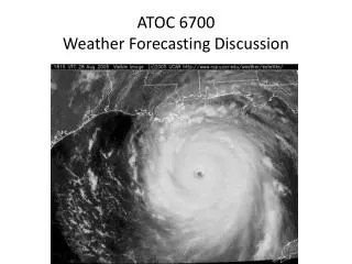
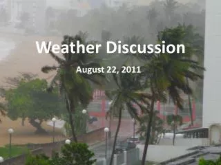
This document provides a comprehensive analysis of Tropical Storm Arlene at its landfall in Brownsville, TX, during July 2011. It includes microwave imagery, 500-mb analyses, and surface analysis data from June 30 to July 4, detailing atmospheric conditions and dry air presence. The findings discuss transverse bands associated with convective systems, their occurrence timing, and implications for aviation turbulence, offering insights into storm dynamics based on historical data.

Weather Discussion
E N D
Presentation Transcript
Weather Discussion 7-5-2011
A little bit about transverse cirrus bands… • “The ideal case for band production appeared to be a strong, isolated convective system that developed, matured, and dissipated without interacting with any other convective storm” (Lenz et al. [2009], 1365). • “Transverse bands were more commonly observed to emerge near the end of the mature stage of the [convective] system and persist through the decay stage of the system” (Lenz et al. [2009], 1365). • “Transverse bands were observed at all hours of the day, though they were most common during the nighttime hours of this study” (Lenz et al. [2009], 1368). • “The average time lag between convection initiation and the first observation of transverse bands was 7 hours, and the average duration of the bands was about 9 hours” (Lenz et al. [2009], 1369, 1372). • Most commonly develop in regions of upper-level divergence and a strong relative vorticity gradient
Geographic Distribution (May – August 2006) Lenz et al. (2009) pg. 1368
Transverse Bands and Aviation Turbulence Lenz et al. (2009) pg. 1364