Download

1 / 19
190 likes | 507 Views
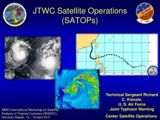
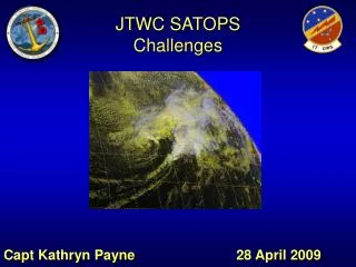
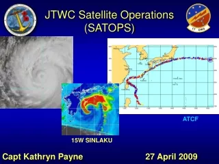
JTWC Satellite Operations (SATOPs). Technical Sergeant Richard C. Kienzle, U. S. Air Force Joint Typhoon Warning Center Satellite Operations. WMO International Workshop on Satellite Analysis of Tropical Cyclones (IWSATC), Honolulu Hawaii, 13 – 16 April 2011. Overview. SATOPs Mission Tools

E N D
JTWC Satellite Operations(SATOPs) Technical Sergeant Richard C. Kienzle, U. S. Air Force Joint Typhoon Warning Center Satellite Operations WMO International Workshop on Satellite Analysis of Tropical Cyclones (IWSATC), Honolulu Hawaii, 13 – 16 April 2011
Overview • SATOPs Mission • Tools • Fixing Process • Conference “Items of Interest” • Contacts
SATOPs Mission Support JTWC TC Forecast Operations • METWATCH AOR for invest areas • Evaluate disturbances for TC genesis • Assess TC position and intensity • Synergistic relationship with Typhoon Duty Officers (TDOs) • Post-storm F-deck QC
SATOPS Tools • USAF / MARK IVB Satellite System • USN / FMQ-17 Satellite System (NSDS-E) • Automated Tropical Cyclone Forecast System (ATCF) • Geo-referenced • From FNMOC/NRL • FNMOC and NRL TC Web Pages
Fixing Process • Position systems every 3 hours • VIS, IR, Multi-spectral • Intensity estimate every 6 hours • Dvorak, subtropical & extratropical • Code and transmit bulletin • Process other agencies’ fixes • E.g., RSMC Dvorak fix, radar & dropsonde fixes • Create position fixes from all available microwave imagery • Post-storm F-deck (fix data) QC • After-the-fact fixes • Quality review of fixes • Feedback to analysts JAAWIN
Technical References • A Workbook on Tropical Clouds and Cloud Systems Observed in Satellite Imagery, 1984 (NAVEDTRA 40971) • Tropical Cyclone Intensity Analysis Using Satellite Data, Dvorak, V. F. 1984 (NOAA Technical Report NESDIS 11) • Intensity Estimation of Tropical Cyclones During Extratropical Transition, Lander, M. A. & Miller, D., 1997 (JTWC SATOPS TN-97/002) • A Satellite Classification Technique for Subtropical Cyclones, Hebert, P. J. & Poteat K. O. 1975 (NOAA Technical Memorandum NWS SR-83-1975)
JTWC Adaptations/In-house Procedures • Shear Technique • Over Land Fixes • Constraints • Monsoon Depressions • Data-T • Local Form • All attempts are made to eliminate systematic differences between analysts through meetings and recurring training
Shear Technique • Is this the most misused technique? • What we think… • Commonly used in developing and dissipating stages when vertical wind shear prevents convective clouds from spiraling into the CSC • This method should be used with great care for weak or initially developing systems as shear distance can result in erroneously high data-T numbers • The NESDIS interpretation…makes sense
Over Land Fixes • Satellite analysts will not perform Dvorak intensity estimates over large land masses such as Australia, China, India, Africa, and other mainland areas. These areas also include the larger islands in the AOR, especially ones with mountainous topography, such as the Philippines, Taiwan, Mainland Japan, Sri Lanka, Madagascar, La Reunion, and the Hawaiian Islands. • Dvorak intensity estimates should be performed when possible; however, performing a Dvorak intensity estimate over or near land will be a combined decision of the satellite analyst and the Typhoon Duty Officer on duty. If the decision is to perform the estimate the following remark will be added to the remarks section of the Fix Entry Page. “Dvorak intensity may not be representative due to land influences.” • If the satellite analyst does not perform an intensity estimate append the following remark to the remarks section of the Fix Entry Page. “Intensity estimate not performed due to systems proximity to land.”
Constraints • While Dvorak constraints limit the amount of fix-to-fix variability due to rather short-lived fluctuations in system convection, it is sometimes necessary to break constraints to represent a rapidly developing or weakening trend • In this case, the analyst is encouraged to break constraints to provide the Typhoon Duty Officer (TDO) and JTWC customers with the most accurate data possible • You must provide sound reasoning for breaking constraints in the remarks section of the fix bulletin • Consult with the TDO and contact SATOPS NCOIC prior to deviating from the current Final-T by ≥2.0
Monsoon Depressions • Assign an initial intensity of T0.0 since the Dvorak technique doesn’t handle these systems well (position only fix – not transmitted – for in-house use only) • Continue assigning T0.0 until Dvorak patterns and rules apply • Common in western Pacific, Arabian Sea, and Bay of Bengal
Data-T • Often analysts are compelled to determine a Data-T • Many times Data-T is difficult to determine • We tell analysts to move forward without the Data-T if you are not confident • Rely on the Pattern and Model for your final-T determination
Current Intensity • Play it by the book; CI always equals final-t during intensification • CI is held the same at initial weakening • CI is held ½ or 1 higher as system weakens • When weakening flat lines, we typically hold the CI higher for a minimum of 12 hours, then drop it to equal the final-t
Other Data Sources • We DO use other sources to aid in positioning such as surface/ship/buoy observations, weather radar, scatterometry data, and microwave imagery • Dvorak intensity estimates ARE NOT adjusted to reflect wind speed from other sources of data • Dvorak methods were developed long before these new sources; Dvorak is one piece of the puzzle for the TDO and should be as objective as possible • If Dvorak is modified based on other data, it is no longer the Dvorak method
The Test of Time • Dvorak’s procedures have withstood the test of time very well • Seasoned analysts will tell you to look past some of the detail when determining intensity; this detail was not there 25 years ago • Impacts of animation and high-resolution imagery • Advent of other data sources (scat, microwave, and others)
Central pressure not operationally important to JTWC • Provided as a derivative product in data sets • Atkinson-Holiday: Until mid-2007 • Knaff-Zehr: Mid 2007 to Present • Courtney-Knaff: Under development • Complex/numerous input required • OMCI • Latitude • SOA • Horizontal size • Vmax Pressure-Wind Relationship
Best Track Records • Criteria used to determine a tropical cyclone for warning/forecasting purposes are also used to determine entrance into historical records (TD in WNP, TS elsewhere) • JTWC has added and deleted cyclones from data set before archiving based on reanalysis • Recent example • TS 27W (Haiyan) added to JTWC archives though no warnings issued by JTWC • Described in 2007 Annual Tropical Cyclone Report