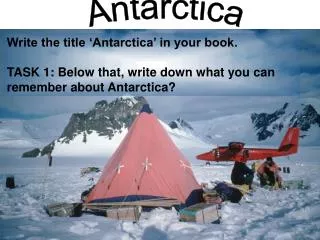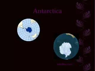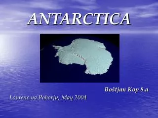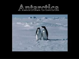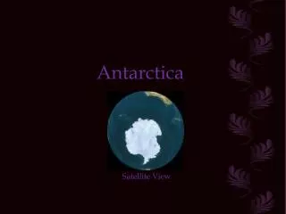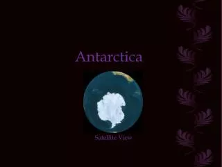
Antarctica
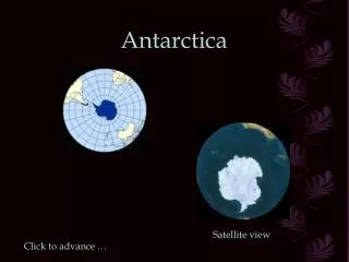
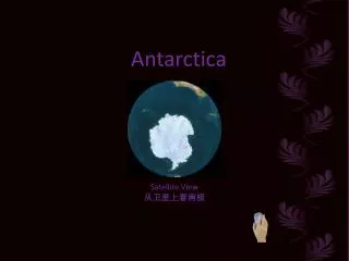
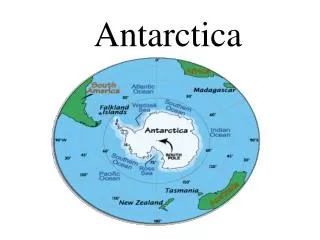
Antarctica. General Information. Land size: 14 million sq. miles Population: officially none, governmental research stations -small groups of scientists at all times. In addition an estimated 8,000 tourists visit each year.

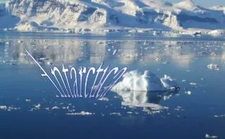
Antarctica
E N D
Presentation Transcript
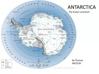
General Information • Land size: 14 million sq. miles • Population: officially none, governmental research stations -small groups of scientists at all times. In addition an estimated 8,000 tourists visit each year. BORDERS: land around the South Pole, oceans = Atlantic, Pacific and the Indian, South America, Africa, Australia
It’s A Fact! • It’s the “Lost Wilderness on Earth.” • Antarcticameans areas opposite the Arctic. • 90% of the world’s ice is here. • Treaty with the other countries that says Antarctica belongs to no one. • Largest iceberg found here: 200 miles long and 60 miles wide.
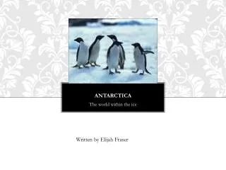
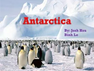
Geography and Nature • Major landforms: mountains, peaks, ice shelves • Animal life: whales, seals, penguins
Climate [-129 degrees] • Temperature: • 200 mile/hr winds • Coldest and windiest place on the Earth
QUESTIONS • About how many people visit Antarctica a year? • How much of the world’s ice is here?
Asiahttp://www.youtube.com/watch?v=XbrZY4mordU&feature=relatedAsiahttp://www.youtube.com/watch?v=XbrZY4mordU&feature=related textbooks page in class 674/YOUR textbooks- page 718
General Information • Hemispheres • Estimated population: 3.758 billion • Highest point: Mt. Everest, Nepal- 29, 023 ft • Lowest point: Dead Sea [Israel/Jordan] • 1,312 ft below sea level BORDERS: Arctic-north, Pacific Ocean-east, Indian Ocean -south and the Ural Mts.- west
Images of the Dead Sea394 sq. miles -10x more salt than any other body of water. -Known to cure what hurts you. -You don’t swim, but float.
It’s A Fact! It’s 1/3 of the earth’s land surface Home to 60% of the world’s people India:sub-continent -a large part of the continent Largest and most populated China and Indiaare two of the world’slargest populated countries Half of the people in the world are Asian Great Wall of China- biggest human- made structure
Geography and Nature • Major landforms: islands, deserts, and mountains[Himalayas] • Major desert: Gobi in Mongolia • Natural resources: mineral, coal, copper, oil • Animal life: bears, monkeys, peacocks • Use the land? – farmland: rice, wheat, corn, bamboo OTHER: Singapore is the most crowded city
Human Characteristics • Climate: cold-dry in the winter, warm to dry in the summer • Rainfall: monsoons- wind patterns bring heavy rainfall • Major cities: Tokyo- Japan, Beijing-China, Calcutta- India • Major languages: Chinese, Japanese, Hindi • Major religions: Hinduism, Buddhism, Islam, Christianity • LITERACY: Men: - 81% Women: 63%
Human Characteristics [cont’d] • Racial/Ethnic groups: Chinese, Japanese, Korean, Tibetans, Philippines, Indian • Economy: Farming and industries- rubber, manufacturing **Fishing (2nd in the world) Other: Snow and Ice Festival
Africa BE SURE these bodies of water are labeled….. Do not forget IT’S A FACT #2 slide not #1
General Information • Land size: 11 million sq miles • Estimated population: 826 million • Highest point: Mt. Kilimanjaro, Tanzania-19,340 ft • Lowest point: Qattara Depression – Libya / Egypt - 436ft below sea level BORDERS: Atlantic Ocean, Red Sea, Indian Ocean, Suez Canal, Med. Sea
It’s A Fact! • The equator divides Africa in ½. • 2nd largest continent • Largest & longest river :Nile – Egypt • Largest desert – Sahara [the USA can fit nicely in the Sahara region] • Highest recorded temp: 138 degrees
Geography and Nature • Major landforms – Lake Victoria, mostly plateaus, few bays • Major deserts – Sahara, Kalahari, Namib • Major rivers – Nile, Congo [heart of Africa] and Niger [empties into the Atlantic]
Geography and Nature • Natural Resources: diamonds, gold, petroleum, copper • Animal life: camels, monkeys, gorillas, cobras, lions, hyenas, BLACK RHINOCORAS [it’s almost extinct] elephants, warthogs • Use of land? crops- bananas, beans, cocoa, coffee, olives, peanuts, LIVESTOCK: camels, goats, pigs, sheep, poultry OTHER:The island of Madagascar{SE}belongs to Africa
Human Characteristics • Climate: tropical to temperate=mild • Rainfall: only 20 inches/year • Major cities: Cairo, Egypt- 6,789, 479 Alexandria, Egypt- 3, 328, 196 Casablanca, Morocco – 2, 940, 623 OTHER: Africa is the festival continent. Throughout the whole continent, colorful and vibrant festivals range through musical, religious, cultural and harvest to name just a few.
Human Characteristics[cont’d] • Major languages: over 1,000 • Major religions: Islam-80%, Christianity-10%, traditional tribal-10% • Literacy: Men: 65% Women: 45% • Economy: agriculture, mining, crops, not that industrial http://www.peacecorps.gov/wws/multimedia/ebooks/bbyl-culture/culture-letter.pdf
DO NOW:Set up a proper heading in your notebook and answer this question:What is the significance in the tribal Africans painting their faces or wearing masks?**Turn to a neighbor and brainstorm some ideas in your notebook. TOPIC: Masks
Think and Share • According to the reading, what is the significance of the African mask? • What justifications can be made to wear the masks? • Was the information we just read relevant to our art project today? • Discuss how we use masks in our culture. Write some ideas in your notebook. • Theatre • Medical • Play • Jobs • Sports
Please follow along either on the paper in front of you or up here. MASKS Authentic African masks are not pieces of wood more or less decorative, but religious symbols with an important role in the life of the village. Generally, they are used in funeral rites and ceremonies related with agriculture or initiation, in which each young man has to participate to be considered a member of the community. There are many ethnic groups that don't use masks, and many others that don't have rites of passage. In funeral rites, the mask takes the vital –crucial- strength that runs away from a being when it dies. During the ritual dance, the porter – caretaker- is protected by the mask, that transforms him into another being. He must be dressed not to be recognized. The dress is also considered part of the mask, but the most important thing is the head, where the vital strength is. Agriculture- science of cultivating the land, producing crops, and raising livestock -is the main occupation in rural zones. Rituals with masks use to be celebrated during the dry season, because the lack of work. In Africa there are many different masks. Here you have a little selection of well-carved reproductions from sub-Saharan west Africa, suitable as a good introduction to this amazing world.
COUNTRIES: Kenya, Ethiopia, Tanzania, South Africa, Ghana, Congo, Mali, Zambia Zimbabwe, Malawi, Nigeria, Uganda
You will now be constructing your own tribal war mask. You’ll Need: Paper for the face, nose Four colors for the eyes-one must be white Feather for lashes Brows Lips Something unique about your tribe’s mask
Masks • Be sure each persons facial features are the same. • Tip: put the entire eye together BEFORE gluing it to the mask.
Separate handout Africa notes- out DO NOW: WEST NYC How does the area in which you live AFFECT your daily life’s routine? EAST MONTAUK
COUNTRIES: Kenya, Ethiopia, Tanzania, South Africa, Ghana, Congo, Mali, Zambia Zimbabwe, Malawi, Nigeria, Uganda
Daily life? Exit TicketOn the backof your DO NOW please do the following: • Your group’s COUNTRY • The country’s BIOME • Answer: How does where your country is located in AFRICA AFFECT your tribe’s daily life routine?
Scantron Name______________________ Subject__________AAAA____________________ Date_______12/6/11______________________ period _________ • Do you get points? • +1 = periods 1 and 3 – FIRE DRILL behavior • 2. Elephant page in packet – take out and staple to test • Newspaper or online articles– take out and staple to test • 4. HAPPY GRAMS • 5. Coupon for good behavior Points
All masks MUST be finished today. See me for the group information sheet when your tribe is finished. * Grading Sheet too