Download

1 / 40
400 likes | 884 Views
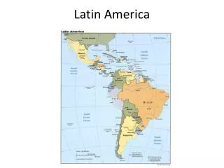
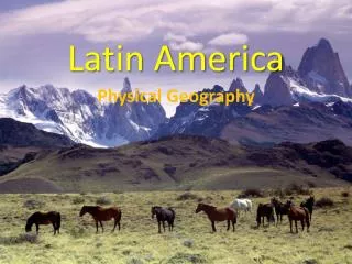
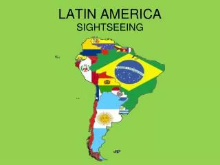
LATIN AMERICA. Where is Latin America?. Find Mexico on a World Map. …and move southward. Latin America. WHY is it called Latin America?. And Spanish just about everywhere else!!!. Portuguese is spoken in Brazil. Latin is a language The two widely spoken languages are Latin-based.

E N D
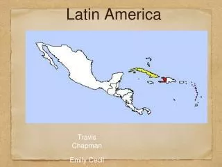
Where is Latin America? • Find Mexico on a World Map... …and move southward
WHY is it called Latin America? And Spanish just about everywhere else!!! Portuguese is spoken in Brazil • Latin is a language • The two widely spoken languages are Latin-based www.skokienet.org/ festival/cultures.html
What physical characteristics do we need to know? CLIMATE • In Central America and northern South America, it is TROPICAL In northern Mexico and southern South America, it is TEMPERATE
Along with climate, • In the Southern Hemisphere: • Remember that SEASONS are REVERSED:desrever
When it is winter in the USA... …it is summer in South America (and southern Africa & Australia & Antarctica)
Weather and Climate • Caribbean and Central America – Hurricanes • El Nino: cyclical climate event that involves the movement of large masses of warm water across the Pacific. Causes change in rainfall patterns.
Physical Features • Mountains in Latin America: • Sierra Madres split along Mexico’s coasts • Andes along west coast of South America • Just like the west coast of the USA, the Andes mountains are VOLCANIC
Mountains in Latin America can be split into agricultural “zones” as you move higher up the mountain. This is called “vertical zonation” Snow caps Sierra Madres Tierra Friano crops, just grazing Tierra Templadacrops that like temperate land ANDES MOUNTAINS: The longLatin America Maps - Due Fridayest chain and 2nd highest mountains in the world!! Mt. Aconcagua: Tallest Mountain in the region: 23,000 ft Tierra Calientecrops that like hot temperatures
Mountains affect on Mexico City • Higher elevation = colder temperatures for latitude • Very Heavily Polluted • Altitude contributes to amount of pollution • Mountains prevent pollution from leaving
But California can handle the earthquakes MUCH better because of building codes and earthquake-proof structures that are built in the states. Unfortunately, Chile, Peru, and other countries in Latin America don’t follow any type of building codes and whole villages can be wiped out in an earthquake!!! • Along with volcanoes, western South America and parts of Central America experience EARTHQUAKES due to the constant motion of the Earth’s tectonic plates- Just like in California!!
Greater (Bigger) Antilles More Physical Features: • There are MANY islands in Latin America • The Caribbean Islands are called the “West Indies” or the “Greater and Lesser Antilles” • The Caribbean Islands are well known for their agriculture and tourism Lesser (Smaller) Antilles
The Galapagos Islands (off the west coast of Ecuador) are known for their Tortoises and other scientific studies of plants and animals. Ga-LAP-ah-goes Islands Does Charles Darwin ring a bell?
“Falkland Islands (Isla Malvinas) Administered by the UK (claimed by Argentina)” • The Falkland Islands are controlled by the United Kingdom • The British defeated the Argentines in the Falkland Island War of 1982 • These islands have a HUGE military advantage because of the location to the Strait of Magellan... • ...esp. if the Panama Canal is blocked during wartime
Other Physical Chars. Grasslands: huge, flat plains in Latin America- known for agriculture • The Llanos are in Venezuela; the Gran Chaco are in Paraguay; and the most famous are the Pampas in Argentina
We’re usually found in grassland ranches…like the Llanos in Venezuela Or the Pampas of Argentina…. where the best beef cattle in the world is raised!! Llanos Latin American Cowboys are called Gauchos Pampas
Unfortunately, we’re being cut down and set aflame to make room for interior farmland and construction!!!! OUCH!!! This is called “Slash and Burn” Agriculture What climate factor is responsible for this climate Rainforests: Costa Rica and Brazil~ Amazonia (in Brazil) is the largest in the world! “Amazonia” http://www.ran.org/info_center/about_rainforests.html
Rain Forest • Average Temp = 80 • Avg. Rainfall = 100 in • Found in tropics (low latitudes) • Thick vegetation
Structure of a Rainforest • 3 layers • Emergent Level: crowns of the tallest trees (90-120 ft) • Canopy: variety of broadleaf & evergreen trees (50 – 75 ft) • Understory: variety of shade tolerant trees (20-40ft) • All layers have vines and small plants growing on the branches
Structure of a Rainforest • Only 1 – 2 % of the sunlight reaches the ground due to the canopy • Eliminates small plants at ground level • The soil of a rainforest in almost completely void of nutrients • Trees get nutrients from small plants that grow and decay
Benefits of a Rainforest • Home for a multitude of species • Potential medicines • Oxygen • Unique human cultures: native people
Rainforest Facts • 25% of all prescription drugs in the US use chemicals derived from plants and animals • Everyday over 214,000 acres of rainforest are destroyed • At the current rate of destruction, 25% of the Earth’s species will be extinct by the middle of the 21st ce.
Deforestation • Cutting down of trees
Reasons for deforestation • Farmland • Mining • Animal grazing • Logging • Urbanization
Effects of Deforestation • Loss of species • Loss of potential medicines • Changes in weather patterns • Contributes to global warming • Soil erosion
Alternatives to Deforestation • Responsible companies • Ecotourism • Reforestation • Other means of economic development
Coastal Deserts: West Coast of South America ATACAMA DESERT in Chile This clip art is actually “wrong” to use for the Atacama…there are cacti shown!! One of the hottest and driest places on Earth. 1/16”/yr THIS is more like it!!! But why can places be so dry??? The “rain shadow” effect is part of the reason www.uni-magdeburg.de/ abp/picturegallery.htm
RAIN SHADOW EFFECT Windward side of the mountains Leeward Side or “protected” side of the mountains ANDES Pacific Ocean http://www-cs-students.stanford.edu/~amitp/simblob/rain-shadow.png The Andes Mountains create rain shadows on leeward slopes and cause moisture to be blocked. That’s how we see such dry areas in Latin America. The Andes are so high that they block moisture from the ocean and create grasslands and deserts on the other side of the mountains.
Orinoco River I'm the Rio de la Plata. I’m actually not a river, but an estuary… the large water feature where fresh water from a river meets the salt water of the sea. Rio Grande The AMAZON!! The largest river in the world!! Parana River Rivers in Latin America
Angel Falls- world highest uninterrupted waterfall Waterfalls and Lakes Lake Maracaibo: extension of Caribbean Sea; rich in oil reserves Lake Titicaca: world’s highest navigable lake Lakes in Latin America
Natural Resources • Oil found in Mexico and Venezuela • Gold, Silver and Copper in MX, Brazil and Chile • Forest Products in the Amazon
Panama Canal • Physical features make it hard to travel around. Magellan first European to sail around South America. The very southern most tip is called Cape Horn and its is famous for its severe storms • Shorter (thousands of miles shorter), safer route created with the Panama Canal.
Impact of Panama Canal • Brought change to Middle America • 75000 workers built what is still regarded as one of the engineering wonders of the world. • Completed in 1914, the canal made a huge impact on world trade.
IMPACTS of Physical Features?: • Location of urbanization? • People settle along coasts, • High population growth rate? • YES! Arable land means more food • Large cities are called: MEGACITIES • Sao Paulo Rio Mexico City
And the MOST important factor from Latin America??? Of course!!!! Didn’t YOU think coffee too?