Download
1 / 12
120 likes | 137 Views
Explore HiRISE's innovative imaging science experiment on Mars with unprecedented resolution, user-friendly tools, and public participation in data analysis. Join us in discovering the red planet's secrets!

E N D
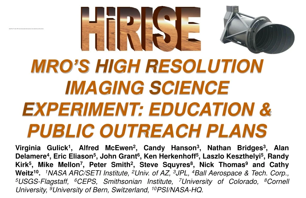
MRO’S HIGH RESOLUTION IMAGING SCIENCE EXPERIMENT: EDUCATION & PUBLIC OUTREACH PLANS Virginia Gulick1, Alfred McEwen2, Candy Hanson3, Nathan Bridges3, Alan Delamere4, Eric Eliason5, John Grant6, Ken Herkenhoff5, Laszlo Keszthelyi5, Randy Kirk5, Mike Mellon7, Peter Smith2, Steve Squyres8, Nick Thomas9 and Cathy Weitz10.1NASA ARC/SETI Institute, 2Univ. of AZ, 3JPL, 4Ball Aerospace & Tech. Corp., 5USGS-Flagstaff, 6CEPS, Smithsonian Institute, 7University of Colorado, 8Cornell University, 9University of Bern, Switzerland, 10PSI/NASA-HQ.
INTRODUCTION The High Resolution Imaging Science Experiment (HiRISE) will fly on the Mars Reconnaissance Orbiter (MRO) mission, planned for launch in August of 2005. HiRISE will investigate deposits and landforms resulting from geologic and climatic processes and is optimized for the evaluation of candidate landing sites. The camera will combine unprecedented resolution (30 cm/pixel at 300km altitude) and signal-to-noise ratio (SNR >100:1 at all latitudes) with a 6 km swath width (at 300 km altitude), partial 3-color coverage, and image >2% of Mars at 1m/pixel or better. Stereo image pairs will be acquired over the highest-priority locations allowing for a relative vertical precision of <25 cm. By combining ultra high resolution and SNR with a large swath width, it is possible to image on a variety of scales down to 1 m, a scale currently afforded only in glimpses by landers. HiRISE will offer such views over any selected region of Mars, providing a bridge between orbital remote sensing and landed missions. The centerpiece of the HiRISE team’s Education and Public Outreach (E/PO) plans is public participation in target selection and data analysis. User-friendly web tools will be available to both the science community and the public to view/analyze HiRISE images and to submit observation suggestions. Processed images will be released soon after acquisition to allow everyone to share in the scientific discovery process. Opportunities will also be provided to the public to participate in data analysis. Other highlights of our E/PO program include the participation of all team members in the E/PO effort and substantial local outreach activities. For additional information and for an opportunity to see what ultra-high resolution images from HIRISE images may look like, please visit HiRISE’s E/PO website at http://marsoweb.nas.nasa.gov/HiRISE .
HIRISE SCIENCE GOALS Exploded view of a HiRISE design. Actual flight structure is slightly different.
HIRISE: THE PEOPLE'S CAMERA CONCEPT • The science community and the broader public as a whole are encouraged to participate in HiRISE targeting and data analysis. This will be made possible by several key innovations: • User-friendly submission of image targeting suggestions, and image browsing and analysis capabilities via HiWeb (based on the successful Marsoweb site, http://marsoweb.nas.nas.gov, used for Mars Explorer Rover 2003 mission landing site selection studies). • A web-based interactive image data map will allow seamless access to all HiRISE, other MRO, and previous Mars mission data including image, topographic, spectral, and derived data sets. The interface will allow inter-comparison of various Mars data sets via transparent overlays on the image data map. A key feature will be rubber-band selection of image targets and a simple justification interface. HiWeb will be the main access to HiRISE data for team members, the science community, and the public at large. • We are planning for everyone to be able to submit image target suggestions by providing location coordinates, justification and a list of constraints (e.g. season, signal-to-noise ratio, resolution, etc.). Science community suggestions will be routed to appropriate HiRISE Co-Investigators for consideration for targeting by HiRISE. Public suggestions will be filtered via NASA Quest and other partners. The HiRISE team together with their education partners will host web events and workshops to educate the public and to encourage high quality suggestions. • Online analysis and visualization web tools will allow easy analysis of data (e.g. on-the-fly 3D perspective views of any location on Mars incorporating user-selected data sets, online image processing, overlay capabilities, and profiling and distance measuring tools). • Public participation in science data generation via Clickworkers (http://clickworkers.arc.nasa.gov). • Public interest in data analysis demonstrated by 80,000 individual users who collectively identified essentially every impact crater(> ~1km) on Mars. Excellent fidelity of results was demonstrated by comparison to the Barlow crater catalog. • Users will generate a variety of geologic feature databases and may participate in image validation for the HiRISE team.
Our prototype HiRISE Sample image viewer allows users to pan & zoom around parts of the Grand Canyon at a spatial resolution similar to what we expect for HiRISE.
MEET THE HIRISE TEAM The HiRISE instrument and science teams together at Ball Aerospace & Technology Corp. in Boulder, Colorado., January, 2002. In addition to the roles and responsibilities listed above, several team members will also be involved in coordinating and prioritizing observations for HiRISE image targeting according to their respective science theme(s). This will help to insure that a variety of imaging targets of high priority are selected.
HIRISE PRINCIPAL INVESTIGATOR: ALFRED MCEWEN Hello, I'd like to tell you a bit about myself and what I hope to accomplish as Principal Investigator (PI) of HiRISE. Unlike many of my peers, I did not want to become an astronaut as a teenager, during the Apollo missions. It was the environmental movement that I cared about, and the Moon and views from space showed that our home planet is precious and unique. I studied Forest Biology, worked on soil conservation and reforestation in the Peace Corps (Guatemala), and worked for the Soil Conservation Service. But scientific research was in my blood, so I returned to school to study geology and was lucky enough to get a job at the U.S. Geological Survey's Center for Astrogeology in Flagstaff, Arizona. I found image processing to be especially rewarding, and processed color image mosaics of many planets and satellites, including Mars. These images have been reproduced in hundreds of books, magazines, and television programs, and have probably done more to advance planetary exploration then all the scientific papers I'll ever publish. In 1996 I moved to the University of Arizona, where I am now a professor of planetary science. To my surprise, I now find myself in a strong position to influence the lives and careers of smart young people such as students who want to explore Mars. I arrived at this position because I was skilled (or at least diligent) at processing and analyzing digital images, alone with a computer, not because I was good with people. My personal goal for the future is to learn how to make the most of this opportunity. When assembling the HiRISE science team, I needed people with all of the essential scientific and technical skills, but I also wanted people who would share “The People's Camera” philosophy. I consider myself immensely lucky to have successfully attracted such a terrific team. HiRISE is crucial to finding the best locations to land, explore Mars on the surface, and collect rocks to return to Earth. NASA's Mars Exploration Program is focused on finding evidence for past or present life on Mars. Actual discovery of Martian life would be of enormous significance to basic science, but nobody knows the chances of success. I've struggled a little to decide what I think about this emphasis on finding life. Our home planet has major environmental problems that are not receiving the attention needed to enable much of Earth's people to live quality lives. Why spend billions of dollars to explore Mars instead of addressing critical problems on this planet? But if we cancelled Mars exploration, the funds would not necessarily go towards conservation. Our priorities need to change. Maybe the search for life on Mars will help make that change, by making us better appreciate the rarity of abundant and complex life. Alfred McEwen, with son Ian, in Mars-like terrain in Iceland.
SCIENCE THEME: LANDSCAPE EVOLUTION Observation Coordinator: John Grant (Smithsonian) A review of existing images of Mars reveals a diverse landscape. In some instances, such as around volcanoes and in valleys, a casual glance suggests the features are much like those here on Earth. Closer inspection, however, often confirms differences in scale and or subtle characteristics relative to their more familiar terrestrial counterparts. These same images also reveal a Mars that is often very different from the Earth. Some locations are marked by huge jumbles of blocks forming chaotic terrain (Fig. 1), whereas others are buried beneath blankets of dust. Bizarre “Thumbprint”, “Swiss cheese”, and other surface textures also occur. Current limits on the resolution of Mars images often preclude distinguishing the of processes responsible for shaping a landscape. The geomorphic thresholds that influence the efficiency and intensity of surface modification by different processes can often be hard to define. Indeed, different processes can sometimes produce very similar appearing landforms. Detecting the subtle, diagnostic signatures of past water erosion versus wind or other processes often requires the high resolution imagery that will be obtained by HiRISE. It is the analysis of HiRISE images that may provide some of the clues for a better understanding of the evolving Martian landscape. Figure 1. Example of chaotic Martian terrain. John Grant
SCIENCE THEME: VOLCANOLOGY Observation Coordinator: Laszlo Keszthelyi Mars is fundamentally a volcanic planet. Geologic mapping of Mars shows that about half the surface seems to be covered with volcanic materials that have been modified to some extent by other processes (such as meteorite impacts, blowing wind, and floods of water). Mars has the largest volcanoes in the entire Solar System. The great volumes of erupted lava have had a profound impact on the entire planet, extracting heat and selected chemicals from within, adding large amounts of acidic gas to the atmosphere, and providing heat to melt frozen water in the crust. Mars cannot be understood without studying its volcanoes. HiRISE will provide the ideal tool to study some of the most puzzling aspects of Mars volcanism. One example is “what were the eruptions that formed the giant lava flows like”? Did the lava ooze quietly out of the ground or did it come blasting up in massive explosions? Detailed pictures of the vents are essential for answering these questions. We expect that many of the flows were fed by tall “curtains of lava” playing over long fissures in the ground. Thus we expect to find rows of cones along cracks in the ground, like are seen in Iceland. The pictures from other cameras have been too fuzzy to find these kinds of features on Mars. Another high priority will be to image places where both lava and water have come gushing out of the ground. These are places where microbes that might live in the deep, warm, wet parts of the crust could have been brought to the surface. Finding scientifically interesting spots that are safe to land future rovers is one of the primary goals for the MRO mission. Figure 1. Rows of lava cones lining the crack from which the Laki lava flow erupted in 1783-1784 in Iceland. This was the largest lava eruption for which detailed written records exist. The gases from this eruption also caused a famine that killed about 20% of the population of Iceland and cooled the climate across the entire Northern Hemisphere. The cones in this picture are about 10 meters tall (30 feet). The path in the distance is actually a one-lane dirt road. Laszlo Keszthelyi
SCIENCE THEME: LAYERING PROCESSES Observation Coordinator: Cathy Weitz Figure 1. “Colorized” subframe of Mars Orbiter Camera image M14-01647 of layered deposits inside an impact crater in Western Arabia Terra. Hundreds of layers can be seen exposed by erosion. The layers are partially covered by dark debris that has filled in topographic lows between the layers. All the layers appear similar in their thicknesses and textures, suggesting they formed by the same process. What formed them? Perhaps deposition of sediments in water, or ash/dust settling out from the atmosphere. Illumination from the left. Figure courtesy ofMalin Space Science Systems/NASA. Mars, like the Earth, appears to be a layered planet, which has major implications for processes that have formed the geology we see today on the surface. Anyone who has ever gone to the Grand Canyon and seen the layering along the canyon walls may know that each layer records a different history for this region, such as a time in the past when the region was covered with a sea and sedimentary layers were emplaced, or a time when volcanism was active and produced volcanic layers. The arrangement of layers relative to each other, such as does one unit lie on top of another or does one layer cut through another, also tells us about the stratigraphy, which is how geologists determine the sequence of processes that occurred over time in a particular area. HiRISE may show us that the layering on Mars is even thinner and more prevalent than we now know. HiRISE images of different layers on Mars can answer questions about the processes that produces the layers. For example, are the layers the result of sediments deposited in lakes or oceans on Mars? Do the layers form from volcanic eruptions pumping ash into the atmosphere that later settles on to the ground? Or perhaps the layers form from cyclic changes in the amount of dust that is entrained into the atmosphere and later deposited on the ground. Analysis of HiRISE data may shed new insight into the physical properties and age relationships of the layers which can then help scientists determine how the layers formed and what role water and climate change played in their deposition. Figure 2. “Colorized” subframe of Mars Orbiter Camera image M03-02733 of layered deposits inside Holden Crater. Because a large valley called Uzboi Vallis can be seen entering into the crater, the layers shown here could be from the deposition of sediments in the water from this valley. Illumination from the upper left. Figure courtesy of Malin Space Science Systems/NASA.
SCIENCE THEME: POLAR GEOLOGY Observation Coordinator: Ken Herkenhoff Figure 1. MGS Mars Orbiter Camera image M03-03597 of the south polar layered deposits. Resolution= 8.5 m/pixel, illumination from bottom. Mars, like Earth, appears to have experienced global climate changes over the past few million years. The effects of Earth's ice ages are well recorded in polar ice in Greenland and Antarctica. Similarly, layered deposits in both polar regions on Mars (see Figure 1) appear to record ancient Martian climate variations. Changes in the tilt (relative to the Sun) of the rotation axes of both Earth and Mars are thought to have influenced their climates, but these changes were larger in the Martian case. For this reason and because of the apparent lack of recent oceans and life on Mars, it should be simpler to determine the causes and history of climate changes on Mars. HiRISE has the potential to return images of the polar layered deposits on Mars that will help to unravel Mars' climate history. Most Mars researchers believe that the polar layered deposits are the result of variations in the amounts of dust and water ice deposited over many climate cycles, but their composition is poorly constrained. In addition, the amount of time needed to form individual layers remains a major uncertainty. Studies of the thickness of polar layers are limited by image resolution. Are thinner layers present, but not visible in the available images? HiRISE is expected to answer this question and better determine the thickness of layers in the polar deposits. Analysis of HiRISE data should result in a better understanding of the timescales involved in the deposition of the layered deposits and provide important information regarding the climate history of Mars. Ken Herkenhoff
SCIENCE THEME: FLUVIAL & HYDROTHERMAL PROCESSES Observation Coordinator: Ginny Gulick More so than any other feature, the abundant evidence for past water activity on Mars has captured the attention and imagination of members of the public and scientists. From the giant outflow channels to the smaller valley networks (Fig. 1) to the relatively tiny fresh young gullies (Fig. 2), Mars displays evidence of fluvial erosion at all ages and scales. The interpretation of this evidence, three decades after the first signs of Martian water were found, remains elusive.Several origins have been proposed for these features, including glaciers, water runoff during a warmer, wetter period in Mars’ history, and hydrothermally driven ground-water outflow. The keys to distinguishing which mechanisms were most active are likely found at the smallest scales within these fluvial features. By clearly resolving meter-scale features, HiRISE should be able to help differentiate between various formation mechanisms. The improvement in image resolution between HiRISE and the typical MOC image (Fig. 2) will be comparable to the improvement between the best Viking images (such as Fig. 1) and MOC. The background image (MGS MOC Release No. MOC2-250) shows Dao, Niger, and Harmakhis Valles emerging from the flank of the Hecates volcano. The association between the volcano and the outflow channel may imply a hydrothermal origin for the channel. Figure 1. Youngfluvial valleys found on the northern slope of the volcano Alba Patera. The prominent crater is about 1 km in diameter. Viking high resolution image ~8m/px. Figure 2. Very young gullies found on the slopes of a southern hemisphere impact crater on Mars. The image width is about the same as the crater diameter in Figure 1. MOC narrow angle image (MOC2-388). Ginny Gulick and daughter Alicia near a glacial melt water channel in Iceland.