Download
1 / 37
370 likes | 460 Views
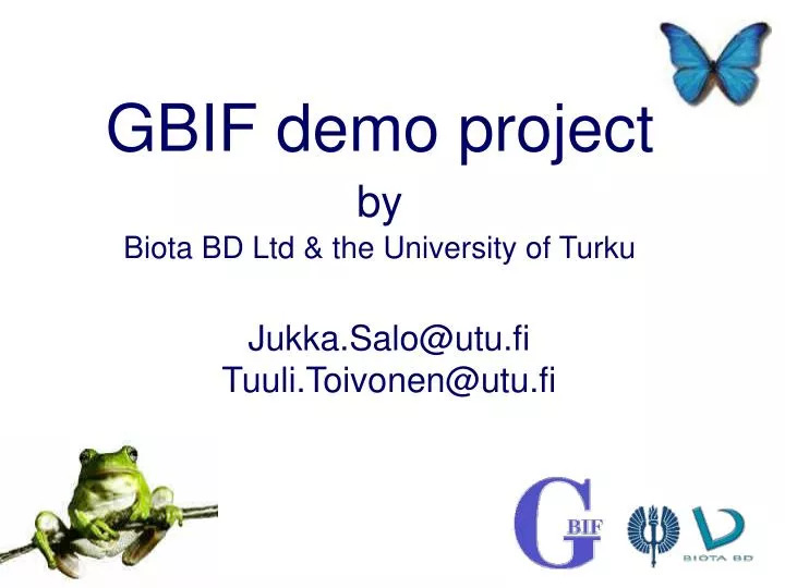
GBIF demo project by Biota BD Ltd & the University of Turku. Jukka.Salo@utu.fi Tuuli.Toivonen@utu.fi. Background.

E N D
GBIF demo projectbyBiota BD Ltd & the University of Turku Jukka.Salo@utu.fiTuuli.Toivonen@utu.fi
Background • The 5th session of the GBIF Governing Board (October 2002) approved the elaboration of a GBIF demonstration project, which would in a clear and practical way show the relevance and usefulness of the GBIF concept and vision to the international community. • Demonstration project is a tool that will promote GBIF, expand the GBIF membership and catalyze fund raising efforts • The goal is to present practical, useful, applicable, scalable and successful projects and approaches to our target audiences.
Two audiences • Potential new GBIF participants (scientific and research institutions, non-governmental organizations, conservation organizations, policy and decision makers). • Existing participants who -among others- would benefit from getting useful and practical tools, applications and examples which could be easily replicable and implemented at different levels (national, regional and global).
Criteria • Address a theme of high impact and high visibility (and therefore become an effective promotional tool for GBIF). • Demonstrate advantages of joining GBIF. • Assist GBIF in its fund raising pursuits. • Show how data from species and specimens can be utilized for scientific and/or practical applications (including highly relevant national and international topics, e.g. conservation purposes, effects of climate change, spread of diseases, alien invasive species, etc). • Focus on end-user needs. • Scalable to a global level. • Integrates two or more GBIF Work Programme Areas. • GBIF Participants able to provide inputs/contributions in its development. • Promotes buy-in from other GBIF participants in its further dissemination and promotion. • Provides an example of the potential of GBIF as a mega-science endeavour through the combination or integration of two or more existing biodiversity data/information sources.
Promotion of GBIF Work Programs • The Project focuses on ways how the use potential of the specimen information (as defined in the DADI, ECAT and DIGIT programmes) and observational data could catalyze interest in the developed and developing countries by better use of biological resources and could contribute to land-use planning and environmental policy formulation.
Objectives • End-user oriented demonstration on the deliverables of the GBIF Work Plan and how the various users will benefit from the GBIF generated activities and further develop their own modes of work. • The general objective of the Demonstration Project is to produce functional demonstration web services of GBIF, taking into account the databasing and data access standards considered by various parallel initiatives (ENBI, BioCASE, etc.) and based on existing regional biodiversity information platforms in Europe and Latin America.
Geographical cover • Two Amazonian biodiversity web services (Siamazonia and WAGIS) that are currently operational and cover the Amazon region of the Andean Community • the Finnish regional biodiversity web service LOUNAISPAIKKA, linked with the European Network on Biodiversity Information Programme (ENBI).
The Amazon • The Amazon data includes datasets from Peru, Colombia, Venezuela, Ecuador, Bolivia and the western States of Brazil). • The demonstration will be based on the existing information systems maintained in Peru and Finland • The example will highlight how using of DADI, DIGIT and ECAT products will assist the institutions in the region to better manage biodiversity resources and demonstrate ways and means of the OCB Work Program in building capacity.
Finland • Platform: Regional environmental information system of the SW Finland • Kevo sub-arctic biodiversity survey: specimens/observations from the Inari Lappland region • Collections of Herbarium and Zoological Museum of University of Turku, linked with long-term ecological surveys and individual research projects on biological diversity • Information already in use for land use and conservation planning and related activities • Demonstration of GBIF tools
GBIF promoted during two symposia • Andean countries: Regional Symposium on Amazon land-use promoting GBIF and the Global Taxonomy Initiative (GTI) under the auspices of Andean Community (Comunidad Andina) • ASEMFOREST symposium of Europe-Asia Meeting (ASEM organisation), demonstration of GBIF work programs and tools for forestry and forest conservation in Asia (EU-Chinese Academy of Science)
After we have millions of specimen records available on-line, what to do with them? Who is the end-user of the information and what does he need? How should the species data be served to reach different end users? How to visualise and integrate the species data to make it understandable?
Presentation of distributions Presentation of summary information Geographical approach
Integrating ecosystems and environmental conditions Integrating human constructionsand legislation Geographical approach
Focus of theDemo project GBIF architecture &focus of the demo project
Serving the informationin an appropriateway Implementingthe GBIF tools Promotion of GBIF Our approach Primarydata
SIAMAZONIA WAGIS Lounaispaikka
SIAMAZONIA WAGIS Lounaispaikka • Peruvian Amazonian BD and Environmental Information System • Distributed data ownershipand management • Maintenance by Peruvian Amazonian Research Institute (IIAP) • Research and planning oriented (land zoning) • Language: Spanish
SIAMAZONIA WAGIS Lounaispaikka • Internet-based geographic information system (GIS) on Western Amazonia • Research oriented, maintained by the University of Turku Amazon Research Team • Language: English
SIAMAZONIA WAGIS Lounaispaikka • Regional envinronmental information system of the SW Finland • Management and administration oriented with private sector users • Language: Finnish
SIAMAZONIA WAGIS Lounaispaikka
? Ecological andenvironmental data Conservationdatabases GIS and remote sensing data Literaturereferences and articles Collectiondatabases Observationaldatabases
? Internet-based service with GIS-component Webserver and spatial server (ArcIMS) GBIF UDDI registry XML, Darwin Core Ecological andenvironmental data Conservationdatabases GIS and remote sensing data Literaturereferences and articles Collectiondatabases On DiGIRproviders Observationaldatabases On DiGIRproviders
!! Internet-based service with GIS-component Webserver and spatial server (ArcIMS) Ecological andenvironmental data Conservationdatabases GIS and remote sensing data Literaturereferences and articles Collectiondatabases On DiGIRproviders Observationaldatabases On DiGIRproviders
Concrete deliverables Primarydata Making available new primary data 1. Digitation of species collections and observations 2. Making available the existing databases of the information systems • Aid in databasing and harmonising • Capacity building of the researchers • Promotion of information flow from north to elsewhere Documentation, lessons learned: • Acknowledgement of IPR of the data owner • Making the information understandable for others • Handling the georeferencing of the data
Concrete deliverables Services using GBIF technology Several running DiGIR providers • Replacing the existing data sharing tools with • Capacity building of data managers • Feedback to GBIF developers • Map servers accessing species data • Integration of ArcIMS-operated map servers with GBIF tools Documentation, lessons learned: • Implementing the tools in different environments • Integrating GBIF technology to existing information systems • Integrating GBIF technology and map servers Implementingthe GBIF tools
Serving the informationin an appropriateway Enhancedunderstanding Concrete deliverables Identification of the user needs What is needed from the view point of different end-user groups? Advanced queries of data Map interfaces for integrated queries of species, environmental conditions and literature Examples of visualisation and geographic analysis options Interner-mapping based examples that help different users to utilise the data
Where we are now? Digitised and harmonised Test services ofDiGIR up & running Primarydata Serving the informationin an appropriateway Implementingthe GBIF tools
Demo project in the InternetOpened: 5th NovemberReady for comments: 10th JanuaryFinalized: 30th JanuaryAddress: http://gbifdemo.utu.fi/
GBIF in the Amazon • Current process: Land use and land use zoning (Andean Community) • Peru: Zonificación Ecológico Económico • Uniform-looking lowland rainforest actually a mosaic of various forest types • Demonstration using the tree-plot data to show floristic variation • GBIF will become an important element in developing planning tools to determine forest concession sites and regulations • Base-line data for forest certification in selected localities • Identifying key areas for protection
Amazon: How tools developed by GBIF will help? • Most of the biodiversity data (collection, observational) located outside Peru • Without DADI, DiGIR, DIGIT impossible to link scattered key data with satellite imagery and land-use maps • Capacity-building elements of OCB
What makes GBIF interesting to end-users? • GBIF structures help to identify where the country-specific biodiversity data is located • Assistance to countries to get in touch with primary producers of data outside the country • Identification of research groups and organisations that have metadata and biodiversity data already linked with environmental parameters • Species-level data for land-use planning and zonification • Identification of timber and non-timber forest resources • Location of genetic resources • Identification of key areas for conservation
What makes GBIF interesting to end-users? • New joint research initiatives • GBIF will be an important mechanism providing orientation and resources for the biodiversity projects of World Bank, GEF and other financial mechanisms linked to Multilateral Environmental Agreements (MEAs) • Linkages between biodiversity and global change scenarios