Download
1 / 32
320 likes | 439 Views
AOS 100: Weather and Climate. Instructor: Nick Bassill Class TA: Courtney Obergfell. Miscellaneous. Exams & Homeworks. Review of September 29 th : Intro to Cyclones and Fronts.

E N D
AOS 100: Weather and Climate Instructor: Nick Bassill Class TA: Courtney Obergfell
Miscellaneous • Exams & Homeworks
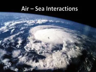
Review of September 29th: Intro to Cyclones and Fronts • Cyclones are areas of low pressure that have winds which rotate counterclockwise around the center (in the northern hemisphere) • Extratropical cyclones affect areas roughly north of 30º N • These cyclones exist because of the different amounts of heating across the planet, so they act to move warm air poleward and cold air equatorward
Review Continued • Extratropical cyclones often have fronts • Fronts are areas that separate two airmasses, often warm vs. cold, and/or dry vs. moist • Cold fronts are locations where warm air is being replaced by cold air • Warm fronts are locations where cold air is being replaced by warm air • Cold fronts are often sharper than warm fronts, partially because it is easier for more dense air to replace less dense air
Fronts • The intersection of different airmasses are called fronts • The most common type are Warm Fronts and Cold Fronts • Fronts typically move in the direction the triangles or semicircles are pointing
Fronts Continued • Fronts are commonly located near regions of precipitation • This is due to the fact that fronts are often areas where warm and moist air is forced to rise • There are four types of fronts: - Cold Fronts - Warm Fronts - Occluded Fronts - Stationary Fronts
Cold Fronts • This often acts to focus upward vertical motion, leading to a narrow band of precipitation • Severe weather is commonly observed in advance of the cold front
Warm Fronts Continued • A warm front has a much shallower slope compared with cold fronts • Precipitation associated with warm fronts is often lighter and has a greater coverage than with cold fronts
Occluded Fronts • Due to the different densities of cold and warm air, cold fronts typically move faster than warm fronts • Therefore, sometimes the cold front “catches up” to the warm front, especially with strong, long-lived cyclones • When this occurs, an occluded front is formed (often depicted in purple)
Occluded Fronts Continued • Recall that precipitation is produced in regions where warm moist air is forced to rise • Once an occluded front has formed, there is no source of warm air, so precipitation often weakens in intensity From: http://www.ux1.eiu.edu/~jpstimac/1400/FIG09_008.jpg
Stationary Fronts • As the name implies, stationary fronts are very slow moving (if they move at all) • Stationary fronts separate cold air from warm air, and can be associated with precipitation • Stationary fronts frequently turn into cold fronts or warm fronts From: http://www.ux1.eiu.edu/~jpstimac/1400/FIG09_008.jpg
Finding Fronts • Fronts will often be associated with all or most of: • A locally strong temperature gradient • Relatively lower pressure • Clouds and precipitation • Converging (coming together) winds • Positive vorticity (i.e. a sharp turning of the winds cyclonicly) • Locally strong moisture gradients • It is often helpful to first locate the location of lowest pressure, since fronts normally originate from it
L ?
Fronts in Other Images • Besides looking at surface observations, fronts can often be seen in other ways • If precipitation is associated with the front, they can be seen on radar images • The clouds associated with fronts can be seen on satellite images also
L L
How Do Low Pressures Form? • Keep in mind that pressure is basically just a measure of the mass of air above the surface (or some other level) • So a surface pressure of 990 mb means that the weight of the atmosphere above that location is less than a spot with a pressure of 1000 mb • This means that to decrease surface pressure, the mass of the atmosphere above that location needs to decrease
Low Pressure Formation Continued • In order to decrease the mass of the column of air above the surface (i.e. to form a low pressure system), you need a net divergence of air in that column • Conversely, to strengthen a high pressure system, you need a net convergence of air in that column • This is where features in the upper levels of the atmosphere become important • But first, we need an understanding of atmospheric forces
Why Are Forces Important? • When we speak of “forces,” we’re really describing why the air in the atmosphere moves the way it does • This describes both how the air moves horizontally (which direction it moves), and why the air moves vertically • For example, precipitation occurs because something forces air upward until it condenses
Horizontal Movement • When a studying the horizontal movement of air, three primary forces are often discussed: • The Pressure-gradient force (or PGF) • The Coriolis force • The Frictional force