Download
1 / 24
240 likes | 394 Views
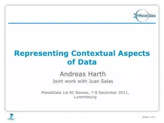
Representing Contextual Aspects of Data. WP2 - Andreas Harth. 1st year review Luxembourg, December 2011. Work Plan View. 24. 12. 0. 6. 18. 30. 36. 42. 48. D2.1 Conceptual model and best practices for high-quality data publishing. D2.2 Methods for quality repair.

E N D
Representing Contextual Aspects of Data WP2 - Andreas Harth 1st year review Luxembourg, December 2011
Work Plan View 24 12 0 6 18 30 36 42 48 D2.1 Conceptualmodelandbestpracticesfor high-quality datapublishing D2.2 Methodsforqualityrepair D2.6 Methodsforassessingthequalityofsensordata Task 2.1 Data qualityassessmentandrepair D2.4 Update of D2.1 FUB D2.3 Modellingandprocessingcontextualaspectsofdata D2.5 Proof-of-conceptevaluationformodellingspaceand time Task 2.2 Temporal, spatial and social aspects of data KIT D2.7 Recommendationsforcontextualdatapublishing Task 2.3 Recommendationsforenhancingbestpracticesfordatapublishing KIT
Outline • Motivation • NeoGeoVocabularies • Mappingsand Community Activities • Demo • Conclusionand Future Work
Motivation • Geospatial data is becoming increasingly relevant • Location-based services, mobile applications • Ever increasing amount of sensor data (phones, satellites…) • Applications require integrated access to geospatial data • Spatial querying • Spatial reasoning
Geospatial Data Scenario Integration Wrapper 1 Mapping 1 Mapping 2 Mapping n ... Source 1 Source 2 Source n
Challenges • Disparate dataformats • Integrated dataformat (syntax) andaccess (datatransferprotocol) - LinkedData (RDF, HTTP) • Most datasourcesprovide just points (geo:lat, geo:long) • Create vocabulary/methodforpublishingregions • Eachdatasourceusesownwaytoencodegeospatialdata • Allowforsyntaxdifferences, providemappingswherepossible (KML, GML, WKT, RDF…) • Instance data not interlinkedacrosssources • Create mappingsbetweeninstances • Geospatialdataispolitical
„Unpolitical“ Datasets • GADM-RDF– http://gadm.geovocab.org/ • RDF representation of the administrative regions of the GADM project (http://gadm.org/) • NUTS-RDF– http://nuts.geovocab.org/ • RDF representation of Eurostat's NUTS nomenclature. GADM and NUTS serve as: • New geospatial information on the Semantic Web. • Bridges between already published spatial datasets. • Experimentation and evaluation datasets.
Prototypical Geo-Ontology Feature Geometry geometry Spatialfunctions Spatialrelations geometry „Luxembourg“ in „Europe“
Features vs. Geometries • NeoGeo vocabularies are based on the General Feature Model • General Feature Model makes a distinction between the feature (resource to which the region belongs), and the actual geometry. • Semantics of the feature are more important than the representation of the geometry. • Instances of the feature are related to the type of the feature. • A feature can be related to multiple distinct geometries; also allows for modelling different geometric properties for one single feature (e.g. different scales).
NeoGeo Vocabularies • Spatial Vocabulary • Representation and reasoning on topological relations based on the Region Connection Calculus (RCC). • Geometry Vocabulary • Representation of geo-referenced geometric shapes. spatial:Feature ngeo:Geometry ngeo:geometry spatial:* RESTfulservices RCC: Randell, D. A., Cui, Z. and Cohn, A. G.: A spatial logic based on regions and connection, 3rd Int. Conf. on Knowledge Representation and Reasoning, 1992.
RCC-8 Properties proper part (PP) proper part inverse (Ppi) part (P) part inverse (Pi) overlaps (O) connectswith (C) discretefrom (DR) partiallyoverlapping (PO) tangential proper part (TPP) non-tangential proper part (NTPP) equal (EQ) tangential proper part inverse (TPPi) non-tangential proper part inverse (NTPPi) externallyconnected (EC) disconnected(DC)
SpatialVocabulary • http://geovocab.org/spatial# • Uses RCC for the representation of topological relations between regions • Supports RCC5 and RCC8 relations • Inference available for most RCC relations • However some rules require „negation as failure“, which requires closed world assumption
ModellingRegions - Alternatives • RDF List of W3C Geo Points • RDF List oflatitude/longitudepairs • RDF Literaloflatitude/longitude • RDF Literal in GML/WKT format (GeoSPARQL) • … • Geometries haveown URI, contentformatnegotiated (KML, GML, WKT…) • Geometryvocabularydescribes high-level featuresofgeospatialregions
VocabularyMappings SC: rdfs:subClassOf, SP: rdfs:subPropertyOf, SA: owl:sameAs
VoCamp • PlanningunderwayforVoCampat UPM (jointlyorganisedwith KIT), weekendof Feb 4th and 5th • Co-locatedwithVoCamp Santa Barbara. • http://vocamp.org/
Summary • NeoGeovocabulariesandexperiences on publishing geo-spatialdataasLinked Data • NUTS and GADM datasets online • Integration vocabulary online, includingvocabularymappings • GADM mappingsto NUTS, DBpedia, LinkedGeoData… • Linked Data Services foraccessing/queryingspatialindices (withinRegion, boundingBox) • Work on similaritymetrics (withoptimisationsandevaluation) forgeospatialregions
Future Work • FinaliseNeoGeo vocabularies (VoCamp) • Improvement of precision of spatial similarity; publish similarity service online • More instance mappings to GADM • Earth and space science data • More experiments: querying of integrated data • Reasoning • Temporal context • First deliverable due in March 2012