Download
1 / 18
180 likes | 313 Views
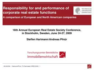
Measuring Accessibility to Urban Services Using Fuzzy Logic within Transportation Geographical Information System. Research funded by. Marius Thériault, François Des Rosiers, Florent Joerin, Laurent Menetrier, Martin Lee-Gosselin & Paul Villeneuve. European Real Estate Society

E N D
Measuring Accessibility to Urban Services Using Fuzzy Logic within Transportation Geographical Information System Research funded by Marius Thériault, François Des Rosiers,Florent Joerin, Laurent Menetrier,Martin Lee-Gosselin & Paul Villeneuve European Real Estate Society 10th Annual Meeting, June 11-13, 2003
Introduction • Accessibility to goods and services is a complex notion which completely pervades territorial issues • It relates to the transportation network and to the distribution of amenities within the city in the light of the needs and preferences of individuals and households • Consequently, it can be defined as the ability of individuals to travel and to participate in activities they consider important at different locations in their environment • Research hypothesis: Various types of persons experience different constraints and are not equally willing to travel in order to reach various kinds of activities, meaning that they have an heterogeneous perception of space
Objective • Design a methodology to integrate people’s commuting patterns in assessing their perceived accessibility • Analyze mobility behaviour of people for reaching their activity places during a typical week-day • Analyse people’s sensitivity to travel time considering various types of activities and households • Define thresholds to qualify suitability of trip duration and activity choices using a fuzzy logic approach • Define and map purpose and status-specific accessibility indices
Previous work • Previous research shows that Euclidean distances to the CBD and travel times to various urban amenities are appropriate measures of the phenomenon • Such indicators are proxies for accessibility focusing on distances from specific physical features which could be easily assessed using road network simulations (route and trip duration); previous work focus on: • Relationship between gravity-based accessibility index and the distribution of population, jobs and shops (Hansen, 1959 - Washington, DC) • Application of gravity models in urban studies (Curry, 1972; Cliff et al., 1974; Johnston, 1973); continued afterwards (Tiefelsdorf, 2003) • Behavioural theories to analyze competing destinations (Fotheringham, 1981 & 1986) • Equity issues related to differences of accessibility (Brueckner and Martin, 1997; Martin 1997) • Market studies for new commercial facilities or public services (Talen and Anselin, 1998; Fotheringham, 1988)
Centrality, Proximity & Accessibility • Centrality is define in reference to CBD, density and intra-urban hierarchy • Proximity refers mostly to a distance concept (Euclidian, network) • Accessibility is assimilated to a potential of interaction mostly driven by socio-economic forces (Handy and Neimeier, 1997; Levinson, 1998) related to mobility • Other perceptual dimensions though are driven by preferences and actual behaviour of people (depend on self valuation of their time and easy access to various types of services) • They define specific utility functions which differ among social groups • These values and willingness are related to specific constraints of individuals and households, including economic status (employment and income), motorization, family structure and life cycle • Therefore, accessibility can be assumed to bear a perceptual component
Origin-Destination Survey • From September 18th to December 17th of 2001, the Ministry of Transport of Quebec (MTQ) and the Quebec City Transit Authority (RTC) • 68 121persons living in 27 839 households interviewed • 174 243trips to reach activities during a week day (Monday to Friday) • Homes and activity places locatedon maps using street addresses • Each person characterized by age, gender, occupation (worker, student, retired, unemployed, etc.) and ownership of a car driver licence • Role in household: lone adult, child (less than 16 years or less than 21 years and still at school), adults living in couple (husband, wife, father, mother), and adult living in multi-generational (two adults with more than 15 years of difference of age) or living in multiple adults households • Various household types: lone person, childless couple, two-parentfamily, lone-parent family, and other households, either multi-generational or more than two adults, with and without children • Departure time, origin and destination of each trip are known
Analyzing Mobility Behaviour (1) • Resorting to O-D survey data, TransCAD GIS was used to find fastest route for each trip and compute travel time using road network (minutes) • Significant differences were found among types of activities as well as types of persons and households
Modelling Centrality (1) • Gravity model of interaction flows (Tiefelsdorf, 2003) used to estimate centrality: where • : Expected number of car trips between locations i and j • : Total population at residential location i • : Total number of potential activities at location j • Dij : Travel time by car from residential location i to activity location j (minutes) • Resulting 52 801 392 potential trips were reduced to 300 079 pairs of residential-activity places (563 residential grid cells x 533 activity cells) • Indices then normalized to 100 by comparison to observed maximum flow
L-Shaped Corridor of high density residential and activity places Modelling Centrality (2)
Suitability Indices (Fuzzy Logic) • According to Kim and Kwan (2003) accessibility measurement should consider “thresholds on activity participation time and travel time in order to identify a meaningful opportunity set when evaluating space-time accessibility” • We define accessibility as theease with which persons, living at a given location, can move to reach activities and services which they consider as most important • Thresholds were computed in SPSS from actual O-D trip durations using the HAVERAGE method considering weighted average of four maximum-likelihood estimators, that is, Huber’s M-estimator, Andrews’ wave estimator, Hampel’s M-estimator and Tukey’s biweight estimator • Assumptions (fuzzy logic):[1] any travel time < median (C50) is totally acceptable (1), [2] a travel time > C90 is likely to be unsatisfactory (0), [3] intermediate cases obtained using linear interpolation between 1 and 0
Modelling Perceptual Accessibility • Accessibility indices were computed for significantly different types of persons and activities using where : • Ai : Raw suitability of residential location i (sum of suitable opportunities) • Sij: Suitability index of travelling from residential location i to activity location j • : Total number of potential activities at location j where • Ai* : Accessibility index of residential location i relative to the most suitable place
Accessibility to Workplace - Women C50 : 9,5 min. C90 : 18,6 min.
Accessibility to Schools - Children C50 : 4,8 min. C90 : 16,1 min.
Accessibility to Groceries - Families C50 : 3,5 min. C90 : 11,2 min.
Conclusion • Findings indicate that overall accessibility to jobs and services is quite homogeneous throughout the City thanks to a highly efficient highway network • There are nevertheless statistically significant differences in the way accessibility is structured depending on trip purposes and household profiles, thereby supporting the hypothesis that various types of persons experience different constraints and are not equally willing to travel in order to reach various kinds of activities QED This leads us to consider whether such perceptual indices of accessibility are actually internalized in housing prices